Rokycany elevation
Rokycany (Plzeňský kraj, Okres Rokycany), Czech Republic elevation is 366 meters and Rokycany elevation in feet is 1201 ft above sea level [src 1]. Rokycany is a populated place (feature code) with elevation that is 21 meters (69 ft) bigger than average city elevation in Czech Republic.
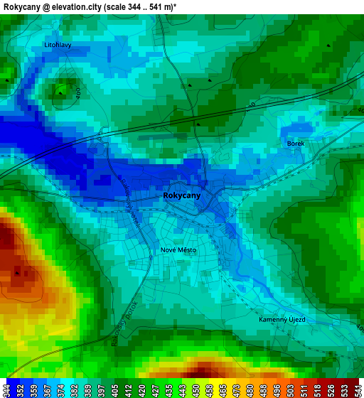
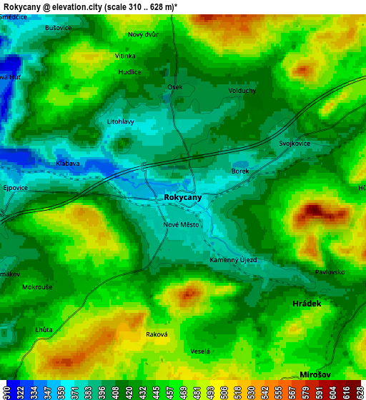
Below is the Elevation map of Rokycany, which displays elevation range with different colors. Scale of the first map is from 344 to 541 m (1129 to 1775 ft) with average elevation of 399.1 meters (=1309 ft) [note 1]
These maps also provides idea of topography and contour of this city, they are displayed at different zoom levels. More info about maps, scale and edge coordinates you can find below images.
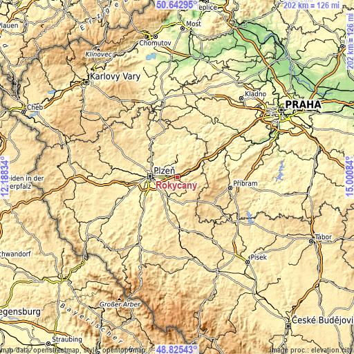
| \ | Map #1 | Map #2 | Topo.Map |
| Scale [m] | 344..541 m | 310..628 m | × |
| Scale [ft] | 1129..1775 ft | 1017..2060 ft | × |
| Average | 399.1 m = 1309 ft | 436.3 m = 1431 ft | × |
| Width | 6.32 km = 3.9 mi | 12.63 km = 7.8 mi | 202.1 km = 125.6 mi |
| Height | 6.32 km = 3.9 mi | 12.63 km = 7.8 mi | 202.1 km = 125.6 mi |
| ↑Max Latitude | 49.77109° | 49.799464° | 50.64295° |
| Latitude at center | 49.7427° | 49.7427° | 49.7427° |
| ↓Min Latitude | 49.714293° | 49.68587° | 48.82543° |
| ← Min Longitude | 13.550645° | 13.506699° | 12.18834° |
| Longitude center | 13.59459° | 13.59459° | 13.59459° |
| →Max Longitude | 13.638535° | 13.682481° | 15.00084° |
Nearby cities:
Cities around Rokycany sort by population:
• Starý Plzenec elevation 348 m
10 km,  240°
240°
• Hrádek 409 m
5.3 km,  128°
128°
• Strašice 508 m
11.7 km,  93°
93°
• Mirošov 455 m
7.6 km,  143°
143°
• Šťáhlavy 354 m
9.9 km,  221°
221°
• Břasy 470 m
10.5 km,  353°
353°
• Chrást 340 m
9.2 km,  307°
307°
• Holoubkov 435 m
7.9 km,  62°
62°
• Dýšina 361 m
8.3 km,  297°
297°
• Mýto 448 m
11.3 km, 62°
• Osek 399 m
3.7 km,  355°
355°
• Dobřív 419 m
7.3 km,  114°
114°
Multilingual:
 En español:
Rokycany elevación 366 m.
 En France:
Rokycany élévation 366 m.
 Auf Deutsch:
Rokycany höhe über dem Meeresspiegel ist 366 m.

Sources and notes:
- [note 1] Map square and city borders are not equal. Map elevation data is calculated only from area inside that square.
- [src 1] Elevation data from geonames database provided with same terms of usage.
- [src 2] The elevation map of Rokycany is generated using elevation data from NASA's 3 arcsec (90m) resolution SRTM data.
- [src 3] Base (background) map © OpenStreetMap contributors tiles are generated by Geofabrik and OpenTopoMap.
Copyright & License:
This Rokycany Elevation Map is licensed under CC BY-SA. You may reuse any part from this page, if you give a proper credit by linking to this URL:
 More info on terms of use page.