Sedlice elevation
Sedlice (Jihočeský kraj, Okres Český Krumlov), Czech Republic elevation is 656 meters and Sedlice elevation in feet is 2152 ft above sea level [src 1]. Sedlice is a populated place (feature code) with elevation that is 311 meters (1020 ft) bigger than average city elevation in Czech Republic.
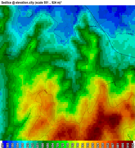
Below is the Elevation map of Sedlice, which displays elevation range with different colors. Scale of the first map is from 551 to 924 m (1808 to 3031 ft) with average elevation of 705.6 meters (=2315 ft) [note 1]
These maps also provides idea of topography and contour of this city, they are displayed at different zoom levels. More info about maps, scale and edge coordinates you can find below images.
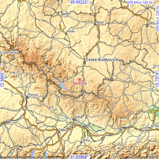
| \ | Map #1 | Topo.Map |
| Scale [m] | 551..924 m | × |
| Scale [ft] | 1808..3031 ft | × |
| Average | 705.6 m = 2315 ft | × |
| Width | 6.44 km = 4 mi | 206.1 km = 128.1 mi |
| Height | 6.44 km = 4 mi | 206.1 km = 128.1 mi |
| ↑Max Latitude | 48.802963° | 49.69223° |
| Latitude at center | 48.77401° | 48.77401° |
| ↓Min Latitude | 48.74504° | 47.83868° |
| ← Min Longitude | 14.347205° | 12.9849° |
| Longitude center | 14.39115° | 14.39115° |
| →Max Longitude | 14.435095° | 15.7974° |
Nearby cities:
Cities around Sedlice sort by population:
• Český Krumlov elevation 492 m
6.9 km,  306°
306°
• Kaplice 542 m
8.5 km,  117°
117°
• Velešín 554 m
8.1 km,  40°
40°
• Větřní 601 m
7.7 km,  270°
270°
• Křemže 524 m
15.8 km,  336°
336°
• Kamenný Újezd 491 m
14.3 km,  16°
16°
• Včelná 442 m
17.3 km, 15°
• Kájov 539 m
10.5 km,  292°
292°
• Benešov nad Černou 659 m
18 km,  105°
105°
• Dolní Dvořiště 619 m
13.8 km,  161°
161°
• Chvalšiny 572 m
15.9 km,  304°
304°
• Malonty 681 m
16.8 km,  125°
125°
Multilingual:
 En español:
Sedlice elevación 656 m.
 En France:
Sedlice élévation 656 m.


Sources and notes:
- [note 1] Map square and city borders are not equal. Map elevation data is calculated only from area inside that square.
- [src 1] Elevation data from geonames database provided with same terms of usage.
- [src 2] The elevation map of Sedlice is generated using elevation data from NASA's 3 arcsec (90m) resolution SRTM data.
- [src 3] Base (background) map © OpenStreetMap contributors tiles are generated by Geofabrik and OpenTopoMap.
Copyright & License:
This Sedlice Elevation Map is licensed under CC BY-SA. You may reuse any part from this page, if you give a proper credit by linking to this URL:
 More info on terms of use page.