Staříč elevation
Staříč (Moravskoslezský, Okres Frýdek-Místek), Czech Republic elevation is 322 meters and Staříč elevation in feet is 1056 ft above sea level [src 1]. Staříč is a populated place (feature code) with elevation that is 23 meters (75 ft) smaller than average city elevation in Czech Republic.
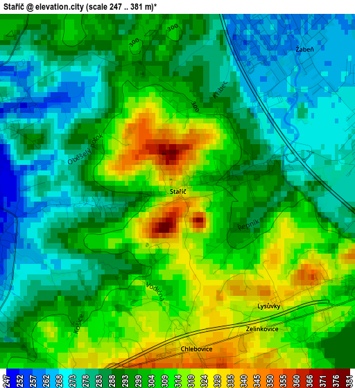
Below is the Elevation map of Staříč, which displays elevation range with different colors. Scale of the first map is from 247 to 381 m (810 to 1250 ft) with average elevation of 297.3 meters (=975 ft) [note 1]
These maps also provides idea of topography and contour of this city, they are displayed at different zoom levels. More info about maps, scale and edge coordinates you can find below images.
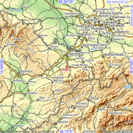
| \ | Map #1 | Topo.Map |
| Scale [m] | 247..381 m | × |
| Scale [ft] | 810..1250 ft | × |
| Average | 297.3 m = 975 ft | × |
| Width | 6.32 km = 3.9 mi | 202.3 km = 125.7 mi |
| Height | 6.32 km = 3.9 mi | 202.3 km = 125.7 mi |
| ↑Max Latitude | 49.714363° | 50.58725° |
| Latitude at center | 49.68594° | 49.68594° |
| ↓Min Latitude | 49.6575° | 48.7676° |
| ← Min Longitude | 18.228865° | 16.86656° |
| Longitude center | 18.27281° | 18.27281° |
| →Max Longitude | 18.316755° | 19.67906° |
Nearby cities:
Cities around Staříč sort by population:
• Frýdek-Místek elevation 283 m
5.6 km,  92°
92°
• Paskov 253 m
5.3 km,  13°
13°
• Brušperk 246 m
4 km,  293°
293°
• Palkovice 322 m
6.5 km,  151°
151°
• Stará Ves nad Ondřejnicí 232 m
7.6 km,  307°
307°
• Fryčovice 263 m
4.2 km,  239°
239°
• Hukvaldy 343 m
7.8 km,  207°
207°
• Krmelín 261 m
5.5 km,  330°
330°
• Řepiště 313 m
6.2 km,  31°
31°
• Sviadnov 277 m
4 km,  84°
84°
• Sedliště 332 m
7.8 km,  62°
62°
• Staré Město 300 m
6.8 km,  105°
105°
Multilingual:
 En español:
Staříč elevación 322 m.
 En France:
Staříč élévation 322 m.


Sources and notes:
- [note 1] Map square and city borders are not equal. Map elevation data is calculated only from area inside that square.
- [src 1] Elevation data from geonames database provided with same terms of usage.
- [src 2] The elevation map of Staříč is generated using elevation data from NASA's 3 arcsec (90m) resolution SRTM data.
- [src 3] Base (background) map © OpenStreetMap contributors tiles are generated by Geofabrik and OpenTopoMap.
Copyright & License:
This Staříč Elevation Map is licensed under CC BY-SA. You may reuse any part from this page, if you give a proper credit by linking to this URL:
 More info on terms of use page.