Emba elevation
Emba (Pafos), Cyprus elevation is 118 meters and Emba elevation in feet is 387 ft above sea level [src 1]. Emba is a populated place (feature code) with elevation that is 60 meters (197 ft) smaller than average city elevation in Cyprus.
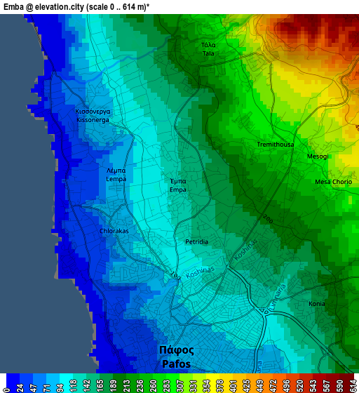
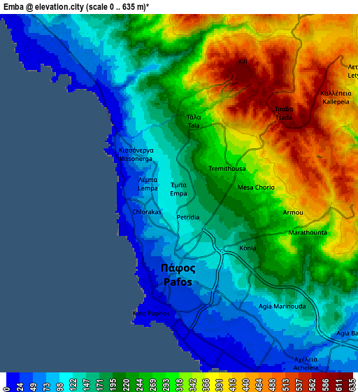
Below is the Elevation map of Emba, which displays elevation range with different colors. Scale of the first map is from 0 to 614 m (0 to 2014 ft) with average elevation of 171 meters (=561 ft) [note 1]
These maps also provides idea of topography and contour of this city, they are displayed at different zoom levels. More info about maps, scale and edge coordinates you can find below images.
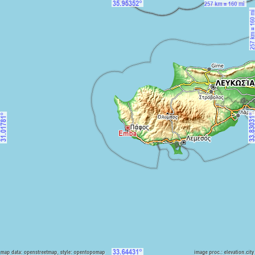
| \ | Map #1 | Map #2 | Topo.Map |
| Scale [m] | 0..614 m | 0..635 m | × |
| Scale [ft] | 0..2014 ft | 0..2083 ft | × |
| Average | 171 m = 561 ft | 240 m = 787 ft | × |
| Width | 8.02 km = 5 mi | 16.05 km = 10 mi | 256.8 km = 159.6 mi |
| Height | 8.02 km = 5 mi | 16.05 km = 10 mi | 256.8 km = 159.6 mi |
| ↑Max Latitude | 34.843075° | 34.879134° | 35.95352° |
| Latitude at center | 34.807° | 34.807° | 34.807° |
| ↓Min Latitude | 34.77091° | 34.734803° | 33.64431° |
| ← Min Longitude | 32.380115° | 32.336169° | 31.01781° |
| Longitude center | 32.42406° | 32.42406° | 32.42406° |
| →Max Longitude | 32.468005° | 32.511951° | 33.83031° |
Nearby cities:
Cities around Emba sort by population:
• Paphos elevation 81 m
3.4 km,  179°
179°
• Geroskipou 29 m
6.3 km,  156°
156°
• Chlórakas 90 m
1.5 km,  226°
226°
• Pégeia 197 m
9.3 km,  335°
335°
• Konia 252 m
4 km,  127°
127°
• Kissonerga 112 m
2.7 km,  310°
310°
• Mesógi 304 m
3 km,  71°
71°
• Tála 289 m
3.5 km,  13°
13°
• Tsáda 615 m
5.8 km,  53°
53°
• Koloni 69 m
7.1 km,  148°
148°
• Geroskípou (quarter) 69 m
5.6 km, 153°
• Tsada - Tremithousa - Tala (Borders) 601 m
4.1 km,  41°
41°
Multilingual:
 En español:
Emba elevación 118 m.
 En France:
Emba élévation 118 m.


Sources and notes:
- [note 1] Map square and city borders are not equal. Map elevation data is calculated only from area inside that square.
- [src 1] Elevation data from geonames database provided with same terms of usage.
- [src 2] The elevation map of Emba is generated using elevation data from NASA's 3 arcsec (90m) resolution SRTM data.
- [src 3] Base (background) map © OpenStreetMap contributors tiles are generated by Geofabrik and OpenTopoMap.
Copyright & License:
This Emba Elevation Map is licensed under CC BY-SA. You may reuse any part from this page, if you give a proper credit by linking to this URL:
 More info on terms of use page.