Páno Polemídia elevation
Páno Polemídia (Limassol), Cyprus elevation is 96 meters and Páno Polemídia elevation in feet is 315 ft above sea level [src 1]. Páno Polemídia is a populated place (feature code) with elevation that is 82 meters (269 ft) smaller than average city elevation in Cyprus.
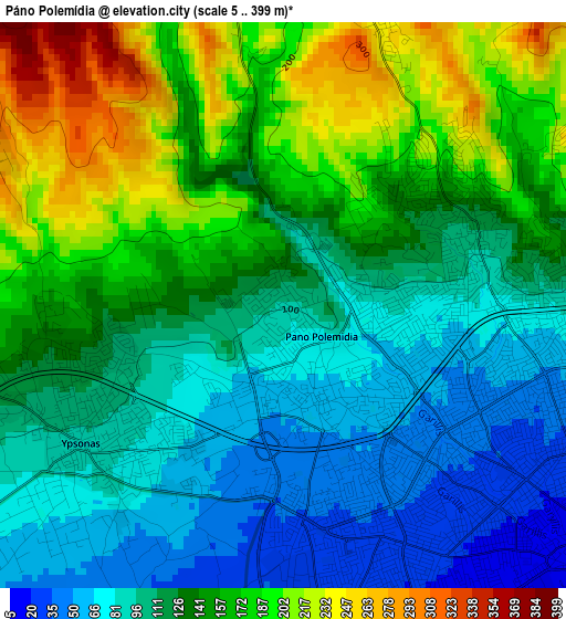
Below is the Elevation map of Páno Polemídia, which displays elevation range with different colors. Scale of the first map is from 5 to 399 m (16 to 1309 ft) with average elevation of 132.5 meters (=435 ft) [note 1]
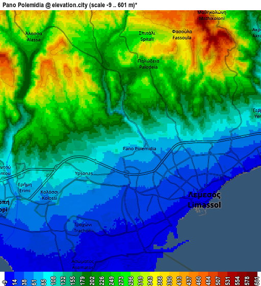
These maps also provides idea of topography and contour of this city, they are displayed at different zoom levels. More info about maps, scale and edge coordinates you can find below images.
| \ | Map #1 | Map #2 | Topo.Map |
| Scale [m] | 5..399 m | -9..601 m | × |
| Scale [ft] | 16..1309 ft | -30..1972 ft | × |
| Average | 132.5 m = 435 ft | 171.3 m = 562 ft | × |
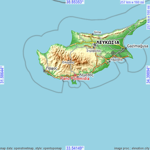
| Width | 8.03 km = 5 mi | 16.07 km = 10 mi | 257.1 km = 159.8 mi |
| Height | 8.03 km = 5 mi | 16.07 km = 10 mi | 257.1 km = 159.8 mi |
| ↑Max Latitude | 34.741709° | 34.777812° | 35.85353° |
| Latitude at center | 34.70559° | 34.70559° | 34.70559° |
| ↓Min Latitude | 34.669455° | 34.633305° | 33.54149° |
| ← Min Longitude | 32.948745° | 32.904799° | 31.58644° |
| Longitude center | 32.99269° | 32.99269° | 32.99269° |
| →Max Longitude | 33.036635° | 33.080581° | 34.39894° |
Nearby cities:
Cities around Páno Polemídia sort by population:
• Limassol elevation 27 m
4.8 km,  120°
120°
• Ýpsonas 91 m
3.4 km,  235°
235°
• Sotíra 292 m
11.8 km,  273°
273°
• Kolossi 54 m
6.8 km,  232°
232°
• Mouttagiáka 67 m
10 km,  80°
80°
• Ágios Týchon 96 m
13.5 km, 80°
• Kyperoúnta 1134 m
25.9 km,  356°
356°
• Erími 77 m
7.5 km,  245°
245°
• Pyrgos 83 m
17.9 km, 77°
• Parekklisha 125 m
15.8 km,  73°
73°
• Peléndri 898 m
21.3 km,  353°
353°
• Páchna 690 m
19.9 km,  294°
294°
Multilingual:
 En español:
Páno Polemídia elevación 96 m.
 En France:
Páno Polemídia élévation 96 m.
 Auf Deutsch:
Páno Polemídia höhe über dem Meeresspiegel ist 96 m.

Sources and notes:
- [note 1] Map square and city borders are not equal. Map elevation data is calculated only from area inside that square.
- [src 1] Elevation data from geonames database provided with same terms of usage.
- [src 2] The elevation map of Páno Polemídia is generated using elevation data from NASA's 3 arcsec (90m) resolution SRTM data.
- [src 3] Base (background) map © OpenStreetMap contributors tiles are generated by Geofabrik and OpenTopoMap.
Copyright & License:
This Páno Polemídia Elevation Map is licensed under CC BY-SA. You may reuse any part from this page, if you give a proper credit by linking to this URL:
 More info on terms of use page.