Tséri elevation
Tséri (Nicosia), Cyprus elevation is 271 meters and Tséri elevation in feet is 889 ft above sea level [src 1]. Tséri is a populated place (feature code) with elevation that is 93 meters (305 ft) bigger than average city elevation in Cyprus.
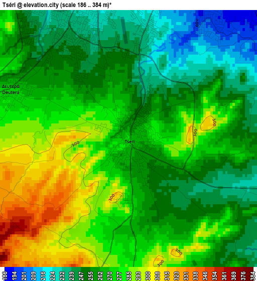
Below is the Elevation map of Tséri, which displays elevation range with different colors. Scale of the first map is from 186 to 384 m (610 to 1260 ft) with average elevation of 266.7 meters (=875 ft) [note 1]
These maps also provides idea of topography and contour of this city, they are displayed at different zoom levels. More info about maps, scale and edge coordinates you can find below images.
| \ | Map #1 | Map #2 | Topo.Map |
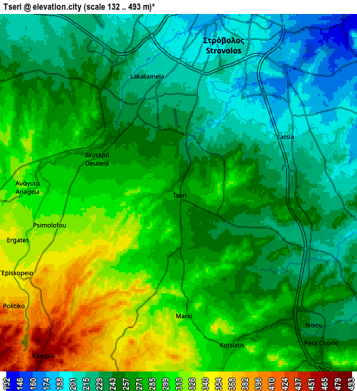
| Scale [m] | 186..384 m | 132..493 m | × |
| Scale [ft] | 610..1260 ft | 433..1617 ft | × |
| Average | 266.7 m = 875 ft | 266.4 m = 874 ft | × |
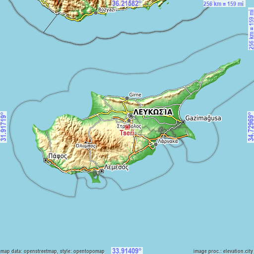
| Width | 8 km = 5 mi | 16 km = 9.9 mi | 255.9 km = 159 mi |
| Height | 8 km = 5 mi | 16 km = 9.9 mi | 255.9 km = 159 mi |
| ↑Max Latitude | 35.109028° | 35.14497° | 36.21582° |
| Latitude at center | 35.07307° | 35.07307° | 35.07307° |
| ↓Min Latitude | 35.037096° | 35.001107° | 33.91409° |
| ← Min Longitude | 33.279495° | 33.235549° | 31.91719° |
| Longitude center | 33.32344° | 33.32344° | 33.32344° |
| →Max Longitude | 33.367385° | 33.411331° | 34.72969° |
Nearby cities:
Cities around Tséri sort by population:
• Nicosia elevation 147 m
12 km,  18°
18°
• Géri 159 m
9.5 km,  67°
67°
• Dáli 222 m
10.6 km,  121°
121°
• Kokkinotrimithiá 218 m
14.3 km,  308°
308°
• Lythrodóntas 417 m
13.8 km,  189°
189°
• Páno Defterá 292 m
5.3 km,  275°
275°
• Káto Defterá 277 m
4.5 km,  286°
286°
• Psimolofou 316 m
5.7 km,  258°
258°
• Ergátes 336 m
7.6 km,  253°
253°
• Alámpra 249 m
11.6 km,  143°
143°
• Aredioú 362 m
11.9 km, 256°
• Péra 374 m
7.7 km,  235°
235°
Multilingual:
 En español:
Tséri elevación 271 m.
 En France:
Tséri élévation 271 m.


Sources and notes:
- [note 1] Map square and city borders are not equal. Map elevation data is calculated only from area inside that square.
- [src 1] Elevation data from geonames database provided with same terms of usage.
- [src 2] The elevation map of Tséri is generated using elevation data from NASA's 3 arcsec (90m) resolution SRTM data.
- [src 3] Base (background) map © OpenStreetMap contributors tiles are generated by Geofabrik and OpenTopoMap.
Copyright & License:
This Tséri Elevation Map is licensed under CC BY-SA. You may reuse any part from this page, if you give a proper credit by linking to this URL:
 More info on terms of use page.