Jimaguayú elevation
Jimaguayú (Camagüey), Cuba elevation is 117 meters and Jimaguayú elevation in feet is 384 ft above sea level [src 1]. Jimaguayú is a seat of a second-order administrative division (feature code) with elevation that is 48 meters (157 ft) bigger than average city elevation in Cuba.
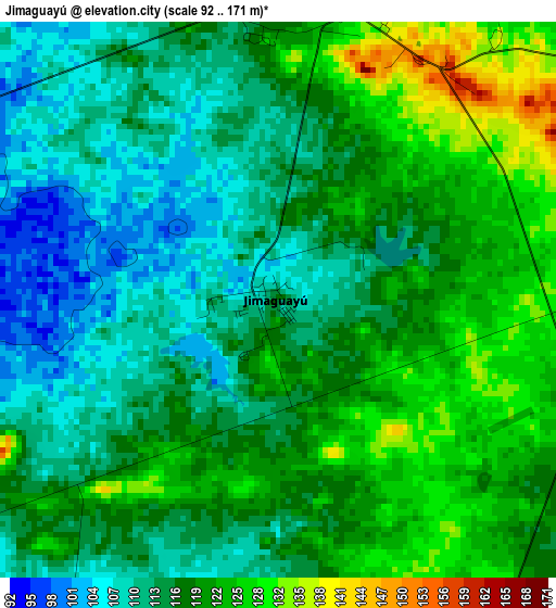
Below is the Elevation map of Jimaguayú, which displays elevation range with different colors. Scale of the first map is from 92 to 171 m (302 to 561 ft) with average elevation of 117.6 meters (=386 ft) [note 1]
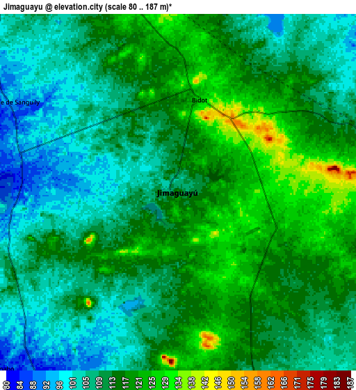
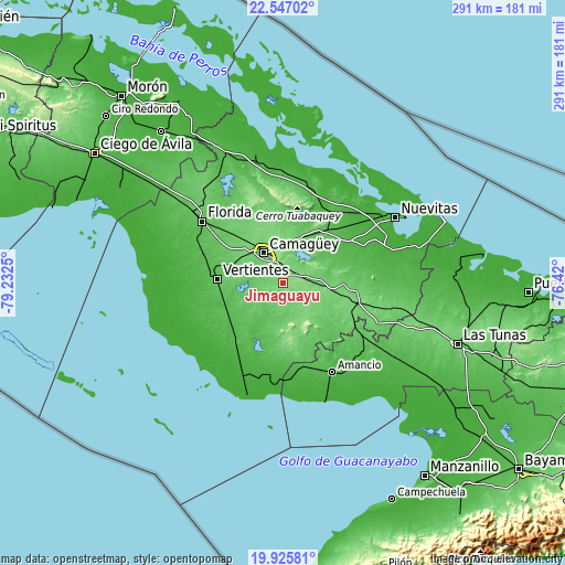
These maps also provides idea of topography and contour of this city, they are displayed at different zoom levels. More info about maps, scale and edge coordinates you can find below images.
| \ | Map #1 | Map #2 | Topo.Map |
| Scale [m] | 92..171 m | 80..187 m | × |
| Scale [ft] | 302..561 ft | 262..614 ft | × |
| Average | 117.6 m = 386 ft | 112.4 m = 369 ft | × |
| Width | 9.11 km = 5.7 mi | 18.22 km = 11.3 mi | 291.5 km = 181.1 mi |
| Height | 9.11 km = 5.7 mi | 18.22 km = 11.3 mi | 291.5 km = 181.1 mi |
| ↑Max Latitude | 21.283194° | 21.324136° | 22.54702° |
| Latitude at center | 21.24224° | 21.24224° | 21.24224° |
| ↓Min Latitude | 21.201275° | 21.160298° | 19.92581° |
| ← Min Longitude | -77.870195° | -77.914141° | -79.2325° |
| Longitude center | -77.82625° | -77.82625° | -77.82625° |
| →Max Longitude | -77.782305° | -77.738359° | -76.42° |
Nearby cities:
Cities around Jimaguayú sort by population:
• Camagüey elevation 102 m
18 km,  328°
328°
• Florida 68 m
52 km,  307°
307°
• Amancio 35 m
53.6 km,  151°
151°
• Guáimaro 84 m
53.7 km,  113°
113°
• Santa Cruz del Sur 7 m
61.1 km,  196°
196°
• Vertientes 71 m
33.6 km,  273°
273°
• Minas 66 m
35.3 km,  39°
39°
• Colombia 64 m
50.2 km,  124°
124°
• Sibanicú 92 m
31.2 km,  91°
91°
• Carlos Manuel de Céspedes 69 m
60 km, 308°
• Cubitas 53 m
52.7 km,  7°
7°
• Najasa 113 m
20.6 km,  155°
155°
Multilingual:
 En español:
Jimaguayú elevación 117 m.
 En France:
Jimaguayú élévation 117 m.
 Auf Deutsch:
Jimaguayú höhe über dem Meeresspiegel ist 117 m.

Sources and notes:
- [note 1] Map square and city borders are not equal. Map elevation data is calculated only from area inside that square.
- [src 1] Elevation data from geonames database provided with same terms of usage.
- [src 2] The elevation map of Jimaguayú is generated using elevation data from NASA's 3 arcsec (90m) resolution SRTM data.
- [src 3] Base (background) map © OpenStreetMap contributors tiles are generated by Geofabrik and OpenTopoMap.
Copyright & License:
This Jimaguayú Elevation Map is licensed under CC BY-SA. You may reuse any part from this page, if you give a proper credit by linking to this URL:
 More info on terms of use page.