La Sierpe elevation
La Sierpe (Sancti Spíritus), Cuba elevation is 43 meters and La Sierpe elevation in feet is 141 ft above sea level [src 1]. La Sierpe is a seat of a second-order administrative division (feature code) with elevation that is 26 meters (85 ft) smaller than average city elevation in Cuba.
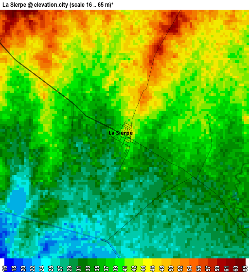
Below is the Elevation map of La Sierpe, which displays elevation range with different colors. Scale of the first map is from 16 to 65 m (52 to 213 ft) with average elevation of 37.3 meters (=122 ft) [note 1]
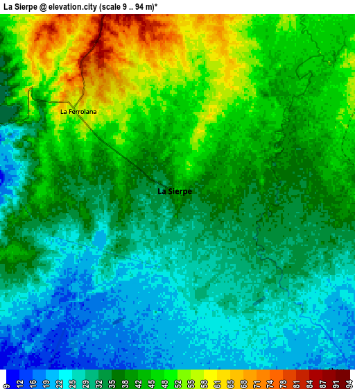
These maps also provides idea of topography and contour of this city, they are displayed at different zoom levels. More info about maps, scale and edge coordinates you can find below images.
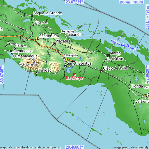
| \ | Map #1 | Map #2 | Topo.Map |
| Scale [m] | 16..65 m | 9..94 m | × |
| Scale [ft] | 52..213 ft | 30..308 ft | × |
| Average | 37.3 m = 122 ft | 38.1 m = 125 ft | × |
| Width | 9.08 km = 5.6 mi | 18.15 km = 11.3 mi | 290.4 km = 180.4 mi |
| Height | 9.08 km = 5.6 mi | 18.15 km = 11.3 mi | 290.4 km = 180.4 mi |
| ↑Max Latitude | 21.813215° | 21.854008° | 23.07231° |
| Latitude at center | 21.77241° | 21.77241° | 21.77241° |
| ↓Min Latitude | 21.731594° | 21.690766° | 20.46063° |
| ← Min Longitude | -79.312265° | -79.356211° | -80.67457° |
| Longitude center | -79.26832° | -79.26832° | -79.26832° |
| →Max Longitude | -79.224375° | -79.180429° | -77.86207° |
Nearby cities:
Cities around La Sierpe sort by population:
• Ciego de Ávila elevation 49 m
52.8 km,  81°
81°
• Sancti Spíritus 66 m
25.1 km,  314°
314°
• Cabaiguán 133 m
41.4 km,  325°
325°
• Chambas 43 m
59.7 km,  37°
37°
• Fomento 127 m
59.6 km, 308°
• Florencia 98 m
51.5 km, 36°
• Jatibonico 79 m
21.6 km,  28°
28°
• Venezuela 22 m
49.2 km,  94°
94°
• Guayos 107 m
36.7 km, 327°
• Zaza del Medio 55 m
27 km,  337°
337°
• Majagua 115 m
31.7 km,  59°
59°
• Taguasco 101 m
25.5 km,  1°
1°
Multilingual:
 En español:
La Sierpe elevación 43 m.
 En France:
La Sierpe élévation 43 m.
 Auf Deutsch:
La Sierpe höhe über dem Meeresspiegel ist 43 m.

Sources and notes:
- [note 1] Map square and city borders are not equal. Map elevation data is calculated only from area inside that square.
- [src 1] Elevation data from geonames database provided with same terms of usage.
- [src 2] The elevation map of La Sierpe is generated using elevation data from NASA's 3 arcsec (90m) resolution SRTM data.
- [src 3] Base (background) map © OpenStreetMap contributors tiles are generated by Geofabrik and OpenTopoMap.
Copyright & License:
This La Sierpe Elevation Map is licensed under CC BY-SA. You may reuse any part from this page, if you give a proper credit by linking to this URL:
 More info on terms of use page.