Perico elevation
Perico (Matanzas), Cuba elevation is 37 meters and Perico elevation in feet is 121 ft above sea level [src 1]. Perico is a seat of a second-order administrative division (feature code) with elevation that is 32 meters (105 ft) smaller than average city elevation in Cuba.
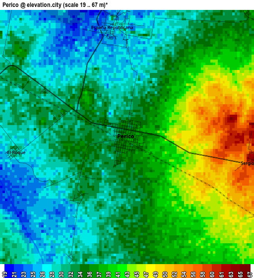
Below is the Elevation map of Perico, which displays elevation range with different colors. Scale of the first map is from 19 to 67 m (62 to 220 ft) with average elevation of 34.9 meters (=115 ft) [note 1]
These maps also provides idea of topography and contour of this city, they are displayed at different zoom levels. More info about maps, scale and edge coordinates you can find below images.
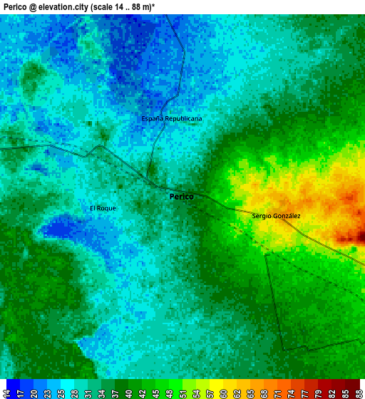
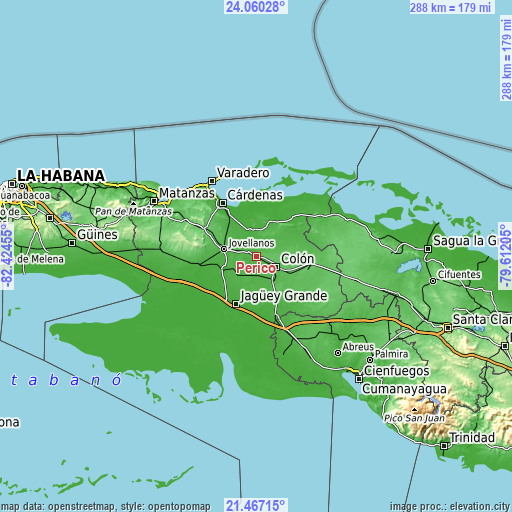
| \ | Map #1 | Map #2 | Topo.Map |
| Scale [m] | 19..67 m | 14..88 m | × |
| Scale [ft] | 62..220 ft | 46..289 ft | × |
| Average | 34.9 m = 115 ft | 34.7 m = 114 ft | × |
| Width | 9.01 km = 5.6 mi | 18.02 km = 11.2 mi | 288.3 km = 179.1 mi |
| Height | 9.01 km = 5.6 mi | 18.02 km = 11.2 mi | 288.3 km = 179.1 mi |
| ↑Max Latitude | 22.810384° | 22.850887° | 24.06028° |
| Latitude at center | 22.76987° | 22.76987° | 22.76987° |
| ↓Min Latitude | 22.729343° | 22.688805° | 21.46715° |
| ← Min Longitude | -81.062245° | -81.106191° | -82.42455° |
| Longitude center | -81.0183° | -81.0183° | -81.0183° |
| →Max Longitude | -80.974355° | -80.930409° | -79.61205° |
Nearby cities:
Cities around Perico sort by population:
• Cárdenas elevation 9 m
35.3 km,  327°
327°
• Colón 60 m
12.9 km,  115°
115°
• Jagüey Grande 16 m
29.3 km,  202°
202°
• Jovellanos 42 m
18.1 km,  281°
281°
• Pedro Betancourt 24 m
28.2 km,  260°
260°
• Limonar 71 m
44.9 km,  296°
296°
• Aguada de Pasajeros 28 m
46.2 km,  157°
157°
• Calimete 23 m
28.4 km, 157°
• Martí 15 m
22.2 km,  27°
27°
• Los Arabos 77 m
30.8 km,  98°
98°
• Bolondrón 52 m
44 km,  269°
269°
• Manguito 50 m
22.9 km,  152°
152°
Multilingual:
 En español:
Perico elevación 37 m.
 En France:
Perico élévation 37 m.


Sources and notes:
- [note 1] Map square and city borders are not equal. Map elevation data is calculated only from area inside that square.
- [src 1] Elevation data from geonames database provided with same terms of usage.
- [src 2] The elevation map of Perico is generated using elevation data from NASA's 3 arcsec (90m) resolution SRTM data.
- [src 3] Base (background) map © OpenStreetMap contributors tiles are generated by Geofabrik and OpenTopoMap.
Copyright & License:
This Perico Elevation Map is licensed under CC BY-SA. You may reuse any part from this page, if you give a proper credit by linking to this URL:
 More info on terms of use page.