Llorente elevation
Llorente (Heredia, Flores), Costa Rica elevation is 1041 meters and Llorente elevation in feet is 3415 ft above sea level [src 1]. Llorente is a populated place (feature code) with elevation that is 301 meters (988 ft) bigger than average city elevation in Costa Rica.
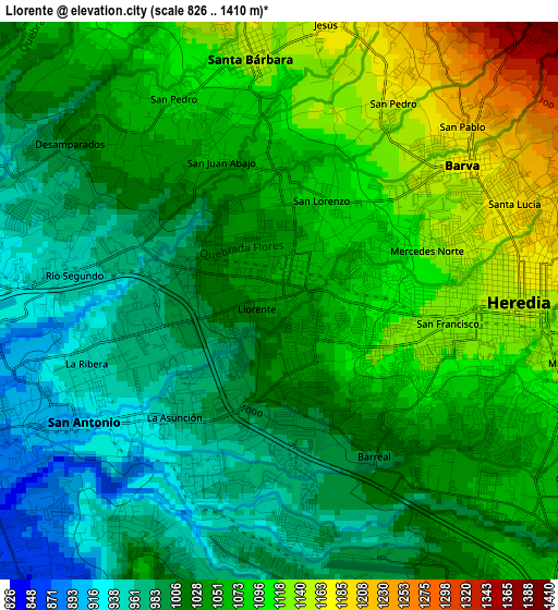
Below is the Elevation map of Llorente, which displays elevation range with different colors. Scale of the first map is from 826 to 1410 m (2710 to 4626 ft) with average elevation of 1044 meters (=3425 ft) [note 1]
These maps also provides idea of topography and contour of this city, they are displayed at different zoom levels. More info about maps, scale and edge coordinates you can find below images.
| \ | Map #1 | Map #2 | Topo.Map |
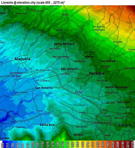
| Scale [m] | 826..1410 m | 655..2275 m | × |
| Scale [ft] | 2710..4626 ft | 2149..7464 ft | × |
| Average | 1044 m = 3425 ft | 1136.2 m = 3728 ft | × |
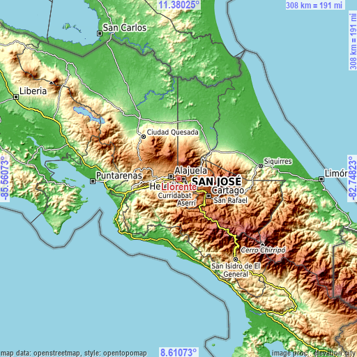
| Width | 9.62 km = 6 mi | 19.25 km = 12 mi | 307.9 km = 191.3 mi |
| Height | 9.62 km = 6 mi | 19.25 km = 12 mi | 308 km = 191.4 mi |
| ↑Max Latitude | 10.041715° | 10.084984° | 11.38025° |
| Latitude at center | 9.99844° | 9.99844° | 9.99844° |
| ↓Min Latitude | 9.955159° | 9.911873° | 8.61073° |
| ← Min Longitude | -84.198425° | -84.242371° | -85.56073° |
| Longitude center | -84.15448° | -84.15448° | -84.15448° |
| →Max Longitude | -84.110535° | -84.066589° | -82.74823° |
Nearby cities:
Cities around Llorente sort by population:
• San Francisco elevation 1128 m
2.8 km,  102°
102°
• Alajuela 954 m
6.6 km,  287°
287°
• Mercedes 1107 m
2.4 km,  67°
67°
• San Rafael 1060 m
8.1 km,  166°
166°
• Heredia 1174 m
4.2 km,  84°
84°
• San Pablo 1203 m
6.4 km,  92°
92°
• San Josecito 1272 m
6.3 km, 71°
• San Antonio 937 m
3.6 km,  241°
241°
• San Rafael 1263 m
6.2 km, 74°
• Santa Ana 909 m
7.9 km,  202°
202°
• Santo Domingo 1327 m
7.3 km,  359°
359°
• La Asunción 956 m
2.9 km,  223°
223°
Multilingual:
 En español:
Llorente elevación 1041 m.
 En France:
Llorente élévation 1041 m.
 Auf Deutsch:
Llorente höhe über dem Meeresspiegel ist 1041 m.

Sources and notes:
- [note 1] Map square and city borders are not equal. Map elevation data is calculated only from area inside that square.
- [src 1] Elevation data from geonames database provided with same terms of usage.
- [src 2] The elevation map of Llorente is generated using elevation data from NASA's 3 arcsec (90m) resolution SRTM data.
- [src 3] Base (background) map © OpenStreetMap contributors tiles are generated by Geofabrik and OpenTopoMap.
Copyright & License:
This Llorente Elevation Map is licensed under CC BY-SA. You may reuse any part from this page, if you give a proper credit by linking to this URL:
 More info on terms of use page.