Algarrobo elevation
Algarrobo (Magdalena, Chibolo), Colombia elevation is 51 meters and Algarrobo elevation in feet is 167 ft above sea level [src 1]. Algarrobo is a populated place (feature code) with elevation that is 1098 meters (3602 ft) smaller than average city elevation in Colombia.
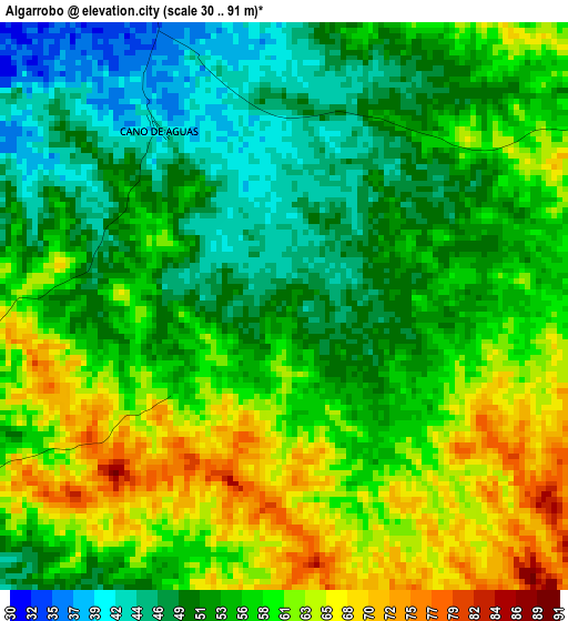
Below is the Elevation map of Algarrobo, which displays elevation range with different colors. Scale of the first map is from 30 to 91 m (98 to 299 ft) with average elevation of 55.8 meters (=183 ft) [note 1]
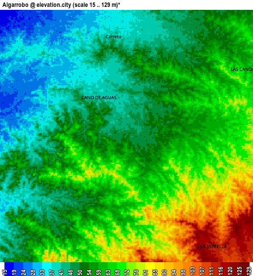
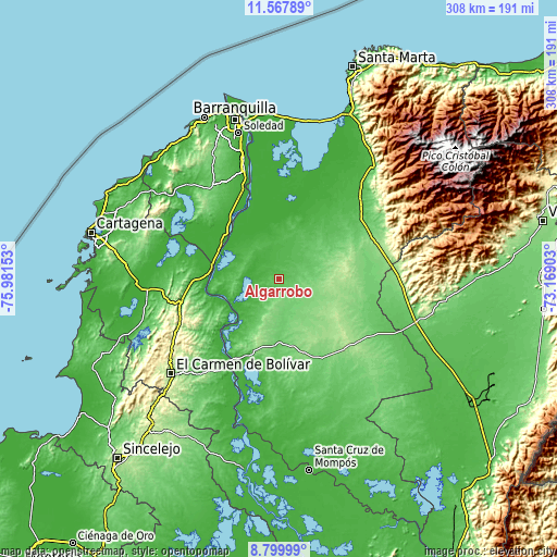
These maps also provides idea of topography and contour of this city, they are displayed at different zoom levels. More info about maps, scale and edge coordinates you can find below images.
| \ | Map #1 | Map #2 | Topo.Map |
| Scale [m] | 30..91 m | 15..129 m | × |
| Scale [ft] | 98..299 ft | 49..423 ft | × |
| Average | 55.8 m = 183 ft | 57.9 m = 190 ft | × |
| Width | 9.62 km = 6 mi | 19.24 km = 12 mi | 307.8 km = 191.3 mi |
| Height | 9.62 km = 6 mi | 19.24 km = 12 mi | 307.8 km = 191.3 mi |
| ↑Max Latitude | 10.23019° | 10.273433° | 11.56789° |
| Latitude at center | 10.18694° | 10.18694° | 10.18694° |
| ↓Min Latitude | 10.143685° | 10.100423° | 8.79999° |
| ← Min Longitude | -74.619225° | -74.663171° | -75.98153° |
| Longitude center | -74.57528° | -74.57528° | -74.57528° |
| →Max Longitude | -74.531335° | -74.487389° | -73.16903° |
Nearby cities:
Cities around Algarrobo sort by population:
• Pivijay elevation 12 m
30.9 km,  351°
351°
• Campo de la Cruz 9 m
39.9 km,  302°
302°
• Chivolo 135 m
18.7 km,  196°
196°
• Suan 10 m
37.1 km, 296°
• Calamar 6 m
38 km,  281°
281°
• San Antonio 110 m
31.1 km, 204°
• El Piñón 9 m
36.3 km,  311°
311°
• Cerro de San Antonio 11 m
35.7 km, 295°
• Concordia 138 m
41.2 km,  161°
161°
• Pedraza 10 m
37.2 km,  270°
270°
• Concordia 15 m
29.3 km,  285°
285°
• Punta de Piedras 22 m
15.6 km,  262°
262°
Multilingual:
 En español:
Algarrobo elevación 51 m.
 En France:
Algarrobo élévation 51 m.
 Auf Deutsch:
Algarrobo höhe über dem Meeresspiegel ist 51 m.

Sources and notes:
- [note 1] Map square and city borders are not equal. Map elevation data is calculated only from area inside that square.
- [src 1] Elevation data from geonames database provided with same terms of usage.
- [src 2] The elevation map of Algarrobo is generated using elevation data from NASA's 3 arcsec (90m) resolution SRTM data.
- [src 3] Base (background) map © OpenStreetMap contributors tiles are generated by Geofabrik and OpenTopoMap.
Copyright & License:
This Algarrobo Elevation Map is licensed under CC BY-SA. You may reuse any part from this page, if you give a proper credit by linking to this URL:
 More info on terms of use page.