La Jagua de Ibirico elevation
La Jagua de Ibirico (Cesar), Colombia elevation is 140 meters and La Jagua de Ibirico elevation in feet is 459 ft above sea level [src 1]. La Jagua de Ibirico is a seat of a second-order administrative division (feature code) with elevation that is 1009 meters (3310 ft) smaller than average city elevation in Colombia.
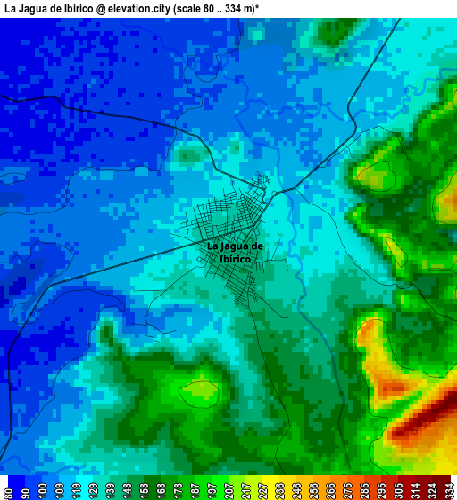
Below is the Elevation map of La Jagua de Ibirico, which displays elevation range with different colors. Scale of the first map is from 80 to 334 m (262 to 1096 ft) with average elevation of 133.7 meters (=439 ft) [note 1]
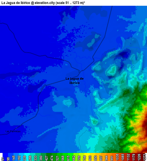
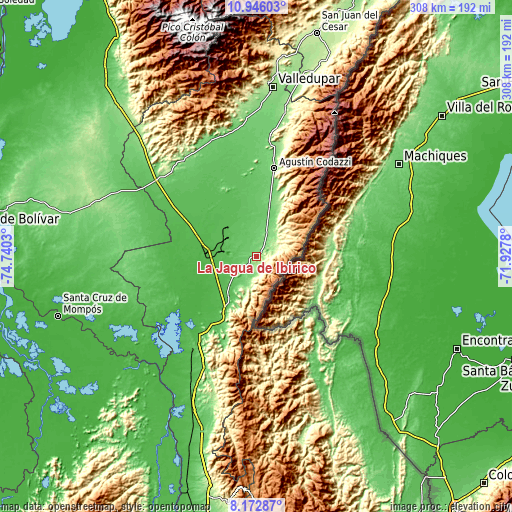
These maps also provides idea of topography and contour of this city, they are displayed at different zoom levels. More info about maps, scale and edge coordinates you can find below images.
| \ | Map #1 | Map #2 | Topo.Map |
| Scale [m] | 80..334 m | 51..1273 m | × |
| Scale [ft] | 262..1096 ft | 167..4177 ft | × |
| Average | 133.7 m = 439 ft | 176 m = 577 ft | × |
| Width | 9.64 km = 6 mi | 19.27 km = 12 mi | 308.3 km = 191.6 mi |
| Height | 9.64 km = 6 mi | 19.27 km = 12 mi | 308.4 km = 191.6 mi |
| ↑Max Latitude | 9.605612° | 9.648938° | 10.94603° |
| Latitude at center | 9.56228° | 9.56228° | 9.56228° |
| ↓Min Latitude | 9.518943° | 9.4756° | 8.17287° |
| ← Min Longitude | -73.377995° | -73.421941° | -74.7403° |
| Longitude center | -73.33405° | -73.33405° | -73.33405° |
| →Max Longitude | -73.290105° | -73.246159° | -71.9278° |
Nearby cities:
Cities around La Jagua de Ibirico sort by population:
• Agustín Codazzi elevation 136 m
53.8 km,  11°
11°
• Curumaní 59 m
46.3 km,  209°
209°
• Chimichagua 35 m
62.4 km,  237°
237°
• Chiriguaná 33 m
36.9 km,  233°
233°
• La Paz 152 m
93.1 km, 10°
• Pailitas 74 m
74.6 km, 205°
• Becerril 112 m
16.9 km,  20°
20°
• Astrea 87 m
70.7 km,  264°
264°
• San Diego 166 m
87.7 km, 10°
• El Paso 41 m
46.5 km,  283°
283°
• El Peñón 21 m
92.8 km, 226°
• Bosconia 84 m
75.8 km,  306°
306°
Multilingual:
 En español:
La Jagua de Ibirico elevación 140 m.
 En France:
La Jagua de Ibirico élévation 140 m.
 Auf Deutsch:
La Jagua de Ibirico höhe über dem Meeresspiegel ist 140 m.
 На русском:
La Jagua de Ibirico высота над уровнем моря 140 м
Sources and notes:
- [note 1] Map square and city borders are not equal. Map elevation data is calculated only from area inside that square.
- [src 1] Elevation data from geonames database provided with same terms of usage.
- [src 2] The elevation map of La Jagua de Ibirico is generated using elevation data from NASA's 3 arcsec (90m) resolution SRTM data.
- [src 3] Base (background) map © OpenStreetMap contributors tiles are generated by Geofabrik and OpenTopoMap.
Copyright & License:
This La Jagua de Ibirico Elevation Map is licensed under CC BY-SA. You may reuse any part from this page, if you give a proper credit by linking to this URL:
 More info on terms of use page.