Leticia elevation
Leticia (Amazonas), Colombia elevation is 82 meters and Leticia elevation in feet is 269 ft above sea level [src 1]. Leticia is a seat of a first-order administrative division (feature code) with elevation that is 1067 meters (3501 ft) smaller than average city elevation in Colombia.
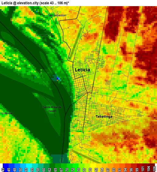
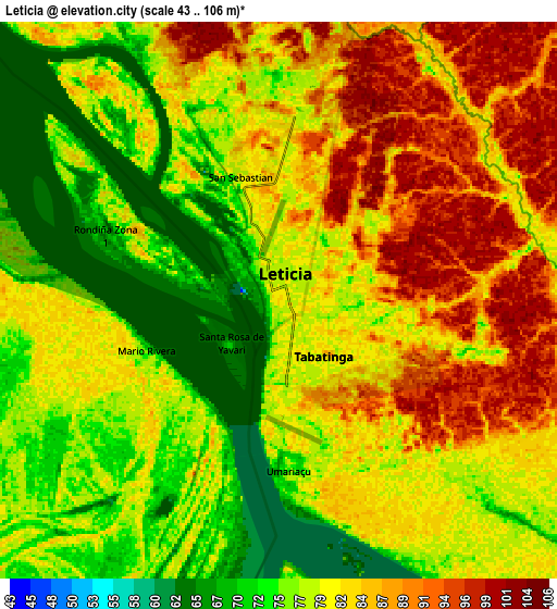
Below is the Elevation map of Leticia, which displays elevation range with different colors. Scale of the first map is from 43 to 106 m (141 to 348 ft) with average elevation of 77.6 meters (=255 ft) [note 1]
These maps also provides idea of topography and contour of this city, they are displayed at different zoom levels. More info about maps, scale and edge coordinates you can find below images.
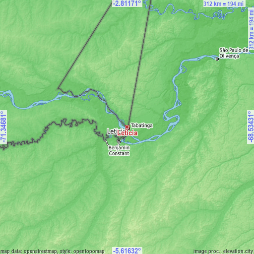
| \ | Map #1 | Map #2 | Topo.Map |
| Scale [m] | 43..106 m | 43..106 m | × |
| Scale [ft] | 141..348 ft | 141..348 ft | × |
| Average | 77.6 m = 255 ft | 80.4 m = 264 ft | × |
| Width | 9.75 km = 6.1 mi | 19.49 km = 12.1 mi | 311.8 km = 193.7 mi |
| Height | 9.75 km = 6.1 mi | 19.49 km = 12.1 mi | 311.9 km = 193.8 mi |
| ↑Max Latitude | -4.171452° | -4.127622° | -2.81171° |
| Latitude at center | -4.21528° | -4.21528° | -4.21528° |
| ↓Min Latitude | -4.259105° | -4.302928° | -5.61632° |
| ← Min Longitude | -69.984505° | -70.028451° | -71.34681° |
| Longitude center | -69.94056° | -69.94056° | -69.94056° |
| →Max Longitude | -69.896615° | -69.852669° | -68.53431° |
Nearby cities:
Cities around Leticia sort by population:
• Tarapacá elevation 67 m
148.8 km,  8°
8°
• Puerto Nariño 92 m
66.1 km,  315°
315°
Multilingual:
 En español:
Leticia elevación 82 m.
 En France:
Leticia élévation 82 m.


Sources and notes:
- [note 1] Map square and city borders are not equal. Map elevation data is calculated only from area inside that square.
- [src 1] Elevation data from geonames database provided with same terms of usage.
- [src 2] The elevation map of Leticia is generated using elevation data from NASA's 3 arcsec (90m) resolution SRTM data.
- [src 3] Base (background) map © OpenStreetMap contributors tiles are generated by Geofabrik and OpenTopoMap.
Copyright & License:
This Leticia Elevation Map is licensed under CC BY-SA. You may reuse any part from this page, if you give a proper credit by linking to this URL:
 More info on terms of use page.