Muyuka elevation
Muyuka (South-West), Cameroon elevation is 41 meters and Muyuka elevation in feet is 135 ft above sea level [src 1]. Muyuka is a populated place (feature code) with elevation that is 634 meters (2080 ft) smaller than average city elevation in Cameroon.
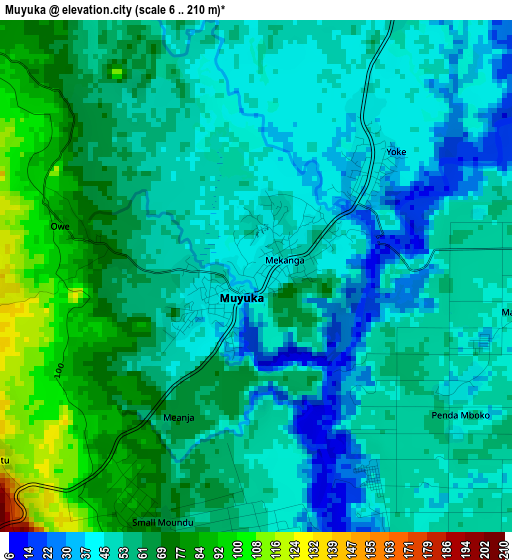
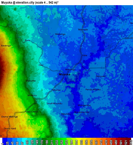
Below is the Elevation map of Muyuka, which displays elevation range with different colors. Scale of the first map is from 6 to 210 m (20 to 689 ft) with average elevation of 56.5 meters (=185 ft) [note 1]
These maps also provides idea of topography and contour of this city, they are displayed at different zoom levels. More info about maps, scale and edge coordinates you can find below images.
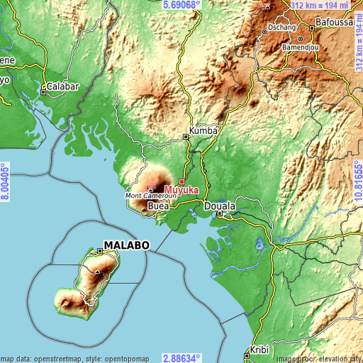
| \ | Map #1 | Map #2 | Topo.Map |
| Scale [m] | 6..210 m | 4..542 m | × |
| Scale [ft] | 20..689 ft | 13..1778 ft | × |
| Average | 56.5 m = 185 ft | 107.8 m = 354 ft | × |
| Width | 9.75 km = 6.1 mi | 19.49 km = 12.1 mi | 311.8 km = 193.7 mi |
| Height | 9.75 km = 6.1 mi | 19.49 km = 12.1 mi | 311.8 km = 193.7 mi |
| ↑Max Latitude | 4.333621° | 4.377439° | 5.69068° |
| Latitude at center | 4.2898° | 4.2898° | 4.2898° |
| ↓Min Latitude | 4.245977° | 4.202151° | 2.88634° |
| ← Min Longitude | 9.366355° | 9.322409° | 8.00405° |
| Longitude center | 9.4103° | 9.4103° | 9.4103° |
| →Max Longitude | 9.454245° | 9.498191° | 10.81655° |
Nearby cities:
Cities around Muyuka sort by population:
• Douala elevation 19 m
42.2 km,  129°
129°
• Kumba 244 m
38.7 km,  6°
6°
• Limbe 74 m
37.3 km,  217°
217°
• Tiko 33 m
24.5 km,  193°
193°
• Mutengene 241 m
24.5 km,  205°
205°
• Buea 825 m
24 km,  230°
230°
• Mbanga 115 m
29.3 km,  36°
36°
• Penja 148 m
49 km, 37°
• Bonabéri 1 m
38.7 km, 128°
• Bekondo 382 m
44.7 km,  347°
347°
• Ndom 123 m
28.6 km, 36°
• Dibombari 57 m
29.9 km,  114°
114°
Multilingual:
 En español:
Muyuka elevación 41 m.
 En France:
Muyuka élévation 41 m.


Sources and notes:
- [note 1] Map square and city borders are not equal. Map elevation data is calculated only from area inside that square.
- [src 1] Elevation data from geonames database provided with same terms of usage.
- [src 2] The elevation map of Muyuka is generated using elevation data from NASA's 3 arcsec (90m) resolution SRTM data.
- [src 3] Base (background) map © OpenStreetMap contributors tiles are generated by Geofabrik and OpenTopoMap.
Copyright & License:
This Muyuka Elevation Map is licensed under CC BY-SA. You may reuse any part from this page, if you give a proper credit by linking to this URL:
 More info on terms of use page.