Wülflingen (Kreis 6) elevation
Wülflingen (Kreis 6) (Zurich, Bezirk Winterthur), Switzerland elevation is 410 meters and Wülflingen (Kreis 6) elevation in feet is 1345 ft above sea level [src 1]. Wülflingen (Kreis 6) is a populated place (feature code) with elevation that is 138 meters (453 ft) smaller than average city elevation in Switzerland.
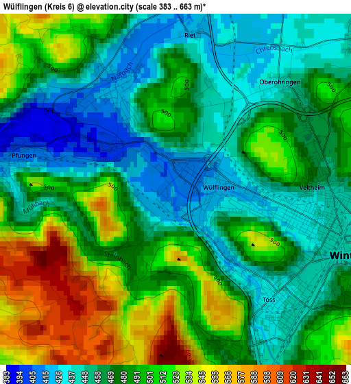
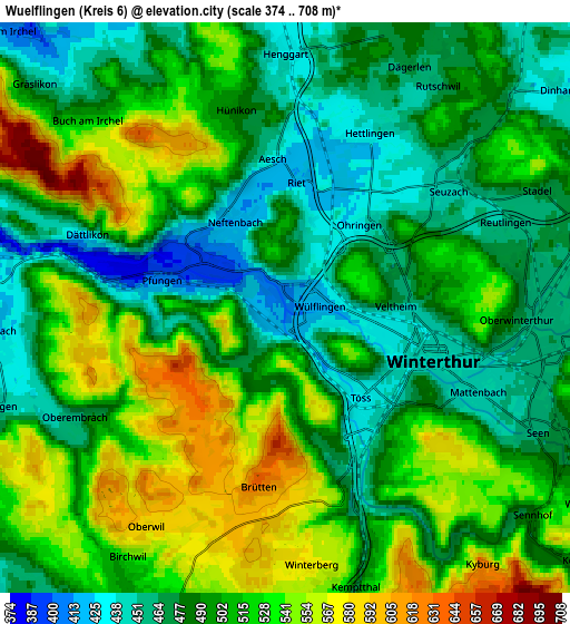
Below is the Elevation map of Wülflingen (Kreis 6), which displays elevation range with different colors. Scale of the first map is from 383 to 663 m (1257 to 2175 ft) with average elevation of 482 meters (=1581 ft) [note 1]
These maps also provides idea of topography and contour of this city, they are displayed at different zoom levels. More info about maps, scale and edge coordinates you can find below images.
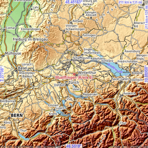
| \ | Map #1 | Map #2 | Topo.Map |
| Scale [m] | 383..663 m | 374..708 m | × |
| Scale [ft] | 1257..2175 ft | 1227..2323 ft | × |
| Average | 482 m = 1581 ft | 503.2 m = 1651 ft | × |
| Width | 6.6 km = 4.1 mi | 13.2 km = 8.2 mi | 211.2 km = 131.2 mi |
| Height | 6.6 km = 4.1 mi | 13.2 km = 8.2 mi | 211.2 km = 131.2 mi |
| ↑Max Latitude | 47.540035° | 47.569693° | 48.45163° |
| Latitude at center | 47.51036° | 47.51036° | 47.51036° |
| ↓Min Latitude | 47.480668° | 47.45096° | 46.5519° |
| ← Min Longitude | 8.639385° | 8.595439° | 7.27708° |
| Longitude center | 8.68333° | 8.68333° | 8.68333° |
| →Max Longitude | 8.727275° | 8.771221° | 10.08958° |
Nearby cities:
Cities around Wülflingen (Kreis 6) sort by population:
• Veltheim (Kreis 5) elevation 472 m
2.6 km,  80°
80°
• Veltheim (Kreis 5) / Rosenberg 481 m
2.5 km, 80°
• Wülflingen (Kreis 6) / Oberfeld 454 m
1.7 km,  137°
137°
• Veltheim (Kreis 5) / Blumenau 434 m
2.5 km,  100°
100°
• Neftenbach / Dorf Neftenbach 414 m
2.4 km,  324°
324°
• Stadt Winterthur (Kreis 1) / Neuwiesen 430 m
2.6 km,  110°
110°
• Töss (Kreis 4) / Schlosstal 432 m
2.4 km, 143°
• Wülflingen (Kreis 6) / Härti 411 m
0.3 km,  11°
11°
• Wülflingen (Kreis 6) / Lindenplatz 419 m
0.7 km, 84°
• Stadt Winterthur (Kreis 1) / Tössfeld 438 m
3 km,  128°
128°
• Stadt Winterthur (Kreis 1) / Brühlberg 454 m
2.6 km,  122°
122°
• Wülflingen (Kreis 6) / Niederfeld 412 m
0.3 km,  241°
241°
Multilingual:
 En español:
Wülflingen (Kreis 6) elevación 410 m.
 En France:
Wülflingen (Kreis 6) élévation 410 m.
 Auf Deutsch:
Wülflingen (Kreis 6) höhe über dem Meeresspiegel ist 410 m.
 На русском:
Wülflingen (Kreis 6) высота над уровнем моря 410 м
Sources and notes:
- [note 1] Map square and city borders are not equal. Map elevation data is calculated only from area inside that square.
- [src 1] Elevation data from geonames database provided with same terms of usage.
- [src 2] The elevation map of Wülflingen (Kreis 6) is generated using elevation data from NASA's 3 arcsec (90m) resolution SRTM data.
- [src 3] Base (background) map © OpenStreetMap contributors tiles are generated by Geofabrik and OpenTopoMap.
Copyright & License:
This Wülflingen (Kreis 6) Elevation Map is licensed under CC BY-SA. You may reuse any part from this page, if you give a proper credit by linking to this URL:
 More info on terms of use page.