Schwerzenbach elevation
Schwerzenbach (Zurich, Bezirk Uster), Switzerland elevation is 447 meters and Schwerzenbach elevation in feet is 1467 ft above sea level [src 1]. Schwerzenbach is a populated place (feature code) with elevation that is 101 meters (331 ft) smaller than average city elevation in Switzerland.
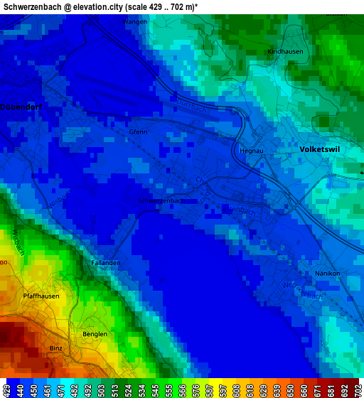
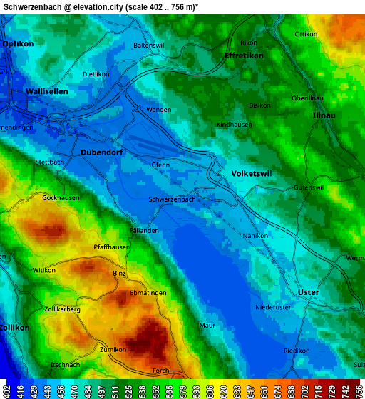
Below is the Elevation map of Schwerzenbach, which displays elevation range with different colors. Scale of the first map is from 429 to 702 m (1407 to 2303 ft) with average elevation of 474.9 meters (=1558 ft) [note 1]
These maps also provides idea of topography and contour of this city, they are displayed at different zoom levels. More info about maps, scale and edge coordinates you can find below images.
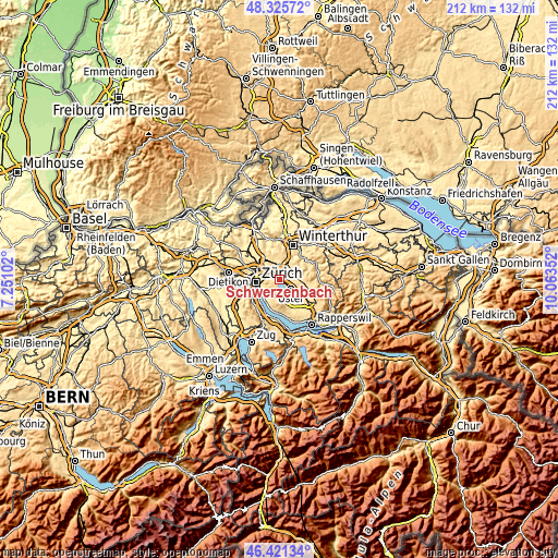
| \ | Map #1 | Map #2 | Topo.Map |
| Scale [m] | 429..702 m | 402..756 m | × |
| Scale [ft] | 1407..2303 ft | 1319..2480 ft | × |
| Average | 474.9 m = 1558 ft | 511.7 m = 1679 ft | × |
| Width | 6.62 km = 4.1 mi | 13.23 km = 8.2 mi | 211.7 km = 131.5 mi |
| Height | 6.62 km = 4.1 mi | 13.23 km = 8.2 mi | 211.7 km = 131.5 mi |
| ↑Max Latitude | 47.411877° | 47.441608° | 48.32572° |
| Latitude at center | 47.38213° | 47.38213° | 47.38213° |
| ↓Min Latitude | 47.352366° | 47.322585° | 46.42134° |
| ← Min Longitude | 8.613325° | 8.569379° | 7.25102° |
| Longitude center | 8.65727° | 8.65727° | 8.65727° |
| →Max Longitude | 8.701215° | 8.745161° | 10.06352° |
Nearby cities:
Cities around Schwerzenbach sort by population:
• Hegnau elevation 451 m
1.5 km,  40°
40°
• Greifensee 444 m
2.4 km,  132°
132°
• Hegnau / Sunnebüel-Eich 460 m
2 km,  55°
55°
• Hegnau / Dammboden-Grindel 448 m
0.9 km,  51°
51°
• Volketswil / Volketswil (Dorf) 470 m
2.7 km,  70°
70°
• Fällanden 448 m
1.8 km,  230°
230°
• Benglen 572 m
2.8 km,  212°
212°
• Nänikon 452 m
2.8 km,  119°
119°
• Schwerzenbach / Blatten 447 m
0.6 km,  280°
280°
• Greifensee / Müllerwis / Seilerwis 448 m
2.2 km, 125°
• Schwerzenbach / Chimli 446 m
0.4 km,  16°
16°
• Dübendorf / Sonnenberg 443 m
2.4 km,  305°
305°
Multilingual:
 En español:
Schwerzenbach elevación 447 m.
 En France:
Schwerzenbach élévation 447 m.
 Auf Deutsch:
Schwerzenbach höhe über dem Meeresspiegel ist 447 m.

Sources and notes:
- [note 1] Map square and city borders are not equal. Map elevation data is calculated only from area inside that square.
- [src 1] Elevation data from geonames database provided with same terms of usage.
- [src 2] The elevation map of Schwerzenbach is generated using elevation data from NASA's 3 arcsec (90m) resolution SRTM data.
- [src 3] Base (background) map © OpenStreetMap contributors tiles are generated by Geofabrik and OpenTopoMap.
Copyright & License:
This Schwerzenbach Elevation Map is licensed under CC BY-SA. You may reuse any part from this page, if you give a proper credit by linking to this URL:
 More info on terms of use page.