Zürich (Kreis 9) / Altstetten elevation
Zürich (Kreis 9) / Altstetten (Zurich, Bezirk Zürich), Switzerland elevation is 403 meters and Zürich (Kreis 9) / Altstetten elevation in feet is 1322 ft above sea level [src 1]. Zürich (Kreis 9) / Altstetten is a section of populated place (feature code) with elevation that is 145 meters (476 ft) smaller than average city elevation in Switzerland.
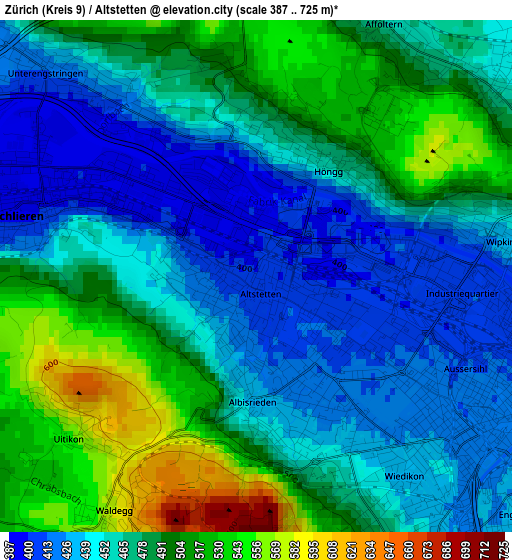
Below is the Elevation map of Zürich (Kreis 9) / Altstetten, which displays elevation range with different colors. Scale of the first map is from 387 to 725 m (1270 to 2379 ft) with average elevation of 471.2 meters (=1546 ft) [note 1]
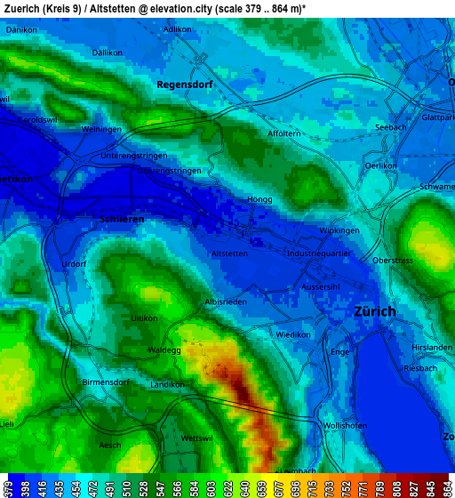
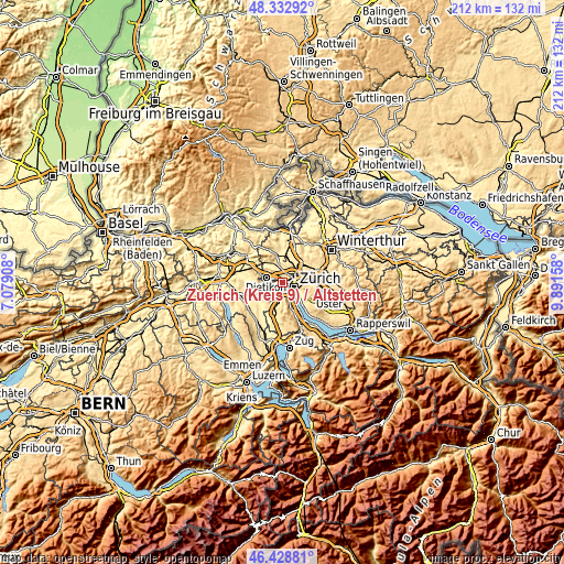
These maps also provides idea of topography and contour of this city, they are displayed at different zoom levels. More info about maps, scale and edge coordinates you can find below images.
| \ | Map #1 | Map #2 | Topo.Map |
| Scale [m] | 387..725 m | 379..864 m | × |
| Scale [ft] | 1270..2379 ft | 1243..2835 ft | × |
| Average | 471.2 m = 1546 ft | 483.3 m = 1586 ft | × |
| Width | 6.62 km = 4.1 mi | 13.23 km = 8.2 mi | 211.7 km = 131.5 mi |
| Height | 6.62 km = 4.1 mi | 13.23 km = 8.2 mi | 211.7 km = 131.5 mi |
| ↑Max Latitude | 47.419203° | 47.448929° | 48.33292° |
| Latitude at center | 47.38946° | 47.38946° | 47.38946° |
| ↓Min Latitude | 47.3597° | 47.329923° | 46.42881° |
| ← Min Longitude | 8.441385° | 8.397439° | 7.07908° |
| Longitude center | 8.48533° | 8.48533° | 8.48533° |
| →Max Longitude | 8.529275° | 8.573221° | 9.89158° |
Nearby cities:
Cities around Zürich (Kreis 9) / Altstetten sort by population:
• Zürich (Kreis 9) elevation 426 m
0.9 km,  207°
207°
• Zürich (Kreis 10) 516 m
2.3 km,  29°
29°
• Zürich (Kreis 3) / Sihlfeld 416 m
2.6 km,  131°
131°
• Zürich (Kreis 10) / Höngg 468 m
1.8 km, 30°
• Zürich (Kreis 9) / Albisrieden 428 m
1.8 km,  168°
168°
• Zürich (Kreis 4) / Hard 410 m
1.9 km,  111°
111°
• Zürich (Kreis 5) 405 m
2.7 km,  94°
94°
• Oberengstringen 417 m
2.6 km,  324°
324°
• Zürich (Kreis 10) / Rütihof 500 m
2.8 km,  350°
350°
• Zürich (Kreis 5) / Escher-Wyss 403 m
2.1 km, 86°
• Oberengstringen / Zentrum 404 m
2.6 km, 319°
• Schlieren / Boden 395 m
2.3 km,  292°
292°
Multilingual:
 En español:
Zürich (Kreis 9) / Altstetten elevación 403 m.
 En France:
Zürich (Kreis 9) / Altstetten élévation 403 m.
 Auf Deutsch:
Zürich (Kreis 9) / Altstetten höhe über dem Meeresspiegel ist 403 m.
 На русском:
Zürich (Kreis 9) / Altstetten высота над уровнем моря 403 м
Sources and notes:
- [note 1] Map square and city borders are not equal. Map elevation data is calculated only from area inside that square.
- [src 1] Elevation data from geonames database provided with same terms of usage.
- [src 2] The elevation map of Zürich (Kreis 9) / Altstetten is generated using elevation data from NASA's 3 arcsec (90m) resolution SRTM data.
- [src 3] Base (background) map © OpenStreetMap contributors tiles are generated by Geofabrik and OpenTopoMap.
Copyright & License:
This Zürich (Kreis 9) / Altstetten Elevation Map is licensed under CC BY-SA. You may reuse any part from this page, if you give a proper credit by linking to this URL:
 More info on terms of use page.