Uster / Nossikon elevation
Uster / Nossikon (Zurich, Bezirk Uster), Switzerland elevation is 483 meters and Uster / Nossikon elevation in feet is 1585 ft above sea level [src 1]. Uster / Nossikon is a section of populated place (feature code) with elevation that is 65 meters (213 ft) smaller than average city elevation in Switzerland.
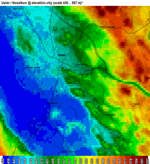
Below is the Elevation map of Uster / Nossikon, which displays elevation range with different colors. Scale of the first map is from 430 to 597 m (1411 to 1959 ft) with average elevation of 485.7 meters (=1594 ft) [note 1]
These maps also provides idea of topography and contour of this city, they are displayed at different zoom levels. More info about maps, scale and edge coordinates you can find below images.
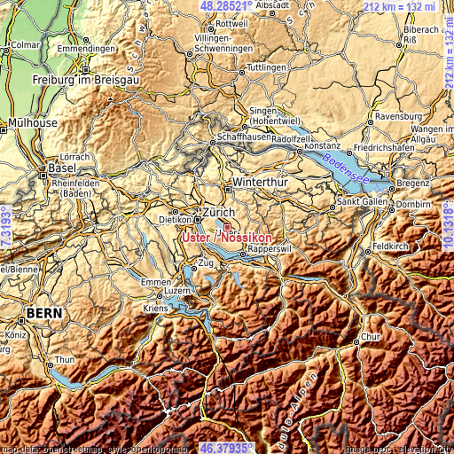
| \ | Map #1 | Topo.Map |
| Scale [m] | 430..597 m | × |
| Scale [ft] | 1411..1959 ft | × |
| Average | 485.7 m = 1594 ft | × |
| Width | 6.62 km = 4.1 mi | 211.9 km = 131.7 mi |
| Height | 6.62 km = 4.1 mi | 211.9 km = 131.7 mi |
| ↑Max Latitude | 47.37065° | 48.28521° |
| Latitude at center | 47.34088° | 47.34088° |
| ↓Min Latitude | 47.311093° | 46.37935° |
| ← Min Longitude | 8.681605° | 7.3193° |
| Longitude center | 8.72555° | 8.72555° |
| →Max Longitude | 8.769495° | 10.1318° |
Nearby cities:
Cities around Uster / Nossikon sort by population:
• Uster elevation 469 m
0.8 km,  333°
333°
• Uster / Kirch-Uster 475 m
0.8 km,  315°
315°
• Uster / Ober-Uster 502 m
1 km,  33°
33°
• Greifensee 444 m
4.4 km,  311°
311°
• Gossau 473 m
4.7 km,  148°
148°
• Uster / Nieder-Uster 459 m
2 km,  291°
291°
• Mönchaltorf 445 m
3.5 km,  186°
186°
• Uster / Gschwader 470 m
2.3 km,  337°
337°
• Nänikon 452 m
4.2 km, 319°
• Nänikon / Nänikon (Dorfkern) 453 m
4.2 km, 323°
• Greifensee / Pfisterhölzli 458 m
3.7 km, 314°
• Mönchaltorf / Dorf 446 m
4.1 km,  183°
183°
Multilingual:
 En español:
Uster / Nossikon elevación 483 m.
 En France:
Uster / Nossikon élévation 483 m.
 Auf Deutsch:
Uster / Nossikon höhe über dem Meeresspiegel ist 483 m.

Sources and notes:
- [note 1] Map square and city borders are not equal. Map elevation data is calculated only from area inside that square.
- [src 1] Elevation data from geonames database provided with same terms of usage.
- [src 2] The elevation map of Uster / Nossikon is generated using elevation data from NASA's 3 arcsec (90m) resolution SRTM data.
- [src 3] Base (background) map © OpenStreetMap contributors tiles are generated by Geofabrik and OpenTopoMap.
Copyright & License:
This Uster / Nossikon Elevation Map is licensed under CC BY-SA. You may reuse any part from this page, if you give a proper credit by linking to this URL:
 More info on terms of use page.