Ecublens elevation
Ecublens (Vaud, Ouest Lausannois District), Switzerland elevation is 419 meters and Ecublens elevation in feet is 1375 ft above sea level [src 1]. Ecublens is a seat of a third-order administrative division (feature code) with elevation that is 129 meters (423 ft) smaller than average city elevation in Switzerland.
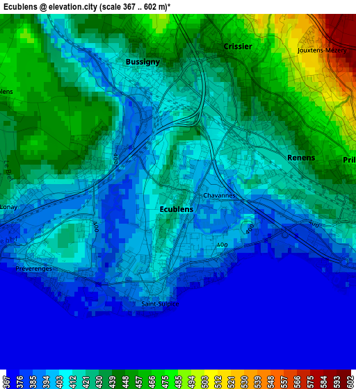
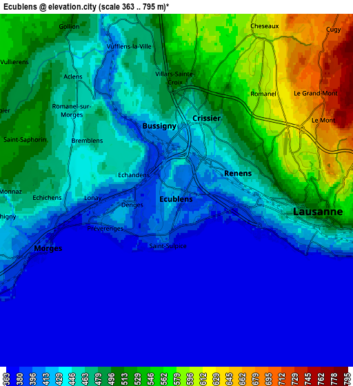
Below is the Elevation map of Ecublens, which displays elevation range with different colors. Scale of the first map is from 367 to 602 m (1204 to 1975 ft) with average elevation of 413.8 meters (=1358 ft) [note 1]
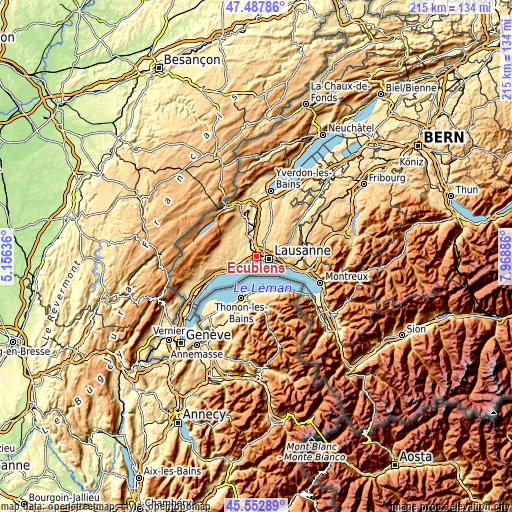
These maps also provides idea of topography and contour of this city, they are displayed at different zoom levels. More info about maps, scale and edge coordinates you can find below images.
| \ | Map #1 | Map #2 | Topo.Map |
| Scale [m] | 367..602 m | 363..795 m | × |
| Scale [ft] | 1204..1975 ft | 1191..2608 ft | × |
| Average | 413.8 m = 1358 ft | 455.7 m = 1495 ft | × |
| Width | 6.72 km = 4.2 mi | 13.45 km = 8.4 mi | 215.1 km = 133.7 mi |
| Height | 6.72 km = 4.2 mi | 13.45 km = 8.4 mi | 215.1 km = 133.7 mi |
| ↑Max Latitude | 46.559215° | 46.589424° | 47.48786° |
| Latitude at center | 46.52899° | 46.52899° | 46.52899° |
| ↓Min Latitude | 46.498748° | 46.468489° | 45.55289° |
| ← Min Longitude | 6.518665° | 6.474719° | 5.15636° |
| Longitude center | 6.56261° | 6.56261° | 6.56261° |
| →Max Longitude | 6.606555° | 6.650501° | 7.96886° |
Nearby cities:
Cities around Ecublens sort by population:
• Lausanne elevation 453 m
5.6 km,  105°
105°
• Renens 441 m
2.3 km,  58°
58°
• Morges 380 m
5.3 km,  248°
248°
• Prilly 489 m
3.3 km,  74°
74°
• Bussigny 432 m
2.5 km,  348°
348°
• Crissier 434 m
2.1 km,  28°
28°
• Blécherette 606 m
4.7 km,  75°
75°
• Chavannes 399 m
0.6 km, 79°
• Le Mont-sur-Lausanne 684 m
6.2 km, 58°
• Préverenges 407 m
3 km, 247°
• Cheseaux 607 m
7.2 km, 27°
• Romanel-sur-Lausanne 599 m
5.1 km,  40°
40°
Multilingual:
 En español:
Ecublens elevación 419 m.
 En France:
Écublens élévation 419 m.
 Auf Deutsch:
Ecublens VD höhe über dem Meeresspiegel ist 419 m.

Sources and notes:
- [note 1] Map square and city borders are not equal. Map elevation data is calculated only from area inside that square.
- [src 1] Elevation data from geonames database provided with same terms of usage.
- [src 2] The elevation map of Ecublens is generated using elevation data from NASA's 3 arcsec (90m) resolution SRTM data.
- [src 3] Base (background) map © OpenStreetMap contributors tiles are generated by Geofabrik and OpenTopoMap.
Copyright & License:
This Ecublens Elevation Map is licensed under CC BY-SA. You may reuse any part from this page, if you give a proper credit by linking to this URL:
 More info on terms of use page.