Bronschhofen elevation
Bronschhofen (Saint Gallen, Wahlkreis Wil), Switzerland elevation is 566 meters and Bronschhofen elevation in feet is 1857 ft above sea level [src 1]. Bronschhofen is a populated place (feature code) with elevation that is 18 meters (59 ft) bigger than average city elevation in Switzerland.
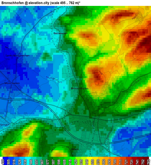
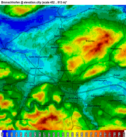
Below is the Elevation map of Bronschhofen, which displays elevation range with different colors. Scale of the first map is from 495 to 762 m (1624 to 2500 ft) with average elevation of 585.8 meters (=1922 ft) [note 1]
These maps also provides idea of topography and contour of this city, they are displayed at different zoom levels. More info about maps, scale and edge coordinates you can find below images.
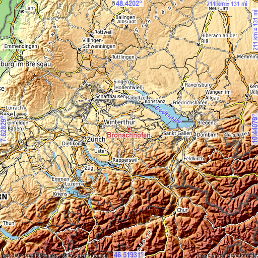
| \ | Map #1 | Map #2 | Topo.Map |
| Scale [m] | 495..762 m | 452..813 m | × |
| Scale [ft] | 1624..2500 ft | 1483..2667 ft | × |
| Average | 585.8 m = 1922 ft | 582.8 m = 1912 ft | × |
| Width | 6.6 km = 4.1 mi | 13.21 km = 8.2 mi | 211.4 km = 131.4 mi |
| Height | 6.6 km = 4.1 mi | 13.21 km = 8.2 mi | 211.3 km = 131.3 mi |
| ↑Max Latitude | 47.508043° | 47.537719° | 48.4202° |
| Latitude at center | 47.47835° | 47.47835° | 47.47835° |
| ↓Min Latitude | 47.44864° | 47.418914° | 46.51931° |
| ← Min Longitude | 8.990595° | 8.946649° | 7.62829° |
| Longitude center | 9.03454° | 9.03454° | 9.03454° |
| →Max Longitude | 9.078485° | 9.122431° | 10.44079° |
Nearby cities:
Cities around Bronschhofen sort by population:
• Wil elevation 569 m
2 km,  156°
156°
• Kirchberg 737 m
7.4 km,  176°
176°
• Sirnach 541 m
3.3 km,  237°
237°
• Münchwilen 514 m
2.8 km,  267°
267°
• Zuzwil 533 m
5.8 km,  94°
94°
• Wängi 470 m
6.4 km,  288°
288°
• Eschlikon 571 m
5.6 km,  252°
252°
• Jonschwil 599 m
7.2 km,  146°
146°
• Rickenbach bei Wil 549 m
3.5 km, 161°
• Fischingen 612 m
8.7 km,  214°
214°
• Affeltrangen 492 m
5.3 km,  358°
358°
• Stettfurt 482 m
8.1 km,  310°
310°
Multilingual:
 En español:
Bronschhofen elevación 566 m.
 En France:
Bronschhofen élévation 566 m.
 Auf Deutsch:
Bronschhofen höhe über dem Meeresspiegel ist 566 m.

Sources and notes:
- [note 1] Map square and city borders are not equal. Map elevation data is calculated only from area inside that square.
- [src 1] Elevation data from geonames database provided with same terms of usage.
- [src 2] The elevation map of Bronschhofen is generated using elevation data from NASA's 3 arcsec (90m) resolution SRTM data.
- [src 3] Base (background) map © OpenStreetMap contributors tiles are generated by Geofabrik and OpenTopoMap.
Copyright & License:
This Bronschhofen Elevation Map is licensed under CC BY-SA. You may reuse any part from this page, if you give a proper credit by linking to this URL:
 More info on terms of use page.