Buus elevation
Buus (Basel-Landschaft, Bezirk Sissach), Switzerland elevation is 436 meters and Buus elevation in feet is 1430 ft above sea level [src 1]. Buus is a populated place (feature code) with elevation that is 112 meters (367 ft) smaller than average city elevation in Switzerland.
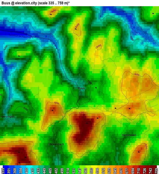
Below is the Elevation map of Buus, which displays elevation range with different colors. Scale of the first map is from 335 to 759 m (1099 to 2490 ft) with average elevation of 524.1 meters (=1719 ft) [note 1]
These maps also provides idea of topography and contour of this city, they are displayed at different zoom levels. More info about maps, scale and edge coordinates you can find below images.
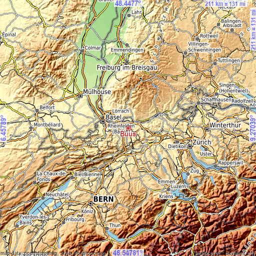
| \ | Map #1 | Topo.Map |
| Scale [m] | 335..759 m | × |
| Scale [ft] | 1099..2490 ft | × |
| Average | 524.1 m = 1719 ft | × |
| Width | 6.6 km = 4.1 mi | 211.2 km = 131.2 mi |
| Height | 6.6 km = 4.1 mi | 211.2 km = 131.2 mi |
| ↑Max Latitude | 47.536027° | 48.4477° |
| Latitude at center | 47.50635° | 47.50635° |
| ↓Min Latitude | 47.476656° | 46.54781° |
| ← Min Longitude | 7.820195° | 6.45789° |
| Longitude center | 7.86414° | 7.86414° |
| →Max Longitude | 7.908085° | 9.27039° |
Nearby cities:
Cities around Buus sort by population:
• Rheinfelden elevation 277 m
7.5 km,  315°
315°
• Möhlin 310 m
6.1 km,  345°
345°
• Sissach 374 m
6.3 km,  221°
221°
• Gelterkinden 397 m
4.7 km,  191°
191°
• Magden 324 m
4.7 km,  302°
302°
• Zunzgen 399 m
7.6 km,  213°
213°
• Stein 301 m
7.9 km,  57°
57°
• Ormalingen 416 m
4.2 km,  171°
171°
• Itingen 366 m
7.4 km,  233°
233°
• Arisdorf 349 m
7.5 km,  275°
275°
• Mumpf 288 m
6.1 km,  44°
44°
• Wegenstetten 435 m
5.1 km,  100°
100°
Multilingual:
 En español:
Buus elevación 436 m.
 En France:
Buus élévation 436 m.


Sources and notes:
- [note 1] Map square and city borders are not equal. Map elevation data is calculated only from area inside that square.
- [src 1] Elevation data from geonames database provided with same terms of usage.
- [src 2] The elevation map of Buus is generated using elevation data from NASA's 3 arcsec (90m) resolution SRTM data.
- [src 3] Base (background) map © OpenStreetMap contributors tiles are generated by Geofabrik and OpenTopoMap.
Copyright & License:
This Buus Elevation Map is licensed under CC BY-SA. You may reuse any part from this page, if you give a proper credit by linking to this URL:
 More info on terms of use page.