Ganterschwil elevation
Ganterschwil (Saint Gallen, Wahlkreis Toggenburg), Switzerland elevation is 619 meters and Ganterschwil elevation in feet is 2031 ft above sea level [src 1]. Ganterschwil is a populated place (feature code) with elevation that is 71 meters (233 ft) bigger than average city elevation in Switzerland.
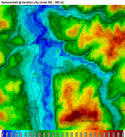
Below is the Elevation map of Ganterschwil, which displays elevation range with different colors. Scale of the first map is from 542 to 900 m (1778 to 2953 ft) with average elevation of 679.4 meters (=2229 ft) [note 1]
These maps also provides idea of topography and contour of this city, they are displayed at different zoom levels. More info about maps, scale and edge coordinates you can find below images.
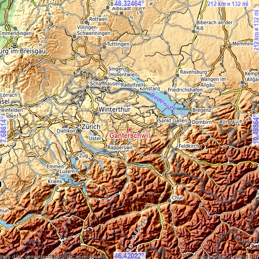
| \ | Map #1 | Topo.Map |
| Scale [m] | 542..900 m | × |
| Scale [ft] | 1778..2953 ft | × |
| Average | 679.4 m = 2229 ft | × |
| Width | 6.62 km = 4.1 mi | 211.8 km = 131.6 mi |
| Height | 6.62 km = 4.1 mi | 211.7 km = 131.5 mi |
| ↑Max Latitude | 47.410778° | 48.32464° |
| Latitude at center | 47.38103° | 47.38103° |
| ↓Min Latitude | 47.351265° | 46.42022° |
| ← Min Longitude | 9.048445° | 7.68614° |
| Longitude center | 9.09239° | 9.09239° |
| →Max Longitude | 9.136335° | 10.49864° |
Nearby cities:
Cities around Ganterschwil sort by population:
• Uzwil elevation 542 m
6.9 km,  27°
27°
• Flawil 621 m
7.7 km,  62°
62°
• Kirchberg 737 m
5.2 km,  310°
310°
• Oberuzwil 563 m
6.1 km, 25°
• Degersheim 814 m
8.2 km,  95°
95°
• Bütschwil 619 m
2.8 km,  213°
213°
• Jonschwil 599 m
4.8 km,  355°
355°
• Mosnang 721 m
4.3 km,  241°
241°
• Mogelsberg 753 m
3.9 km,  122°
122°
• Lichtensteig 638 m
6.4 km,  183°
183°
• Lütisburg 582 m
1.7 km,  335°
335°
• Oberhelfenschwil 825 m
3 km,  152°
152°
Multilingual:
 En español:
Ganterschwil elevación 619 m.
 En France:
Ganterschwil élévation 619 m.
 Auf Deutsch:
Ganterschwil höhe über dem Meeresspiegel ist 619 m.

Sources and notes:
- [note 1] Map square and city borders are not equal. Map elevation data is calculated only from area inside that square.
- [src 1] Elevation data from geonames database provided with same terms of usage.
- [src 2] The elevation map of Ganterschwil is generated using elevation data from NASA's 3 arcsec (90m) resolution SRTM data.
- [src 3] Base (background) map © OpenStreetMap contributors tiles are generated by Geofabrik and OpenTopoMap.
Copyright & License:
This Ganterschwil Elevation Map is licensed under CC BY-SA. You may reuse any part from this page, if you give a proper credit by linking to this URL:
 More info on terms of use page.