Kloten elevation
Kloten (Zurich, Bezirk Bülach), Switzerland elevation is 439 meters and Kloten elevation in feet is 1440 ft above sea level [src 1]. Kloten is a populated place (feature code) with elevation that is 109 meters (358 ft) smaller than average city elevation in Switzerland.
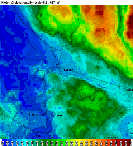
Below is the Elevation map of Kloten, which displays elevation range with different colors. Scale of the first map is from 412 to 627 m (1352 to 2057 ft) with average elevation of 469.5 meters (=1540 ft) [note 1]
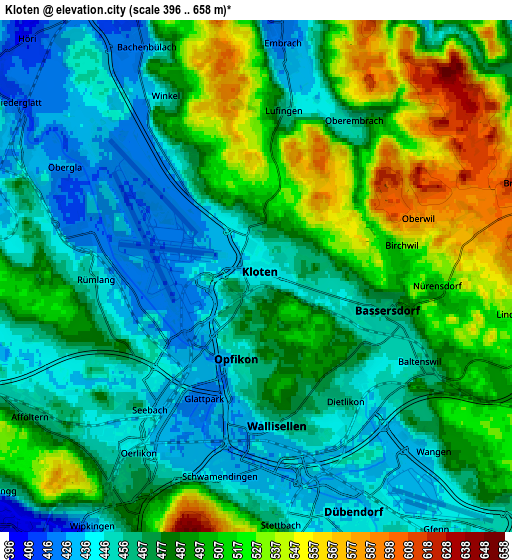
These maps also provides idea of topography and contour of this city, they are displayed at different zoom levels. More info about maps, scale and edge coordinates you can find below images.
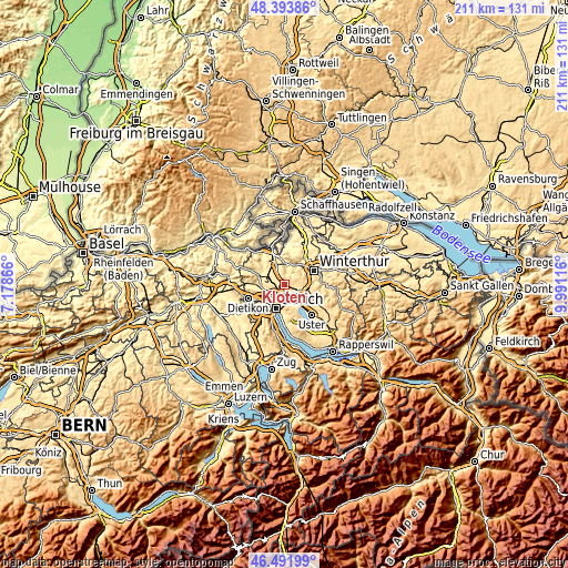
| \ | Map #1 | Map #2 | Topo.Map |
| Scale [m] | 412..627 m | 396..658 m | × |
| Scale [ft] | 1352..2057 ft | 1299..2159 ft | × |
| Average | 469.5 m = 1540 ft | 481.5 m = 1580 ft | × |
| Width | 6.61 km = 4.1 mi | 13.22 km = 8.2 mi | 211.5 km = 131.4 mi |
| Height | 6.61 km = 4.1 mi | 13.22 km = 8.2 mi | 211.5 km = 131.4 mi |
| ↑Max Latitude | 47.481228° | 47.510919° | 48.39386° |
| Latitude at center | 47.45152° | 47.45152° | 47.45152° |
| ↓Min Latitude | 47.421795° | 47.392054° | 46.49199° |
| ← Min Longitude | 8.540965° | 8.497019° | 7.17866° |
| Longitude center | 8.58491° | 8.58491° | 8.58491° |
| →Max Longitude | 8.628855° | 8.672801° | 9.99116° |
Nearby cities:
Cities around Kloten sort by population:
• Kloten / Rütlen elevation 468 m
0.5 km,  153°
153°
• Kloten / Holberg 465 m
0.8 km,  227°
227°
• Kloten / Geissberg 448 m
0.5 km,  55°
55°
• Glattbrugg / Rohr/Platten-Balsberg 429 m
2.1 km,  221°
221°
• Kloten / Kloten (Zentrum) 440 m
0.1 km,  97°
97°
• Kloten / Freienberg (Chanzler-Chlini Chaseren) 478 m
1.6 km,  350°
350°
• Kloten / Horainli 438 m
0.3 km,  333°
333°
• Kloten / Balsberg 462 m
1.3 km, 216°
• Opfikon 438 m
2.3 km,  197°
197°
• Kloten / Spitz 482 m
0.8 km,  167°
167°
• Grossacker/Opfikon 447 m
2.8 km,  189°
189°
• Kloten / Hostrass 447 m
0.7 km,  81°
81°
Multilingual:
 En español:
Kloten elevación 439 m.
 En France:
Kloten élévation 439 m.


Sources and notes:
- [note 1] Map square and city borders are not equal. Map elevation data is calculated only from area inside that square.
- [src 1] Elevation data from geonames database provided with same terms of usage.
- [src 2] The elevation map of Kloten is generated using elevation data from NASA's 3 arcsec (90m) resolution SRTM data.
- [src 3] Base (background) map © OpenStreetMap contributors tiles are generated by Geofabrik and OpenTopoMap.
Copyright & License:
This Kloten Elevation Map is licensed under CC BY-SA. You may reuse any part from this page, if you give a proper credit by linking to this URL:
 More info on terms of use page.