Kreuzlingen elevation
Kreuzlingen (Thurgau, Kreuzlingen District), Switzerland elevation is 414 meters and Kreuzlingen elevation in feet is 1358 ft above sea level [src 1]. Kreuzlingen is a seat of a second-order administrative division (feature code) with elevation that is 134 meters (440 ft) smaller than average city elevation in Switzerland.
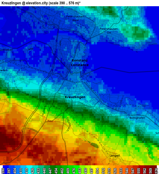
Below is the Elevation map of Kreuzlingen, which displays elevation range with different colors. Scale of the first map is from 390 to 576 m (1280 to 1890 ft) with average elevation of 441.1 meters (=1447 ft) [note 1]
These maps also provides idea of topography and contour of this city, they are displayed at different zoom levels. More info about maps, scale and edge coordinates you can find below images.
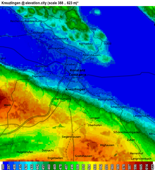
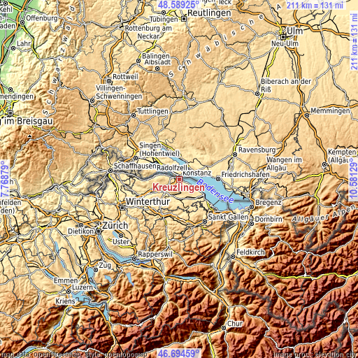
| \ | Map #1 | Map #2 | Topo.Map |
| Scale [m] | 390..576 m | 388..623 m | × |
| Scale [ft] | 1280..1890 ft | 1273..2044 ft | × |
| Average | 441.1 m = 1447 ft | 456.4 m = 1497 ft | × |
| Width | 6.58 km = 4.1 mi | 13.17 km = 8.2 mi | 210.7 km = 130.9 mi |
| Height | 6.58 km = 4.1 mi | 13.17 km = 8.2 mi | 210.7 km = 130.9 mi |
| ↑Max Latitude | 47.680105° | 47.709684° | 48.58925° |
| Latitude at center | 47.65051° | 47.65051° | 47.65051° |
| ↓Min Latitude | 47.620898° | 47.591269° | 46.69459° |
| ← Min Longitude | 9.131095° | 9.087149° | 7.76879° |
| Longitude center | 9.17504° | 9.17504° | 9.17504° |
| →Max Longitude | 9.218985° | 9.262931° | 10.58129° |
Nearby cities:
Cities around Kreuzlingen sort by population:
• Weinfelden elevation 429 m
10.9 km,  211°
211°
• Tägerwilen 404 m
2.7 km,  285°
285°
• Bürglen 439 m
11.4 km,  189°
189°
• Berg 554 m
8 km,  184°
184°
• Märstetten-Dorf 426 m
10.3 km,  231°
231°
• Münsterlingen 411 m
4.8 km,  115°
115°
• Ermatingen 401 m
7.1 km, 288°
• Altnau 440 m
7.9 km, 124°
• Bottighofen 417 m
3 km, 121°
• Güttingen 422 m
9.9 km, 121°
• Langrickenbach 522 m
8.3 km,  139°
139°
• Gottlieben 400 m
3.4 km,  295°
295°
Multilingual:
 En español:
Kreuzlingen elevación 414 m.
 En France:
Kreuzlingen élévation 414 m.
 Auf Deutsch:
Kreuzlingen höhe über dem Meeresspiegel ist 414 m.

Sources and notes:
- [note 1] Map square and city borders are not equal. Map elevation data is calculated only from area inside that square.
- [src 1] Elevation data from geonames database provided with same terms of usage.
- [src 2] The elevation map of Kreuzlingen is generated using elevation data from NASA's 3 arcsec (90m) resolution SRTM data.
- [src 3] Base (background) map © OpenStreetMap contributors tiles are generated by Geofabrik and OpenTopoMap.
Copyright & License:
This Kreuzlingen Elevation Map is licensed under CC BY-SA. You may reuse any part from this page, if you give a proper credit by linking to this URL:
 More info on terms of use page.