Niederlenz elevation
Niederlenz (Aargau, Bezirk Lenzburg), Switzerland elevation is 383 meters and Niederlenz elevation in feet is 1257 ft above sea level [src 1]. Niederlenz is a populated place (feature code) with elevation that is 165 meters (541 ft) smaller than average city elevation in Switzerland.
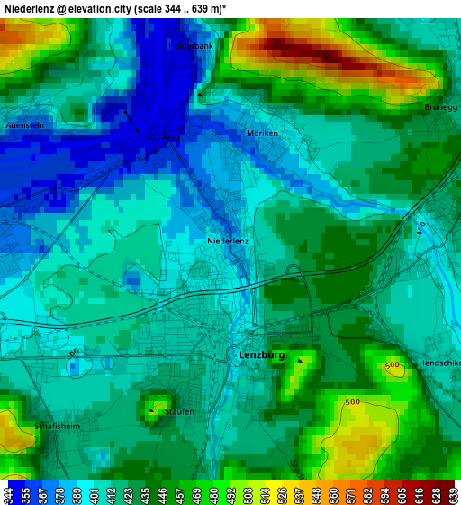
Below is the Elevation map of Niederlenz, which displays elevation range with different colors. Scale of the first map is from 344 to 639 m (1129 to 2096 ft) with average elevation of 422.6 meters (=1386 ft) [note 1]
These maps also provides idea of topography and contour of this city, they are displayed at different zoom levels. More info about maps, scale and edge coordinates you can find below images.
| \ | Map #1 | Map #2 | Topo.Map |
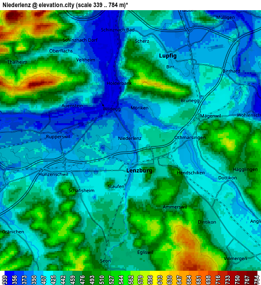
| Scale [m] | 344..639 m | 339..784 m | × |
| Scale [ft] | 1129..2096 ft | 1112..2572 ft | × |
| Average | 422.6 m = 1386 ft | 449.4 m = 1474 ft | × |
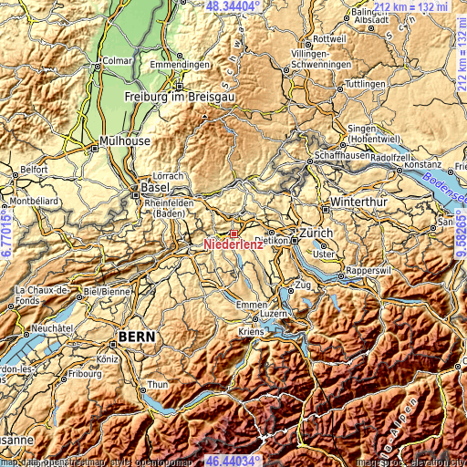
| Width | 6.61 km = 4.1 mi | 13.23 km = 8.2 mi | 211.7 km = 131.5 mi |
| Height | 6.61 km = 4.1 mi | 13.23 km = 8.2 mi | 211.7 km = 131.5 mi |
| ↑Max Latitude | 47.430527° | 47.460247° | 48.34404° |
| Latitude at center | 47.40079° | 47.40079° | 47.40079° |
| ↓Min Latitude | 47.371037° | 47.341266° | 46.44034° |
| ← Min Longitude | 8.132455° | 8.088509° | 6.77015° |
| Longitude center | 8.1764° | 8.1764° | 8.1764° |
| →Max Longitude | 8.220345° | 8.264291° | 9.58265° |
Nearby cities:
Cities around Niederlenz sort by population:
• Lenzburg elevation 402 m
1.4 km,  184°
184°
• Rupperswil 374 m
3.6 km,  270°
270°
• Birr 395 m
4.5 km,  33°
33°
• Dottikon 416 m
5.1 km,  110°
110°
• Schafisheim 414 m
3.7 km,  223°
223°
• Staufen 420 m
2.2 km,  199°
199°
• Othmarsingen 392 m
2.8 km,  88°
88°
• Hägglingen 469 m
5.9 km,  103°
103°
• Schinznach Dorf 383 m
5.7 km,  332°
332°
• Egliswil 453 m
5.8 km,  173°
173°
• Veltheim 376 m
4.7 km, 332°
• Schinznach Bad 360 m
5.5 km,  353°
353°
Multilingual:
 En español:
Niederlenz elevación 383 m.
 En France:
Niederlenz élévation 383 m.
 Auf Deutsch:
Niederlenz höhe über dem Meeresspiegel ist 383 m.

Sources and notes:
- [note 1] Map square and city borders are not equal. Map elevation data is calculated only from area inside that square.
- [src 1] Elevation data from geonames database provided with same terms of usage.
- [src 2] The elevation map of Niederlenz is generated using elevation data from NASA's 3 arcsec (90m) resolution SRTM data.
- [src 3] Base (background) map © OpenStreetMap contributors tiles are generated by Geofabrik and OpenTopoMap.
Copyright & License:
This Niederlenz Elevation Map is licensed under CC BY-SA. You may reuse any part from this page, if you give a proper credit by linking to this URL:
 More info on terms of use page.