Suhr elevation
Suhr (Aargau, Bezirk Aarau), Switzerland elevation is 396 meters and Suhr elevation in feet is 1299 ft above sea level [src 1]. Suhr is a seat of a third-order administrative division (feature code) with elevation that is 152 meters (499 ft) smaller than average city elevation in Switzerland.
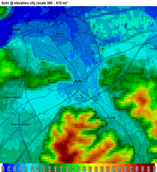
Below is the Elevation map of Suhr, which displays elevation range with different colors. Scale of the first map is from 360 to 615 m (1181 to 2018 ft) with average elevation of 429.5 meters (=1409 ft) [note 1]
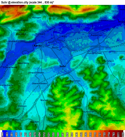
These maps also provides idea of topography and contour of this city, they are displayed at different zoom levels. More info about maps, scale and edge coordinates you can find below images.
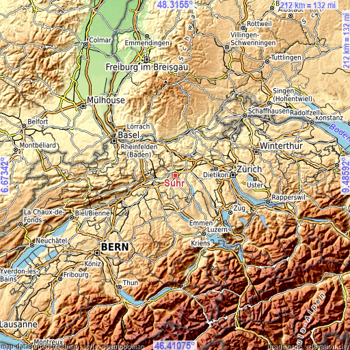
| \ | Map #1 | Map #2 | Topo.Map |
| Scale [m] | 360..615 m | 344..830 m | × |
| Scale [ft] | 1181..2018 ft | 1129..2723 ft | × |
| Average | 429.5 m = 1409 ft | 467.3 m = 1533 ft | × |
| Width | 6.62 km = 4.1 mi | 13.24 km = 8.2 mi | 211.8 km = 131.6 mi |
| Height | 6.62 km = 4.1 mi | 13.24 km = 8.2 mi | 211.8 km = 131.6 mi |
| ↑Max Latitude | 47.401473° | 47.431209° | 48.3155° |
| Latitude at center | 47.37172° | 47.37172° | 47.37172° |
| ↓Min Latitude | 47.34195° | 47.312163° | 46.41075° |
| ← Min Longitude | 8.035725° | 7.991779° | 6.67342° |
| Longitude center | 8.07967° | 8.07967° | 8.07967° |
| →Max Longitude | 8.123615° | 8.167561° | 9.48592° |
Nearby cities:
Cities around Suhr sort by population:
• Aarau elevation 389 m
3.5 km,  310°
310°
• Oberentfelden 413 m
3.1 km,  236°
236°
• Buchs 385 m
2.4 km,  4°
4°
• Gränichen 411 m
2.2 km,  128°
128°
• Küttigen 417 m
5.3 km,  334°
334°
• Schönenwerd 388 m
5.9 km,  267°
267°
• Rupperswil 374 m
4.9 km,  48°
48°
• Kölliken 426 m
6.1 km,  225°
225°
• Muhen 430 m
4.4 km,  204°
204°
• Schafisheim 414 m
4.8 km,  83°
83°
• Teufenthal 453 m
5.6 km,  148°
148°
• Biberstein 413 m
5 km, 4°
Multilingual:
 En español:
Suhr elevación 396 m.
 En France:
Suhr élévation 396 m.


Sources and notes:
- [note 1] Map square and city borders are not equal. Map elevation data is calculated only from area inside that square.
- [src 1] Elevation data from geonames database provided with same terms of usage.
- [src 2] The elevation map of Suhr is generated using elevation data from NASA's 3 arcsec (90m) resolution SRTM data.
- [src 3] Base (background) map © OpenStreetMap contributors tiles are generated by Geofabrik and OpenTopoMap.
Copyright & License:
This Suhr Elevation Map is licensed under CC BY-SA. You may reuse any part from this page, if you give a proper credit by linking to this URL:
 More info on terms of use page.