Thun elevation
Thun (Bern, Thun District), Switzerland elevation is 565 meters and Thun elevation in feet is 1854 ft above sea level [src 1]. Thun is a seat of a second-order administrative division (feature code) with elevation that is 17 meters (56 ft) bigger than average city elevation in Switzerland.
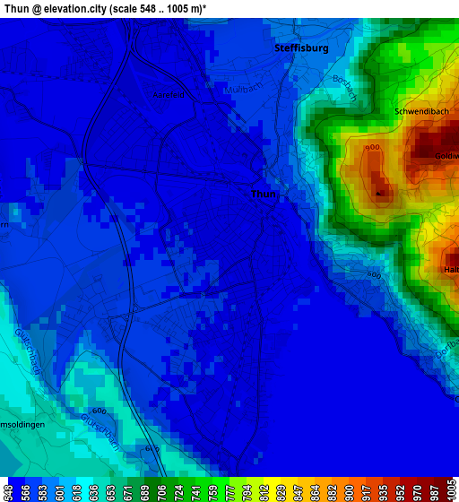
Below is the Elevation map of Thun, which displays elevation range with different colors. Scale of the first map is from 548 to 1005 m (1798 to 3297 ft) with average elevation of 608.9 meters (=1998 ft) [note 1]
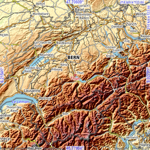
These maps also provides idea of topography and contour of this city, they are displayed at different zoom levels. More info about maps, scale and edge coordinates you can find below images.
| \ | Map #1 | Map #2 | Topo.Map |
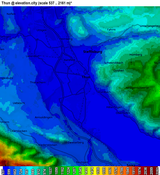
| Scale [m] | 548..1005 m | 537..2161 m | × |
| Scale [ft] | 1798..3297 ft | 1762..7090 ft | × |
| Average | 608.9 m = 1998 ft | 719.1 m = 2359 ft | × |
| Width | 6.7 km = 4.2 mi | 13.39 km = 8.3 mi | 214.3 km = 133.2 mi |
| Height | 6.7 km = 4.2 mi | 13.39 km = 8.3 mi | 214.3 km = 133.2 mi |
| ↑Max Latitude | 46.781282° | 46.811366° | 47.70609° |
| Latitude at center | 46.75118° | 46.75118° | 46.75118° |
| ↓Min Latitude | 46.721062° | 46.690927° | 45.77904° |
| ← Min Longitude | 7.577715° | 7.533769° | 6.21541° |
| Longitude center | 7.62166° | 7.62166° | 7.62166° |
| →Max Longitude | 7.665605° | 7.709551° | 9.02791° |
Nearby cities:
Cities around Thun sort by population:
• Steffisburg elevation 584 m
3.1 km,  15°
15°
• Uetendorf 557 m
4.5 km,  304°
304°
• Heimberg 564 m
5 km,  344°
344°
• Sigriswil 797 m
8 km,  118°
118°
• Hilterfingen 588 m
3.5 km, 120°
• Wimmis 638 m
8.5 km,  170°
170°
• Thierachern 572 m
3.6 km,  273°
273°
• Seftigen 582 m
7.5 km, 302°
• Uttigen 543 m
5.8 km,  325°
325°
• Buchholterberg 873 m
8 km,  30°
30°
• Blumenstein 663 m
7.7 km,  262°
262°
• Uebeschi 648 m
5.2 km,  253°
253°
Multilingual:
 En español:
Thun elevación 565 m.
 En France:
Thoune élévation 565 m.


Sources and notes:
- [note 1] Map square and city borders are not equal. Map elevation data is calculated only from area inside that square.
- [src 1] Elevation data from geonames database provided with same terms of usage.
- [src 2] The elevation map of Thun is generated using elevation data from NASA's 3 arcsec (90m) resolution SRTM data.
- [src 3] Base (background) map © OpenStreetMap contributors tiles are generated by Geofabrik and OpenTopoMap.
Copyright & License:
This Thun Elevation Map is licensed under CC BY-SA. You may reuse any part from this page, if you give a proper credit by linking to this URL:
 More info on terms of use page.