Obo elevation
Obo (Haut-Mbomou), Central African Republic elevation is 639 meters and Obo elevation in feet is 2096 ft above sea level [src 1]. Obo is a seat of a first-order administrative division (feature code) with elevation that is 134 meters (440 ft) bigger than average city elevation in Central African Republic.
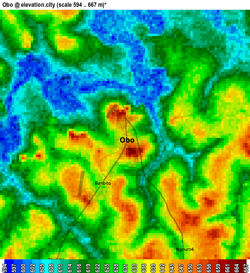
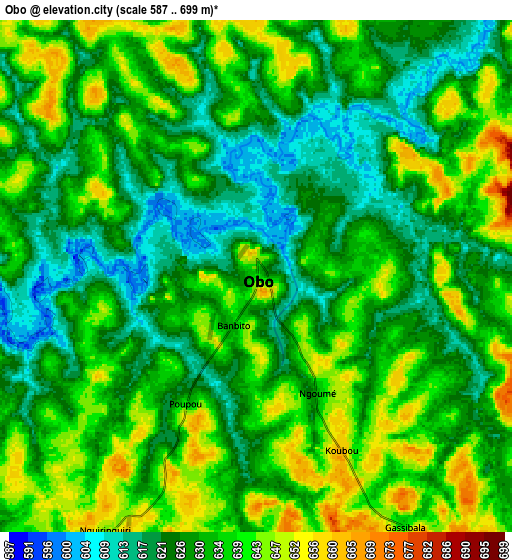
Below is the Elevation map of Obo, which displays elevation range with different colors. Scale of the first map is from 594 to 667 m (1949 to 2188 ft) with average elevation of 623.3 meters (=2045 ft) [note 1]
These maps also provides idea of topography and contour of this city, they are displayed at different zoom levels. More info about maps, scale and edge coordinates you can find below images.
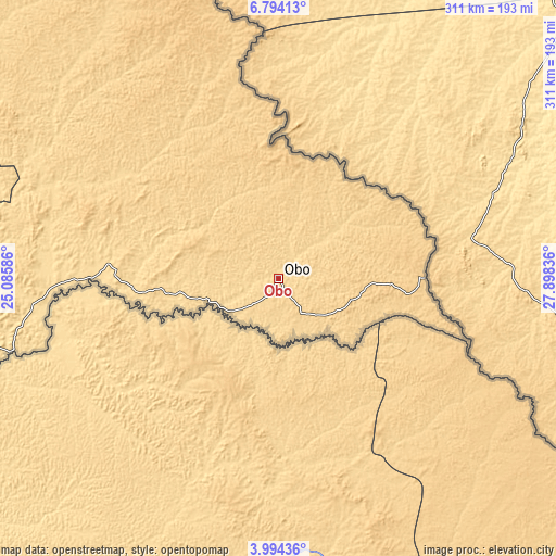
| \ | Map #1 | Map #2 | Topo.Map |
| Scale [m] | 594..667 m | 587..699 m | × |
| Scale [ft] | 1949..2188 ft | 1926..2293 ft | × |
| Average | 623.3 m = 2045 ft | 631.5 m = 2072 ft | × |
| Width | 9.73 km = 6 mi | 19.46 km = 12.1 mi | 311.3 km = 193.4 mi |
| Height | 9.73 km = 6 mi | 19.46 km = 12.1 mi | 311.3 km = 193.4 mi |
| ↑Max Latitude | 5.439609° | 5.483355° | 6.79413° |
| Latitude at center | 5.39586° | 5.39586° | 5.39586° |
| ↓Min Latitude | 5.352108° | 5.308353° | 3.99436° |
| ← Min Longitude | 26.448165° | 26.404219° | 25.08586° |
| Longitude center | 26.49211° | 26.49211° | 26.49211° |
| →Max Longitude | 26.536055° | 26.580001° | 27.89836° |
Nearby cities:
Cities around Obo sort by population:
• Bangassou elevation 506 m
413.3 km,  259°
259°
• Zemio 579 m
155.5 km,  254°
254°
Multilingual:
 En español:
Obo elevación 639 m.
 En France:
Obo élévation 639 m.


Sources and notes:
- [note 1] Map square and city borders are not equal. Map elevation data is calculated only from area inside that square.
- [src 1] Elevation data from geonames database provided with same terms of usage.
- [src 2] The elevation map of Obo is generated using elevation data from NASA's 3 arcsec (90m) resolution SRTM data.
- [src 3] Base (background) map © OpenStreetMap contributors tiles are generated by Geofabrik and OpenTopoMap.
Copyright & License:
This Obo Elevation Map is licensed under CC BY-SA. You may reuse any part from this page, if you give a proper credit by linking to this URL:
 More info on terms of use page.