San Ignacio elevation
San Ignacio (Cayo), Belize elevation is 60 meters and San Ignacio elevation in feet is 197 ft above sea level [src 1]. San Ignacio is a populated place (feature code) with elevation that is 29 meters (95 ft) bigger than average city elevation in Belize.
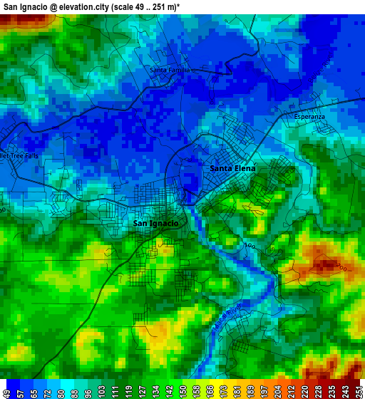
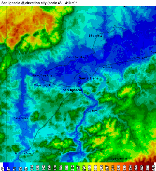
Below is the Elevation map of San Ignacio, which displays elevation range with different colors. Scale of the first map is from 49 to 251 m (161 to 823 ft) with average elevation of 103 meters (=338 ft) [note 1]
These maps also provides idea of topography and contour of this city, they are displayed at different zoom levels. More info about maps, scale and edge coordinates you can find below images.
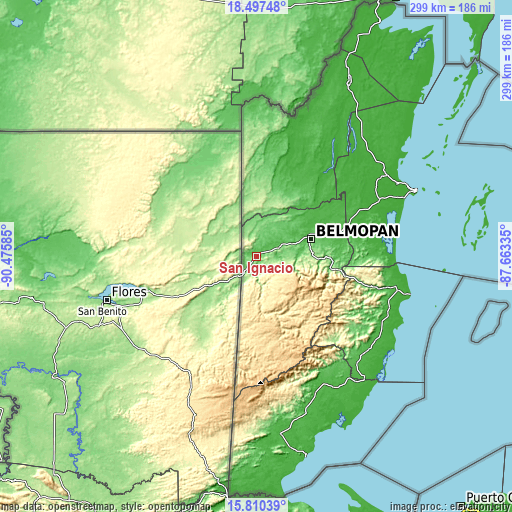
| \ | Map #1 | Map #2 | Topo.Map |
| Scale [m] | 49..251 m | 43..410 m | × |
| Scale [ft] | 161..823 ft | 141..1345 ft | × |
| Average | 103 m = 338 ft | 139 m = 456 ft | × |
| Width | 9.34 km = 5.8 mi | 18.68 km = 11.6 mi | 298.8 km = 185.7 mi |
| Height | 9.34 km = 5.8 mi | 18.68 km = 11.6 mi | 298.8 km = 185.7 mi |
| ↑Max Latitude | 17.200785° | 17.24276° | 18.49748° |
| Latitude at center | 17.1588° | 17.1588° | 17.1588° |
| ↓Min Latitude | 17.116806° | 17.074802° | 15.81039° |
| ← Min Longitude | -89.113545° | -89.157491° | -90.47585° |
| Longitude center | -89.0696° | -89.0696° | -89.0696° |
| →Max Longitude | -89.025655° | -88.981709° | -87.66335° |
Nearby cities:
Cities around San Ignacio sort by population:
• Belize City elevation 6 m
100 km,  67°
67°
• Orange Walk 16 m
115.8 km,  27°
27°
• Belmopan 71 m
33.7 km, 72°
• Dangriga 7 m
91.4 km,  103°
103°
• Corozal 5 m
155.1 km, 27°
• San Pedro 4 m
144.2 km,  54°
54°
• Benque Viejo el Carmen 89 m
11.9 km,  218°
218°
• Punta Gorda 8 m
121.1 km,  166°
166°
• Placencia 11 m
103.6 km,  133°
133°
• Shipyard 20 m
92.8 km, 28°
• Valley of Peace 80 m
31.7 km, 51°
Multilingual:
 En español:
San Ignacio elevación 60 m.
 En France:
San Ignacio élévation 60 m.
 Auf Deutsch:
San Ignacio höhe über dem Meeresspiegel ist 60 m.

Sources and notes:
- [note 1] Map square and city borders are not equal. Map elevation data is calculated only from area inside that square.
- [src 1] Elevation data from geonames database provided with same terms of usage.
- [src 2] The elevation map of San Ignacio is generated using elevation data from NASA's 3 arcsec (90m) resolution SRTM data.
- [src 3] Base (background) map © OpenStreetMap contributors tiles are generated by Geofabrik and OpenTopoMap.
Copyright & License:
This San Ignacio Elevation Map is licensed under CC BY-SA. You may reuse any part from this page, if you give a proper credit by linking to this URL:
 More info on terms of use page.