Ashmyany elevation
Ashmyany (Grodnenskaya), Belarus elevation is 175 meters and Ashmyany elevation in feet is 574 ft above sea level [src 1]. Ashmyany is a seat of a second-order administrative division (feature code) with elevation that is 8 meters (26 ft) bigger than average city elevation in Belarus.
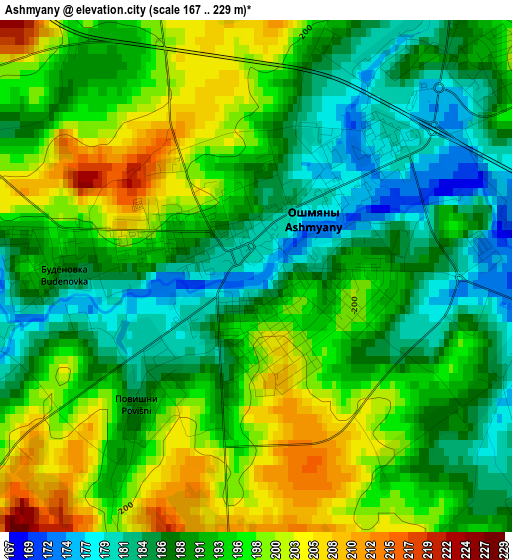
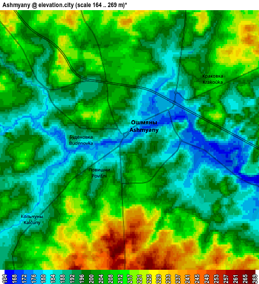
Below is the Elevation map of Ashmyany, which displays elevation range with different colors. Scale of the first map is from 167 to 229 m (548 to 751 ft) with average elevation of 192.5 meters (=632 ft) [note 1]
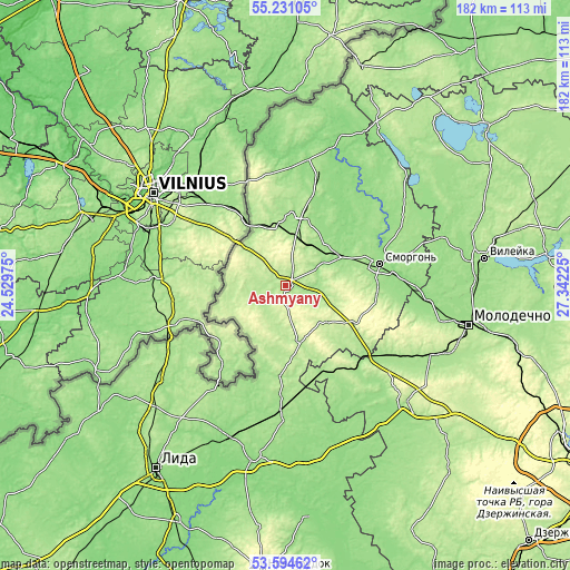
These maps also provides idea of topography and contour of this city, they are displayed at different zoom levels. More info about maps, scale and edge coordinates you can find below images.
| \ | Map #1 | Map #2 | Topo.Map |
| Scale [m] | 167..229 m | 164..269 m | × |
| Scale [ft] | 548..751 ft | 538..883 ft | × |
| Average | 192.5 m = 632 ft | 203 m = 666 ft | × |
| Width | 5.69 km = 3.5 mi | 11.37 km = 7.1 mi | 182 km = 113.1 mi |
| Height | 5.69 km = 3.5 mi | 11.37 km = 7.1 mi | 181.9 km = 113 mi |
| ↑Max Latitude | 54.446561° | 54.472105° | 55.23105° |
| Latitude at center | 54.421° | 54.421° | 54.421° |
| ↓Min Latitude | 54.395424° | 54.369831° | 53.59462° |
| ← Min Longitude | 25.892055° | 25.848109° | 24.52975° |
| Longitude center | 25.936° | 25.936° | 25.936° |
| →Max Longitude | 25.979945° | 26.023891° | 27.34225° |
Nearby cities:
Cities around Ashmyany sort by population:
• Smarhon’ elevation 153 m
30.4 km,  77°
77°
• Valozhyn 203 m
53.2 km,  133°
133°
• Astravyets 161 m
21.5 km,  3°
3°
• Vishnyeva 158 m
49.6 km,  49°
49°
• Voranava 172 m
50.6 km,  233°
233°
• Hal’shany 202 m
18.8 km,  164°
164°
• Narach 156 m
53.8 km,  72°
72°
• Kreva 224 m
26 km,  117°
117°
• Baruny 230 m
17.4 km, 131°
• Soly 150 m
19.6 km,  58°
58°
• Turets-Bayary 146 m
47 km,  95°
95°
• Hyeranyony 183 m
41.2 km,  214°
214°
Multilingual:
 En español:
Ashmiany elevación 175 m.
 En France:
Achmiany élévation 175 m.
 Auf Deutsch:
Aschmjany höhe über dem Meeresspiegel ist 175 m.

Sources and notes:
- [note 1] Map square and city borders are not equal. Map elevation data is calculated only from area inside that square.
- [src 1] Elevation data from geonames database provided with same terms of usage.
- [src 2] The elevation map of Ashmyany is generated using elevation data from NASA's 3 arcsec (90m) resolution SRTM data.
- [src 3] Base (background) map © OpenStreetMap contributors tiles are generated by Geofabrik and OpenTopoMap.
Copyright & License:
This Ashmyany Elevation Map is licensed under CC BY-SA. You may reuse any part from this page, if you give a proper credit by linking to this URL:
 More info on terms of use page.