Byalynichy elevation
Byalynichy (Mogilev), Belarus elevation is 182 meters and Byalynichy elevation in feet is 597 ft above sea level [src 1]. Byalynichy is a seat of a second-order administrative division (feature code) with elevation that is 15 meters (49 ft) bigger than average city elevation in Belarus.
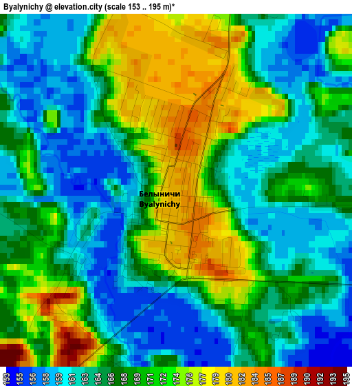
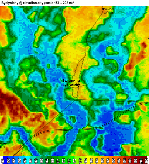
Below is the Elevation map of Byalynichy, which displays elevation range with different colors. Scale of the first map is from 153 to 195 m (502 to 640 ft) with average elevation of 167.3 meters (=549 ft) [note 1]
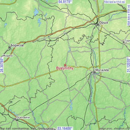
These maps also provides idea of topography and contour of this city, they are displayed at different zoom levels. More info about maps, scale and edge coordinates you can find below images.
| \ | Map #1 | Map #2 | Topo.Map |
| Scale [m] | 153..195 m | 151..202 m | × |
| Scale [ft] | 502..640 ft | 495..663 ft | × |
| Average | 167.3 m = 549 ft | 170.2 m = 558 ft | × |
| Width | 5.74 km = 3.6 mi | 11.49 km = 7.1 mi | 183.8 km = 114.2 mi |
| Height | 5.74 km = 3.6 mi | 11.49 km = 7.1 mi | 183.8 km = 114.2 mi |
| ↑Max Latitude | 54.025223° | 54.05103° | 54.8178° |
| Latitude at center | 53.9994° | 53.9994° | 53.9994° |
| ↓Min Latitude | 53.973561° | 53.947706° | 53.16458° |
| ← Min Longitude | 29.670155° | 29.626209° | 28.30785° |
| Longitude center | 29.7141° | 29.7141° | 29.7141° |
| →Max Longitude | 29.758045° | 29.801991° | 31.12035° |
Nearby cities:
Cities around Byalynichy sort by population:
• Mahilyow elevation 184 m
42.3 km,  102°
102°
• Shklow 158 m
44.3 km,  57°
57°
• Talachyn 199 m
45.5 km,  358°
358°
• Kruhlaye 195 m
28.3 km,  10°
10°
• Buynichy 171 m
39.7 km,  114°
114°
• Myazhysyatki 170 m
39.1 km,  129°
129°
• Veyno 173 m
47.6 km, 112°
• Palykavichy Pyershyya 156 m
42.2 km,  92°
92°
• Dashkawka 159 m
46.4 km, 129°
• Kamyennyya Lavy 186 m
39.3 km,  75°
75°
• Vishow 191 m
18.3 km, 96°
• Bobr 176 m
47.7 km,  323°
323°
Multilingual:
 En español:
Byalynichy elevación 182 m.
 En France:
Byalynichy élévation 182 m.
 Auf Deutsch:
Byalynichy höhe über dem Meeresspiegel ist 182 m.

Sources and notes:
- [note 1] Map square and city borders are not equal. Map elevation data is calculated only from area inside that square.
- [src 1] Elevation data from geonames database provided with same terms of usage.
- [src 2] The elevation map of Byalynichy is generated using elevation data from NASA's 3 arcsec (90m) resolution SRTM data.
- [src 3] Base (background) map © OpenStreetMap contributors tiles are generated by Geofabrik and OpenTopoMap.
Copyright & License:
This Byalynichy Elevation Map is licensed under CC BY-SA. You may reuse any part from this page, if you give a proper credit by linking to this URL:
 More info on terms of use page.