Lyuban’ elevation
Lyuban’ (Minsk), Belarus elevation is 138 meters and Lyuban’ elevation in feet is 453 ft above sea level [src 1]. Lyuban’ is a seat of a second-order administrative division (feature code) with elevation that is 29 meters (95 ft) smaller than average city elevation in Belarus.
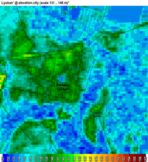
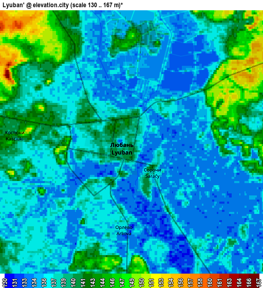
Below is the Elevation map of Lyuban’, which displays elevation range with different colors. Scale of the first map is from 131 to 148 m (430 to 486 ft) with average elevation of 135.8 meters (=446 ft) [note 1]
These maps also provides idea of topography and contour of this city, they are displayed at different zoom levels. More info about maps, scale and edge coordinates you can find below images.
| \ | Map #1 | Map #2 | Topo.Map |
| Scale [m] | 131..148 m | 130..167 m | × |
| Scale [ft] | 430..486 ft | 427..548 ft | × |
| Average | 135.8 m = 446 ft | 138.2 m = 453 ft | × |
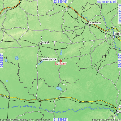
| Width | 5.91 km = 3.7 mi | 11.82 km = 7.3 mi | 189.1 km = 117.5 mi |
| Height | 5.91 km = 3.7 mi | 11.82 km = 7.3 mi | 189.1 km = 117.5 mi |
| ↑Max Latitude | 52.825062° | 52.851608° | 53.64046° |
| Latitude at center | 52.7985° | 52.7985° | 52.7985° |
| ↓Min Latitude | 52.771922° | 52.745327° | 51.93992° |
| ← Min Longitude | 27.960855° | 27.916909° | 26.59855° |
| Longitude center | 28.0048° | 28.0048° | 28.0048° |
| →Max Longitude | 28.048745° | 28.092691° | 29.41105° |
Nearby cities:
Cities around Lyuban’ sort by population:
• Salihorsk elevation 157 m
31.2 km,  267°
267°
• Slutsk 150 m
39.2 km,  310°
310°
• Zhytkavichy 137 m
65.5 km,  188°
188°
• Staryya Darohi 160 m
32.1 km,  33°
33°
• Hlusk 144 m
47.1 km,  75°
75°
• Starobin 146 m
37.5 km,  257°
257°
• Chyrvonaya Slabada 157 m
56.4 km,  276°
276°
• Urechcha 146 m
18.2 km,  335°
335°
• Hlusha 169 m
65.5 km,  60°
60°
• Sarachy 140 m
1.6 km,  144°
144°
• Hotsk 140 m
66 km,  242°
242°
• Aktsyabrski 132 m
61.4 km,  106°
106°
Multilingual:
 En español:
Lyuban’ elevación 138 m.
 En France:
Lyuban’ élévation 138 m.


Sources and notes:
- [note 1] Map square and city borders are not equal. Map elevation data is calculated only from area inside that square.
- [src 1] Elevation data from geonames database provided with same terms of usage.
- [src 2] The elevation map of Lyuban’ is generated using elevation data from NASA's 3 arcsec (90m) resolution SRTM data.
- [src 3] Base (background) map © OpenStreetMap contributors tiles are generated by Geofabrik and OpenTopoMap.
Copyright & License:
This Lyuban’ Elevation Map is licensed under CC BY-SA. You may reuse any part from this page, if you give a proper credit by linking to this URL:
 More info on terms of use page.