Pastavy elevation
Pastavy (Vitebsk), Belarus elevation is 140 meters and Pastavy elevation in feet is 459 ft above sea level [src 1]. Pastavy is a populated place (feature code) with elevation that is 27 meters (89 ft) smaller than average city elevation in Belarus.
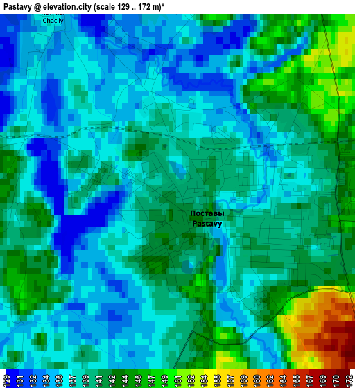
Below is the Elevation map of Pastavy, which displays elevation range with different colors. Scale of the first map is from 129 to 172 m (423 to 564 ft) with average elevation of 139.3 meters (=457 ft) [note 1]
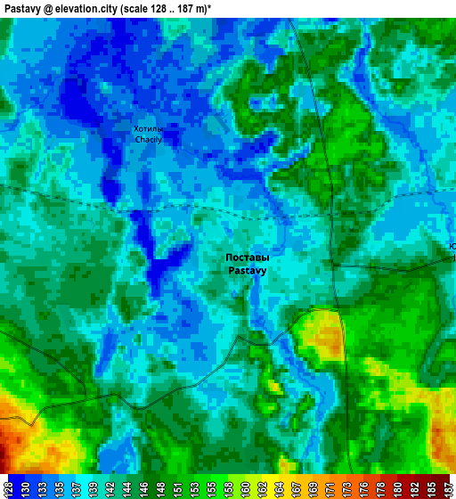
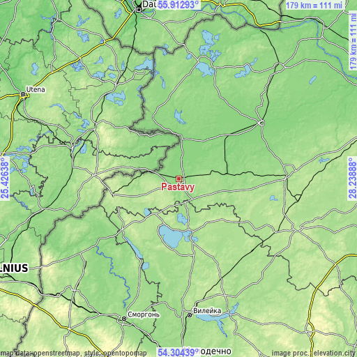
These maps also provides idea of topography and contour of this city, they are displayed at different zoom levels. More info about maps, scale and edge coordinates you can find below images.
| \ | Map #1 | Map #2 | Topo.Map |
| Scale [m] | 129..172 m | 128..187 m | × |
| Scale [ft] | 423..564 ft | 420..614 ft | × |
| Average | 139.3 m = 457 ft | 142.5 m = 468 ft | × |
| Width | 5.59 km = 3.5 mi | 11.18 km = 6.9 mi | 178.9 km = 111.2 mi |
| Height | 5.59 km = 3.5 mi | 11.18 km = 6.9 mi | 178.8 km = 111.1 mi |
| ↑Max Latitude | 55.141885° | 55.166994° | 55.91293° |
| Latitude at center | 55.11676° | 55.11676° | 55.11676° |
| ↓Min Latitude | 55.09162° | 55.066463° | 54.30439° |
| ← Min Longitude | 26.788685° | 26.744739° | 25.42638° |
| Longitude center | 26.83263° | 26.83263° | 26.83263° |
| →Max Longitude | 26.876575° | 26.920521° | 28.23888° |
Nearby cities:
Cities around Pastavy sort by population:
• Hlybokaye elevation 159 m
54.6 km,  87°
87°
• Braslaw 139 m
59.8 km,  12°
12°
• Myadzyel 164 m
27.3 km,  165°
165°
• Sharkawshchyna 129 m
49.1 km,  55°
55°
• Vishnyeva 158 m
49.4 km,  203°
203°
• Narach 156 m
61.7 km,  186°
186°
• Narach 170 m
24.3 km, 199°
• Vidzy 140 m
33.4 km,  337°
337°
• Lyntupy 211 m
34 km,  257°
257°
• Mosar 143 m
41.6 km,  73°
73°
• Svir 153 m
40.6 km,  223°
223°
• Kryvichy 173 m
53.5 km,  146°
146°
Multilingual:
 En español:
Pastavy elevación 140 m.
 En France:
Pastavy élévation 140 m.


Sources and notes:
- [note 1] Map square and city borders are not equal. Map elevation data is calculated only from area inside that square.
- [src 1] Elevation data from geonames database provided with same terms of usage.
- [src 2] The elevation map of Pastavy is generated using elevation data from NASA's 3 arcsec (90m) resolution SRTM data.
- [src 3] Base (background) map © OpenStreetMap contributors tiles are generated by Geofabrik and OpenTopoMap.
Copyright & License:
This Pastavy Elevation Map is licensed under CC BY-SA. You may reuse any part from this page, if you give a proper credit by linking to this URL:
 More info on terms of use page.