Rechytsa elevation
Rechytsa (Gomel Oblast), Belarus elevation is 128 meters and Rechytsa elevation in feet is 420 ft above sea level [src 1]. Rechytsa is a seat of a second-order administrative division (feature code) with elevation that is 39 meters (128 ft) smaller than average city elevation in Belarus.
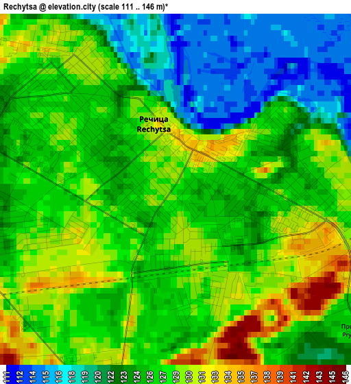
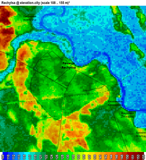
Below is the Elevation map of Rechytsa, which displays elevation range with different colors. Scale of the first map is from 111 to 146 m (364 to 479 ft) with average elevation of 126.1 meters (=414 ft) [note 1]
These maps also provides idea of topography and contour of this city, they are displayed at different zoom levels. More info about maps, scale and edge coordinates you can find below images.
| \ | Map #1 | Map #2 | Topo.Map |
| Scale [m] | 111..146 m | 108..155 m | × |
| Scale [ft] | 364..479 ft | 354..509 ft | × |
| Average | 126.1 m = 414 ft | 125 m = 410 ft | × |
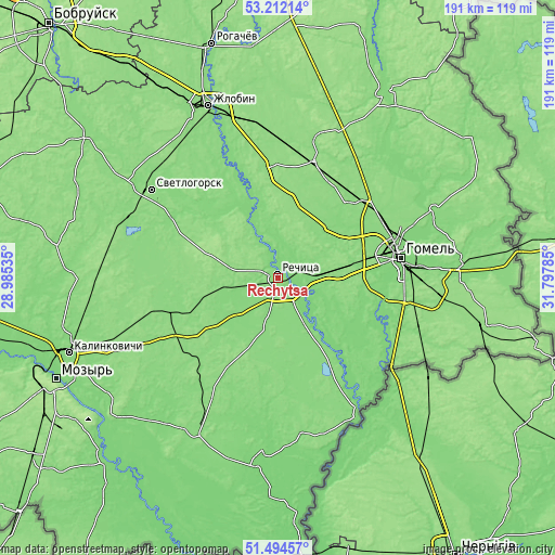
| Width | 5.97 km = 3.7 mi | 11.94 km = 7.4 mi | 191 km = 118.7 mi |
| Height | 5.97 km = 3.7 mi | 11.94 km = 7.4 mi | 191 km = 118.7 mi |
| ↑Max Latitude | 52.388528° | 52.41534° | 53.21214° |
| Latitude at center | 52.3617° | 52.3617° | 52.3617° |
| ↓Min Latitude | 52.334856° | 52.307995° | 51.49457° |
| ← Min Longitude | 30.347655° | 30.303709° | 28.98535° |
| Longitude center | 30.3916° | 30.3916° | 30.3916° |
| →Max Longitude | 30.435545° | 30.479491° | 31.79785° |
Nearby cities:
Cities around Rechytsa sort by population:
• Homyel' elevation 138 m
40.4 km,  78°
78°
• Svyetlahorsk 142 m
53.5 km,  304°
304°
• Kastsyukowka 138 m
40.7 km,  61°
61°
• Loyew 132 m
53.8 km,  149°
149°
• Vasilyevichy 137 m
40.2 km,  252°
252°
• Sasnovy Bor 136 m
56.5 km,  288°
288°
• Novaya Huta 133 m
49.5 km,  125°
125°
• Peramoga 124 m
46.3 km,  85°
85°
• Khal’ch 135 m
55.3 km,  65°
65°
• Karanyowka 137 m
48.9 km, 91°
• Buda-Kashalyova 147 m
41.4 km,  16°
16°
• Horad Rechytsa 129 m
0.3 km,  41°
41°
Multilingual:
 En español:
Rechytsa elevación 128 m.
 En France:
Rechytsa élévation 128 m.
 Auf Deutsch:
Rechytsa höhe über dem Meeresspiegel ist 128 m.

Sources and notes:
- [note 1] Map square and city borders are not equal. Map elevation data is calculated only from area inside that square.
- [src 1] Elevation data from geonames database provided with same terms of usage.
- [src 2] The elevation map of Rechytsa is generated using elevation data from NASA's 3 arcsec (90m) resolution SRTM data.
- [src 3] Base (background) map © OpenStreetMap contributors tiles are generated by Geofabrik and OpenTopoMap.
Copyright & License:
This Rechytsa Elevation Map is licensed under CC BY-SA. You may reuse any part from this page, if you give a proper credit by linking to this URL:
 More info on terms of use page.