Michanovichi elevation
Michanovichi (Minsk), Belarus elevation is 193 meters and Michanovichi elevation in feet is 633 ft above sea level [src 1]. Michanovichi is a populated place (feature code) with elevation that is 26 meters (85 ft) bigger than average city elevation in Belarus.
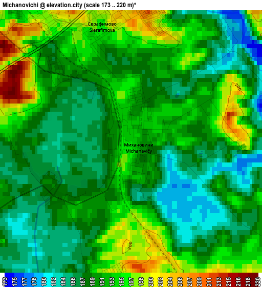
Below is the Elevation map of Michanovichi, which displays elevation range with different colors. Scale of the first map is from 173 to 220 m (568 to 722 ft) with average elevation of 190.7 meters (=626 ft) [note 1]
These maps also provides idea of topography and contour of this city, they are displayed at different zoom levels. More info about maps, scale and edge coordinates you can find below images.
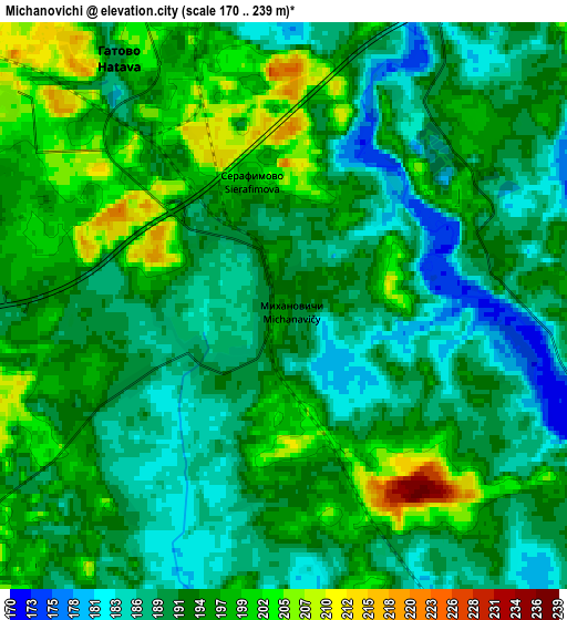
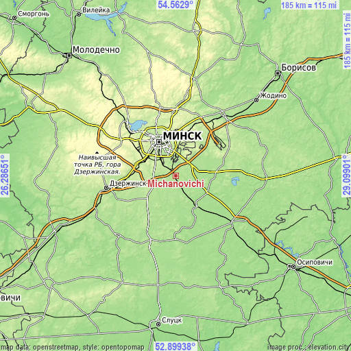
| \ | Map #1 | Map #2 | Topo.Map |
| Scale [m] | 173..220 m | 170..239 m | × |
| Scale [ft] | 568..722 ft | 558..784 ft | × |
| Average | 190.7 m = 626 ft | 192.7 m = 632 ft | × |
| Width | 5.78 km = 3.6 mi | 11.56 km = 7.2 mi | 185 km = 115 mi |
| Height | 5.78 km = 3.6 mi | 11.56 km = 7.2 mi | 184.9 km = 114.9 mi |
| ↑Max Latitude | 53.765354° | 53.791322° | 54.5629° |
| Latitude at center | 53.73937° | 53.73937° | 53.73937° |
| ↓Min Latitude | 53.71337° | 53.687354° | 52.89938° |
| ← Min Longitude | 27.648815° | 27.604869° | 26.28651° |
| Longitude center | 27.69276° | 27.69276° | 27.69276° |
| →Max Longitude | 27.736705° | 27.780651° | 29.09901° |
Nearby cities:
Cities around Michanovichi sort by population:
• Machulishchy elevation 215 m
7.8 km,  304°
304°
• Hatava 193 m
5.9 km,  324°
324°
• Syenitsa 209 m
14.6 km,  314°
314°
• Yubilyeyny 217 m
14.3 km, 308°
• Zamostochye 190 m
14.6 km,  52°
52°
• Samakhvalavichy 207 m
12.4 km,  270°
270°
• Vyaliki Trastsyanets 203 m
12.5 km,  6°
6°
• Pryvol’ny 194 m
9.4 km, 46°
• Schomyslitsa 242 m
18.2 km, 299°
• Luhavaya Slabada 181 m
11 km,  64°
64°
• Dukora 174 m
17.6 km,  112°
112°
• Atolina 228 m
17.6 km,  285°
285°
Multilingual:
 En español:
Michanovichi elevación 193 m.
 En France:
Michanovichi élévation 193 m.
 Auf Deutsch:
Michanovichi höhe über dem Meeresspiegel ist 193 m.

Sources and notes:
- [note 1] Map square and city borders are not equal. Map elevation data is calculated only from area inside that square.
- [src 1] Elevation data from geonames database provided with same terms of usage.
- [src 2] The elevation map of Michanovichi is generated using elevation data from NASA's 3 arcsec (90m) resolution SRTM data.
- [src 3] Base (background) map © OpenStreetMap contributors tiles are generated by Geofabrik and OpenTopoMap.
Copyright & License:
This Michanovichi Elevation Map is licensed under CC BY-SA. You may reuse any part from this page, if you give a proper credit by linking to this URL:
 More info on terms of use page.