Freeport elevation
Freeport, Bahamas elevation is 6 meters and Freeport elevation in feet is 20 ft above sea level [src 1]. Freeport is a seat of a first-order administrative division (feature code) with elevation that is 4 meters (13 ft) smaller than average city elevation in Bahamas.
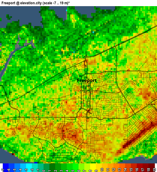
Below is the Elevation map of Freeport, which displays elevation range with different colors. Scale of the first map is from -7 to 19 m (-23 to 62 ft) with average elevation of 6.6 meters (=22 ft) [note 1]
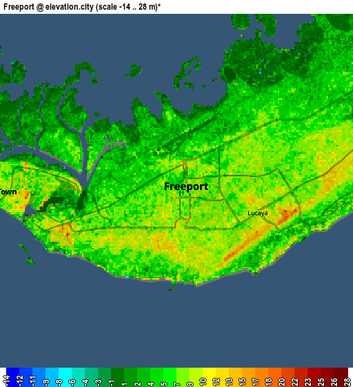
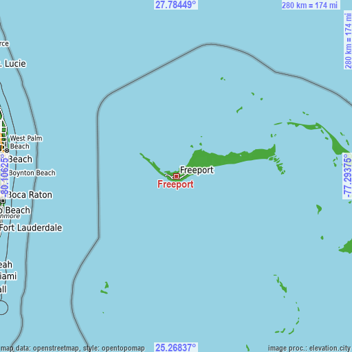
These maps also provides idea of topography and contour of this city, they are displayed at different zoom levels. More info about maps, scale and edge coordinates you can find below images.
| \ | Map #1 | Map #2 | Topo.Map |
| Scale [m] | -7..19 m | -14..28 m | × |
| Scale [ft] | -23..62 ft | -46..92 ft | × |
| Average | 6.6 m = 22 ft | 5.9 m = 19 ft | × |
| Width | 8.74 km = 5.4 mi | 17.49 km = 10.9 mi | 279.8 km = 173.9 mi |
| Height | 8.74 km = 5.4 mi | 17.49 km = 10.9 mi | 279.8 km = 173.9 mi |
| ↑Max Latitude | 26.57264° | 26.611937° | 27.78449° |
| Latitude at center | 26.53333° | 26.53333° | 26.53333° |
| ↓Min Latitude | 26.494007° | 26.45467° | 25.26837° |
| ← Min Longitude | -78.743945° | -78.787891° | -80.10625° |
| Longitude center | -78.7° | -78.7° | -78.7° |
| →Max Longitude | -78.656055° | -78.612109° | -77.29375° |
Nearby cities:
Cities around Freeport sort by population:
• Nassau elevation 5 m
213 km,  140°
140°
• Lucaya 7 m
3.3 km,  90°
90°
• West End 5 m
32.4 km,  301°
301°
• Cooper’s Town 3 m
123.9 km,  72°
72°
• San Andros 15 m
175.6 km,  158°
158°
• Marsh Harbour 4 m
162.8 km, 89°
• High Rock 8 m
42.8 km,  78°
78°
• Andros Town 14 m
223.7 km, 155°
• Dunmore Town 18 m
235.9 km,  119°
119°
• Spanish Wells 9 m
222.3 km, 119°
• Alice Town 1 m
107.6 km,  213°
213°
• Hard Bargain 7 m
115.4 km,  102°
102°
Multilingual:
 En español:
Freeport elevación 6 m.
 En France:
Freeport élévation 6 m.


Sources and notes:
- [note 1] Map square and city borders are not equal. Map elevation data is calculated only from area inside that square.
- [src 1] Elevation data from geonames database provided with same terms of usage.
- [src 2] The elevation map of Freeport is generated using elevation data from NASA's 3 arcsec (90m) resolution SRTM data.
- [src 3] Base (background) map © OpenStreetMap contributors tiles are generated by Geofabrik and OpenTopoMap.
Copyright & License:
This Freeport Elevation Map is licensed under CC BY-SA. You may reuse any part from this page, if you give a proper credit by linking to this URL:
 More info on terms of use page.