Lokossa elevation
Lokossa (Mono), Benin elevation is 47 meters and Lokossa elevation in feet is 154 ft above sea level [src 1]. Lokossa is a seat of a first-order administrative division (feature code) with elevation that is 116 meters (381 ft) smaller than average city elevation in Benin.
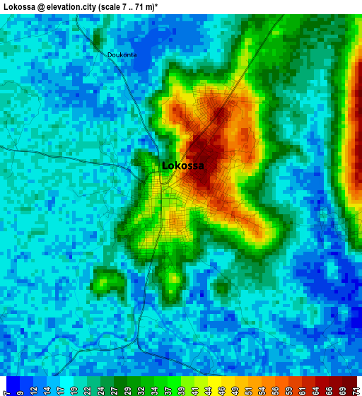
Below is the Elevation map of Lokossa, which displays elevation range with different colors. Scale of the first map is from 7 to 71 m (23 to 233 ft) with average elevation of 24.2 meters (=79 ft) [note 1]
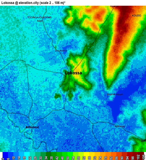
These maps also provides idea of topography and contour of this city, they are displayed at different zoom levels. More info about maps, scale and edge coordinates you can find below images.
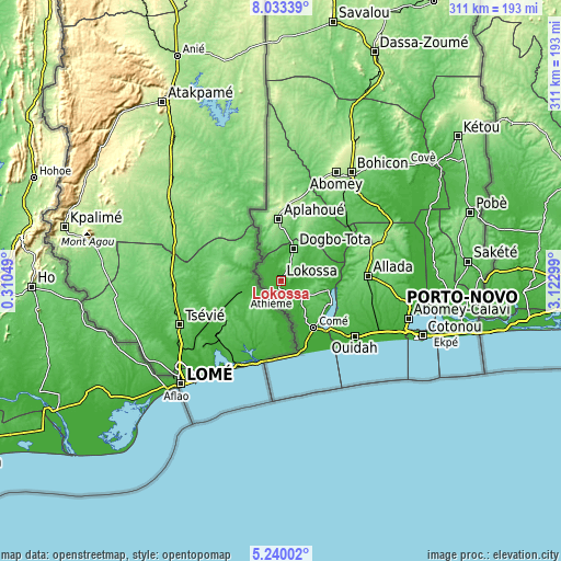
| \ | Map #1 | Map #2 | Topo.Map |
| Scale [m] | 7..71 m | 2..106 m | × |
| Scale [ft] | 23..233 ft | 7..348 ft | × |
| Average | 24.2 m = 79 ft | 25.9 m = 85 ft | × |
| Width | 9.71 km = 6 mi | 19.41 km = 12.1 mi | 310.6 km = 193 mi |
| Height | 9.71 km = 6 mi | 19.41 km = 12.1 mi | 310.6 km = 193 mi |
| ↑Max Latitude | 6.682339° | 6.725984° | 8.03339° |
| Latitude at center | 6.63869° | 6.63869° | 6.63869° |
| ↓Min Latitude | 6.595037° | 6.551381° | 5.24002° |
| ← Min Longitude | 1.672795° | 1.628849° | 0.31049° |
| Longitude center | 1.71674° | 1.71674° | 1.71674° |
| →Max Longitude | 1.760685° | 1.804631° | 3.12299° |
Nearby cities:
Cities around Lokossa sort by population:
• Ouidah elevation 17 m
50.9 km,  126°
126°
• Dogbo 72 m
19.2 km,  21°
21°
• Comé 29 m
31.5 km,  144°
144°
• Allada 93 m
48.1 km,  86°
86°
• Aplahoué 124 m
33 km,  353°
353°
• Hévié 18 m
63.9 km,  112°
112°
• Grand-Popo 4 m
41.5 km,  163°
163°
• Hinvi 121 m
51.7 km,  74°
74°
• Pahou 8 m
61.6 km,  116°
116°
• Sé 119 m
44.6 km, 73°
• Kpomassè 64 m
36.3 km, 122°
• Avakpa 54 m
36.1 km, 85°
Multilingual:
 En español:
Lokossa elevación 47 m.
 En France:
Lokossa élévation 47 m.


Sources and notes:
- [note 1] Map square and city borders are not equal. Map elevation data is calculated only from area inside that square.
- [src 1] Elevation data from geonames database provided with same terms of usage.
- [src 2] The elevation map of Lokossa is generated using elevation data from NASA's 3 arcsec (90m) resolution SRTM data.
- [src 3] Base (background) map © OpenStreetMap contributors tiles are generated by Geofabrik and OpenTopoMap.
Copyright & License:
This Lokossa Elevation Map is licensed under CC BY-SA. You may reuse any part from this page, if you give a proper credit by linking to this URL:
 More info on terms of use page.