Porto-Novo elevation
Porto-Novo (Ouémé), Benin elevation is 20 meters and Porto-Novo elevation in feet is 66 ft above sea level [src 1]. Porto-Novo is a capital of a political entity (feature code) with elevation that is 143 meters (469 ft) smaller than average city elevation in Benin.
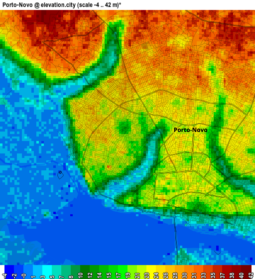
Below is the Elevation map of Porto-Novo, which displays elevation range with different colors. Scale of the first map is from -4 to 42 m (-13 to 138 ft) with average elevation of 15.4 meters (=51 ft) [note 1]
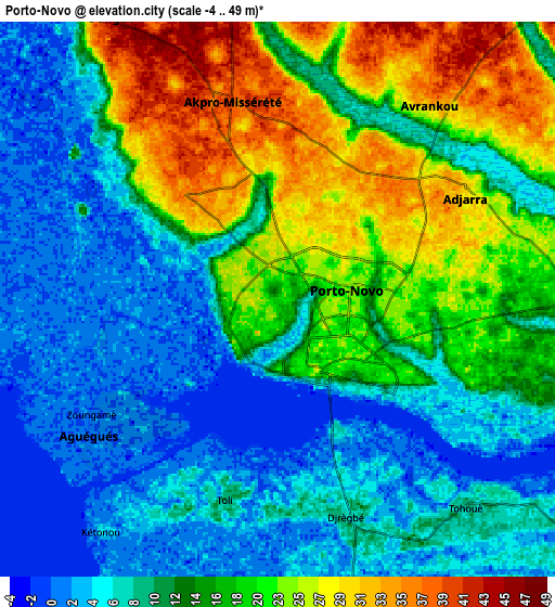
These maps also provides idea of topography and contour of this city, they are displayed at different zoom levels. More info about maps, scale and edge coordinates you can find below images.
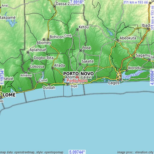
| \ | Map #1 | Map #2 | Topo.Map |
| Scale [m] | -4..42 m | -4..49 m | × |
| Scale [ft] | -13..138 ft | -13..161 ft | × |
| Average | 15.4 m = 51 ft | 13.8 m = 45 ft | × |
| Width | 9.71 km = 6 mi | 19.42 km = 12.1 mi | 310.7 km = 193.1 mi |
| Height | 9.71 km = 6 mi | 19.42 km = 12.1 mi | 310.7 km = 193.1 mi |
| ↑Max Latitude | 6.540121° | 6.583779° | 7.8916° |
| Latitude at center | 6.49646° | 6.49646° | 6.49646° |
| ↓Min Latitude | 6.452795° | 6.409126° | 5.09744° |
| ← Min Longitude | 2.559645° | 2.515699° | 1.19734° |
| Longitude center | 2.60359° | 2.60359° | 2.60359° |
| →Max Longitude | 2.647535° | 2.691481° | 4.00984° |
Nearby cities:
Cities around Porto-Novo sort by population:
• Cotonou elevation 7 m
25.1 km,  234°
234°
• Abomey-Calavi 11 m
27.9 km,  258°
258°
• Pobé 136 m
54.2 km,  7°
7°
• Sakété 80 m
27.3 km, 12°
• Allada 93 m
53.4 km,  290°
290°
• Hévié 18 m
40.1 km, 257°
• Houinvigue 74 m
45.4 km,  342°
342°
• Pahou 8 m
44.7 km,  254°
254°
• Adjohon 29 m
28.3 km,  330°
330°
• So-Ava 1 m
22.3 km,  268°
268°
• Banigbé 37 m
20.3 km,  34°
34°
• Semi 8 m
14.5 km,  174°
174°
Multilingual:
 En español:
Porto Novo elevación 20 m.
 En France:
Porto Novo élévation 20 m.
 Auf Deutsch:
Porto Novo höhe über dem Meeresspiegel ist 20 m.

Sources and notes:
- [note 1] Map square and city borders are not equal. Map elevation data is calculated only from area inside that square.
- [src 1] Elevation data from geonames database provided with same terms of usage.
- [src 2] The elevation map of Porto-Novo is generated using elevation data from NASA's 3 arcsec (90m) resolution SRTM data.
- [src 3] Base (background) map © OpenStreetMap contributors tiles are generated by Geofabrik and OpenTopoMap.
Copyright & License:
This Porto-Novo Elevation Map is licensed under CC BY-SA. You may reuse any part from this page, if you give a proper credit by linking to this URL:
 More info on terms of use page.