Zlatitsa elevation
Zlatitsa (Sofia, Obshtina Zlatitsa), Bulgaria elevation is 692 meters and Zlatitsa elevation in feet is 2270 ft above sea level [src 1]. Zlatitsa is a populated place (feature code) with elevation that is 373 meters (1224 ft) bigger than average city elevation in Bulgaria.
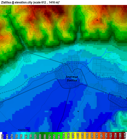
Below is the Elevation map of Zlatitsa, which displays elevation range with different colors. Scale of the first map is from 612 to 1416 m (2008 to 4646 ft) with average elevation of 820.7 meters (=2693 ft) [note 1]
These maps also provides idea of topography and contour of this city, they are displayed at different zoom levels. More info about maps, scale and edge coordinates you can find below images.
| \ | Map #1 | Map #2 | Topo.Map |
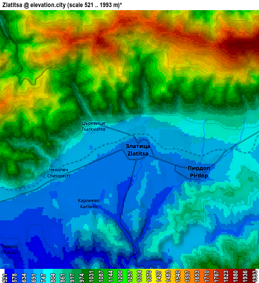
| Scale [m] | 612..1416 m | 521..1993 m | × |
| Scale [ft] | 2008..4646 ft | 1709..6539 ft | × |
| Average | 820.7 m = 2693 ft | 983 m = 3225 ft | × |
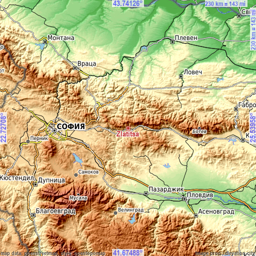
| Width | 7.18 km = 4.5 mi | 14.36 km = 8.9 mi | 229.8 km = 142.8 mi |
| Height | 7.18 km = 4.5 mi | 14.36 km = 8.9 mi | 229.8 km = 142.8 mi |
| ↑Max Latitude | 42.748949° | 42.781211° | 43.74126° |
| Latitude at center | 42.71667° | 42.71667° | 42.71667° |
| ↓Min Latitude | 42.684374° | 42.652062° | 41.67488° |
| ← Min Longitude | 24.089385° | 24.045439° | 22.72708° |
| Longitude center | 24.13333° | 24.13333° | 24.13333° |
| →Max Longitude | 24.177275° | 24.221221° | 25.53958° |
Nearby cities:
Cities around Zlatitsa sort by population:
• Panagyurishte elevation 518 m
25.1 km,  169°
169°
• Etropole 535 m
16.9 km,  320°
320°
• Teteven 419 m
24.8 km,  26°
26°
• Pirdop 675 m
4.5 km,  114°
114°
• Strelcha 511 m
28.4 km,  148°
148°
• Pravets 519 m
25.6 km, 316°
• Koprivshtitsa 1098 m
20 km,  117°
117°
• Mirkovo 725 m
12.4 km,  261°
261°
• Chelopech 716 m
4.5 km,  245°
245°
• Anton 1174 m
12.8 km,  73°
73°
• Klisura 772 m
25.9 km,  94°
94°
• Chavdar 591 m
10.1 km,  222°
222°
Multilingual:
 En español:
Zlatitsa elevación 692 m.
 En France:
Zlatitsa élévation 692 m.
 Auf Deutsch:
Zlatitsa höhe über dem Meeresspiegel ist 692 m.

Sources and notes:
- [note 1] Map square and city borders are not equal. Map elevation data is calculated only from area inside that square.
- [src 1] Elevation data from geonames database provided with same terms of usage.
- [src 2] The elevation map of Zlatitsa is generated using elevation data from NASA's 3 arcsec (90m) resolution SRTM data.
- [src 3] Base (background) map © OpenStreetMap contributors tiles are generated by Geofabrik and OpenTopoMap.
Copyright & License:
This Zlatitsa Elevation Map is licensed under CC BY-SA. You may reuse any part from this page, if you give a proper credit by linking to this URL:
 More info on terms of use page.