Kaya elevation
Kaya (Centre-Nord, Province du Sanmatenga), Burkina Faso elevation is 341 meters and Kaya elevation in feet is 1119 ft above sea level [src 1]. Kaya is a seat of a first-order administrative division (feature code) with elevation that is 37 meters (121 ft) bigger than average city elevation in Burkina Faso.
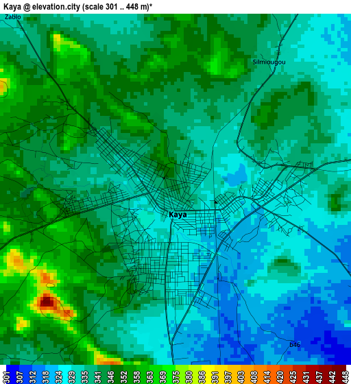
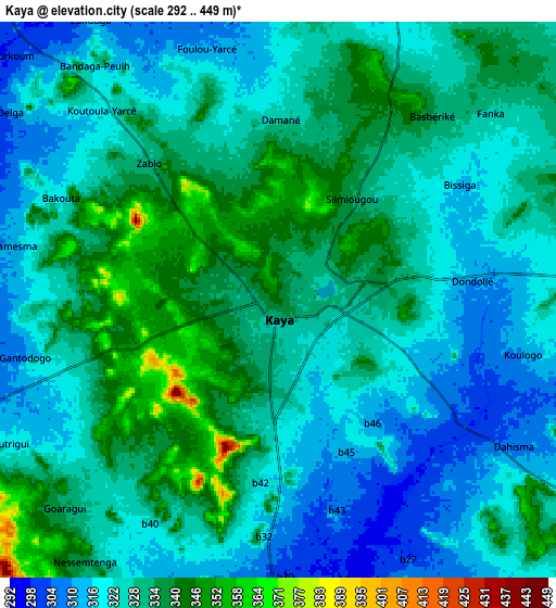
Below is the Elevation map of Kaya, which displays elevation range with different colors. Scale of the first map is from 301 to 448 m (988 to 1470 ft) with average elevation of 338.8 meters (=1112 ft) [note 1]
These maps also provides idea of topography and contour of this city, they are displayed at different zoom levels. More info about maps, scale and edge coordinates you can find below images.
| \ | Map #1 | Map #2 | Topo.Map |
| Scale [m] | 301..448 m | 292..449 m | × |
| Scale [ft] | 988..1470 ft | 958..1473 ft | × |
| Average | 338.8 m = 1112 ft | 327.8 m = 1075 ft | × |
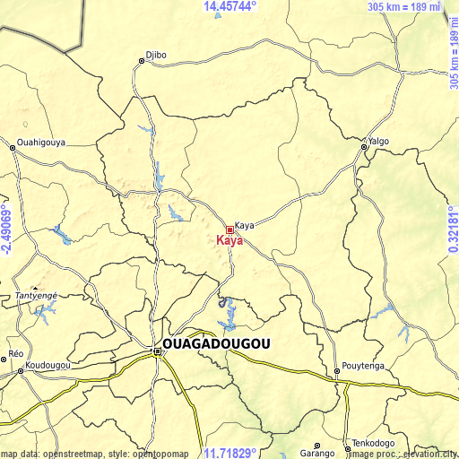
| Width | 9.52 km = 5.9 mi | 19.04 km = 11.8 mi | 304.6 km = 189.3 mi |
| Height | 9.52 km = 5.9 mi | 19.04 km = 11.8 mi | 304.6 km = 189.3 mi |
| ↑Max Latitude | 13.134469° | 13.177261° | 14.45744° |
| Latitude at center | 13.09167° | 13.09167° | 13.09167° |
| ↓Min Latitude | 13.048863° | 13.006049° | 11.71829° |
| ← Min Longitude | -1.128385° | -1.172331° | -2.49069° |
| Longitude center | -1.08444° | -1.08444° | -1.08444° |
| →Max Longitude | -1.040495° | -0.996549° | 0.32181° |
Nearby cities:
Cities around Kaya sort by population:
• Kongoussi elevation 330 m
55.3 km,  298°
298°
• Boulsa 313 m
72.7 km,  130°
130°
• Ziniaré 303 m
61.2 km,  202°
202°
• Loumbila 295 m
71 km,  206°
206°
• Nagréongo 270 m
69.3 km,  190°
190°
• Dapélogo 295 m
67.8 km,  226°
226°
• Ourgou-Manéga 307 m
57.5 km, 232°
• Absouya 256 m
50.3 km,  176°
176°
• Zitenga 334 m
45.3 km, 212°
• Mané 258 m
30.4 km,  247°
247°
• Korsimoro 263 m
29.7 km, 176°
• Boussouma 301 m
20.1 km, 179°
Multilingual:
 En español:
Kaya elevación 341 m.
 En France:
Kaya élévation 341 m.


Sources and notes:
- [note 1] Map square and city borders are not equal. Map elevation data is calculated only from area inside that square.
- [src 1] Elevation data from geonames database provided with same terms of usage.
- [src 2] The elevation map of Kaya is generated using elevation data from NASA's 3 arcsec (90m) resolution SRTM data.
- [src 3] Base (background) map © OpenStreetMap contributors tiles are generated by Geofabrik and OpenTopoMap.
Copyright & License:
This Kaya Elevation Map is licensed under CC BY-SA. You may reuse any part from this page, if you give a proper credit by linking to this URL:
 More info on terms of use page.