Assesse elevation
Assesse (Wallonia, Province de Namur), Belgium elevation is 247 meters and Assesse elevation in feet is 810 ft above sea level [src 1]. Assesse is a populated place (feature code) with elevation that is 148 meters (486 ft) bigger than average city elevation in Belgium.
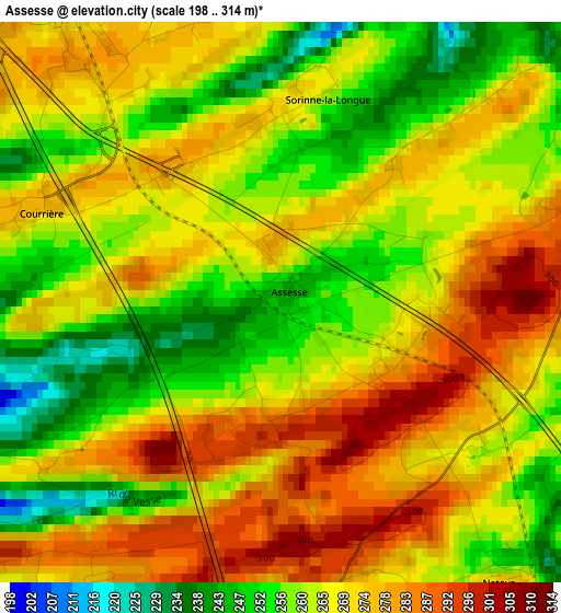
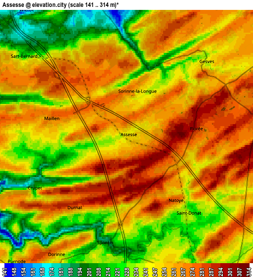
Below is the Elevation map of Assesse, which displays elevation range with different colors. Scale of the first map is from 198 to 314 m (650 to 1030 ft) with average elevation of 266.6 meters (=875 ft) [note 1]
These maps also provides idea of topography and contour of this city, they are displayed at different zoom levels. More info about maps, scale and edge coordinates you can find below images.
| \ | Map #1 | Map #2 | Topo.Map |
| Scale [m] | 198..314 m | 141..314 m | × |
| Scale [ft] | 650..1030 ft | 463..1030 ft | × |
| Average | 266.6 m = 875 ft | 250.6 m = 822 ft | × |
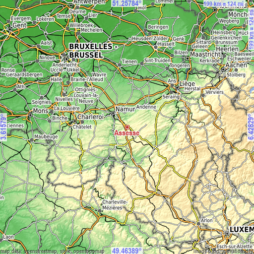
| Width | 6.23 km = 3.9 mi | 12.47 km = 7.7 mi | 199.5 km = 124 mi |
| Height | 6.23 km = 3.9 mi | 12.47 km = 7.7 mi | 199.5 km = 124 mi |
| ↑Max Latitude | 50.397362° | 50.425367° | 51.25784° |
| Latitude at center | 50.36934° | 50.36934° | 50.36934° |
| ↓Min Latitude | 50.341302° | 50.313247° | 49.46389° |
| ← Min Longitude | 4.978095° | 4.934149° | 3.61579° |
| Longitude center | 5.02204° | 5.02204° | 5.02204° |
| →Max Longitude | 5.065985° | 5.109931° | 6.42829° |
Nearby cities:
Cities around Assesse sort by population:
• Namur elevation 88 m
15.4 km,  314°
314°
• Andenne 78 m
14.3 km,  21°
21°
• Ciney 261 m
10 km,  146°
146°
• Dinant 96 m
14.6 km,  212°
212°
• Profondeville 93 m
11.2 km,  273°
273°
• Yvoir 96 m
11 km,  245°
245°
• Anhée 91 m
12.1 km,  237°
237°
• Hamois 250 m
10.1 km,  108°
108°
• Gesves 246 m
5.2 km,  46°
46°
• Marchin 264 m
19 km,  55°
55°
• Havelange 303 m
15.5 km,  81°
81°
• Ohey 269 m
10.3 km,  44°
44°
Multilingual:
 En español:
Assesse elevación 247 m.
 En France:
Assesse élévation 247 m.


Sources and notes:
- [note 1] Map square and city borders are not equal. Map elevation data is calculated only from area inside that square.
- [src 1] Elevation data from geonames database provided with same terms of usage.
- [src 2] The elevation map of Assesse is generated using elevation data from NASA's 3 arcsec (90m) resolution SRTM data.
- [src 3] Base (background) map © OpenStreetMap contributors tiles are generated by Geofabrik and OpenTopoMap.
Copyright & License:
This Assesse Elevation Map is licensed under CC BY-SA. You may reuse any part from this page, if you give a proper credit by linking to this URL:
 More info on terms of use page.