Beersel elevation
Beersel (Flanders, Provincie Vlaams-Brabant), Belgium elevation is 43 meters and Beersel elevation in feet is 141 ft above sea level [src 1]. Beersel is a populated place (feature code) with elevation that is 56 meters (184 ft) smaller than average city elevation in Belgium.
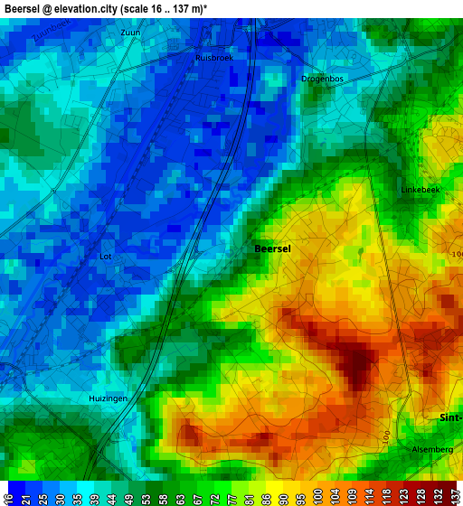
Below is the Elevation map of Beersel, which displays elevation range with different colors. Scale of the first map is from 16 to 137 m (52 to 449 ft) with average elevation of 57.4 meters (=188 ft) [note 1]
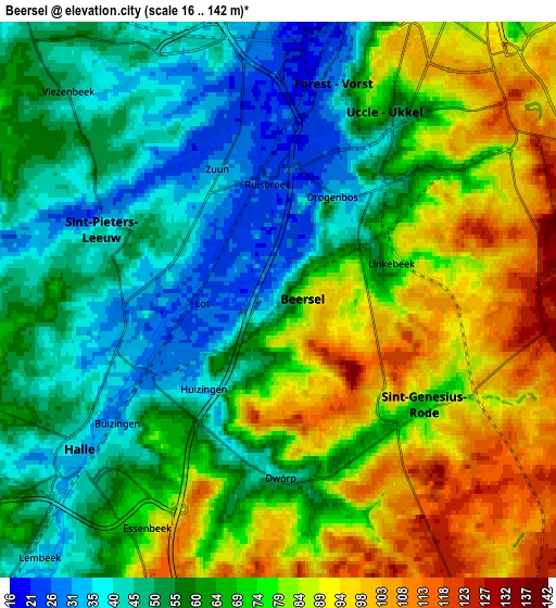
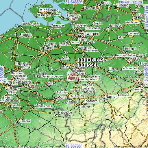
These maps also provides idea of topography and contour of this city, they are displayed at different zoom levels. More info about maps, scale and edge coordinates you can find below images.
| \ | Map #1 | Map #2 | Topo.Map |
| Scale [m] | 16..137 m | 16..142 m | × |
| Scale [ft] | 52..449 ft | 52..466 ft | × |
| Average | 57.4 m = 188 ft | 67.1 m = 220 ft | × |
| Width | 6.18 km = 3.8 mi | 12.36 km = 7.7 mi | 197.8 km = 122.9 mi |
| Height | 6.18 km = 3.8 mi | 12.36 km = 7.7 mi | 197.8 km = 122.9 mi |
| ↑Max Latitude | 50.793677° | 50.821447° | 51.64689° |
| Latitude at center | 50.76589° | 50.76589° | 50.76589° |
| ↓Min Latitude | 50.738087° | 50.710267° | 49.86798° |
| ← Min Longitude | 4.256255° | 4.212309° | 2.89395° |
| Longitude center | 4.3002° | 4.3002° | 4.3002° |
| →Max Longitude | 4.344145° | 4.388091° | 5.70645° |
Nearby cities:
Cities around Beersel sort by population:
• Brussels elevation 28 m
10 km,  19°
19°
• Dilbeek 84 m
9.6 km,  342°
342°
• Braine-l'Alleud 93 m
10.3 km,  152°
152°
• Halle 34 m
5.8 km,  232°
232°
• Sint-Pieters-Leeuw 45 m
4.3 km,  290°
290°
• Waterloo 119 m
9 km,  129°
129°
• Sint-Genesius-Rode 83 m
4.6 km,  118°
118°
• Braine-le-Château 78 m
9.7 km,  190°
190°
• Sint-Martens-Lennik 57 m
10.5 km,  298°
298°
• Drogenbos 31 m
2.6 km, 23°
• Linkebeek 85 m
2.6 km,  85°
85°
• Pepingen 52 m
9.9 km,  265°
265°
Multilingual:
 En español:
Beersel elevación 43 m.
 En France:
Beersel élévation 43 m.


Sources and notes:
- [note 1] Map square and city borders are not equal. Map elevation data is calculated only from area inside that square.
- [src 1] Elevation data from geonames database provided with same terms of usage.
- [src 2] The elevation map of Beersel is generated using elevation data from NASA's 3 arcsec (90m) resolution SRTM data.
- [src 3] Base (background) map © OpenStreetMap contributors tiles are generated by Geofabrik and OpenTopoMap.
Copyright & License:
This Beersel Elevation Map is licensed under CC BY-SA. You may reuse any part from this page, if you give a proper credit by linking to this URL:
 More info on terms of use page.