Borgloon elevation
Borgloon (Flanders, Provincie Limburg), Belgium elevation is 98 meters and Borgloon elevation in feet is 322 ft above sea level [src 1]. Borgloon is a populated place (feature code) with elevation that is 1 meters (3 ft) smaller than average city elevation in Belgium.
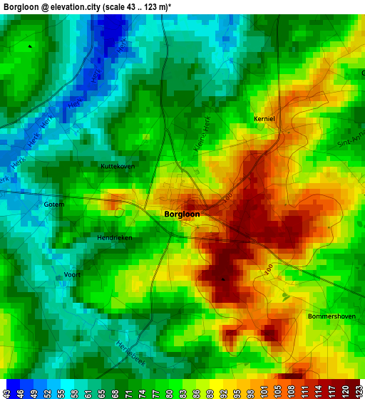
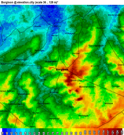
Below is the Elevation map of Borgloon, which displays elevation range with different colors. Scale of the first map is from 43 to 123 m (141 to 404 ft) with average elevation of 78.4 meters (=257 ft) [note 1]
These maps also provides idea of topography and contour of this city, they are displayed at different zoom levels. More info about maps, scale and edge coordinates you can find below images.
| \ | Map #1 | Map #2 | Topo.Map |
| Scale [m] | 43..123 m | 36..128 m | × |
| Scale [ft] | 141..404 ft | 118..420 ft | × |
| Average | 78.4 m = 257 ft | 72.3 m = 237 ft | × |
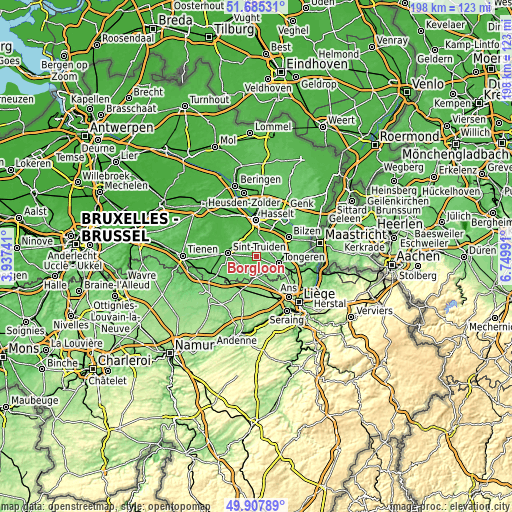
| Width | 6.18 km = 3.8 mi | 12.35 km = 7.7 mi | 197.6 km = 122.8 mi |
| Height | 6.18 km = 3.8 mi | 12.35 km = 7.7 mi | 197.6 km = 122.8 mi |
| ↑Max Latitude | 50.832813° | 50.86056° | 51.68531° |
| Latitude at center | 50.80505° | 50.80505° | 50.80505° |
| ↓Min Latitude | 50.77727° | 50.749474° | 49.90789° |
| ← Min Longitude | 5.299715° | 5.255769° | 3.93741° |
| Longitude center | 5.34366° | 5.34366° | 5.34366° |
| →Max Longitude | 5.387605° | 5.431551° | 6.74991° |
Nearby cities:
Cities around Borgloon sort by population:
• Sint-Truiden elevation 54 m
11.1 km,  276°
276°
• Tongeren 107 m
8.9 km,  107°
107°
• Alken 39 m
8.3 km,  341°
341°
• Hoeselt 77 m
11.1 km,  65°
65°
• Kortessem 55 m
6.8 km,  28°
28°
• Wellen 47 m
4 km,  354°
354°
• Heers 75 m
6.4 km,  207°
207°
• Nieuwerkerken 44 m
12.3 km,  301°
301°
• Oreye 112 m
9.7 km,  177°
177°
• Crisnée 113 m
10.5 km,  158°
158°
• Sint-Joris 48 m
8.9 km,  325°
325°
• Terkoest 37 m
11.4 km, 335°
Multilingual:
 En español:
Borgloon elevación 98 m.
 En France:
Looz élévation 98 m.
 Auf Deutsch:
Borgloon, Loon höhe über dem Meeresspiegel ist 98 m.

Sources and notes:
- [note 1] Map square and city borders are not equal. Map elevation data is calculated only from area inside that square.
- [src 1] Elevation data from geonames database provided with same terms of usage.
- [src 2] The elevation map of Borgloon is generated using elevation data from NASA's 3 arcsec (90m) resolution SRTM data.
- [src 3] Base (background) map © OpenStreetMap contributors tiles are generated by Geofabrik and OpenTopoMap.
Copyright & License:
This Borgloon Elevation Map is licensed under CC BY-SA. You may reuse any part from this page, if you give a proper credit by linking to this URL:
 More info on terms of use page.