Eupen elevation
Eupen (Wallonia, Province de Liège), Belgium elevation is 298 meters and Eupen elevation in feet is 978 ft above sea level [src 1]. Eupen is a populated place (feature code) with elevation that is 199 meters (653 ft) bigger than average city elevation in Belgium.
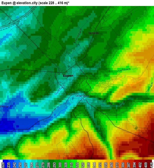
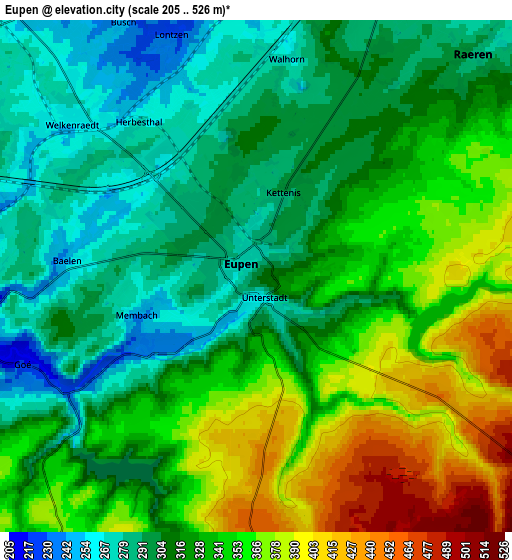
Below is the Elevation map of Eupen, which displays elevation range with different colors. Scale of the first map is from 228 to 416 m (748 to 1365 ft) with average elevation of 304.7 meters (=1000 ft) [note 1]
These maps also provides idea of topography and contour of this city, they are displayed at different zoom levels. More info about maps, scale and edge coordinates you can find below images.
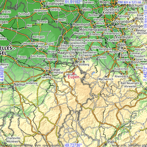
| \ | Map #1 | Map #2 | Topo.Map |
| Scale [m] | 228..416 m | 205..526 m | × |
| Scale [ft] | 748..1365 ft | 673..1726 ft | × |
| Average | 304.7 m = 1000 ft | 327.9 m = 1076 ft | × |
| Width | 6.2 km = 3.9 mi | 12.4 km = 7.7 mi | 198.4 km = 123.3 mi |
| Height | 6.2 km = 3.9 mi | 12.4 km = 7.7 mi | 198.4 km = 123.3 mi |
| ↑Max Latitude | 50.655769° | 50.683621° | 51.51152° |
| Latitude at center | 50.6279° | 50.6279° | 50.6279° |
| ↓Min Latitude | 50.600015° | 50.572113° | 49.72736° |
| ← Min Longitude | 5.992525° | 5.948579° | 4.63022° |
| Longitude center | 6.03647° | 6.03647° | 6.03647° |
| →Max Longitude | 6.080415° | 6.124361° | 7.44272° |
Nearby cities:
Cities around Eupen sort by population:
• Verviers elevation 201 m
13 km,  250°
250°
• Herve 300 m
17.2 km,  274°
274°
• Dison 197 m
13.1 km,  261°
261°
• La Calamine 220 m
10.2 km,  349°
349°
• Raeren 318 m
7.1 km,  51°
51°
• Plombières 167 m
13.3 km,  335°
335°
• Welkenraedt 256 m
5.9 km,  307°
307°
• Jalhay 386 m
9.1 km,  212°
212°
• Limbourg 262 m
6.9 km, 255°
• Lontzen 223 m
6.3 km, 340°
• Aubel 226 m
15 km,  303°
303°
• Baelen 257 m
4.4 km, 274°
Multilingual:
 En español:
Eupen elevación 298 m.
 En France:
Eupen élévation 298 m.


Sources and notes:
- [note 1] Map square and city borders are not equal. Map elevation data is calculated only from area inside that square.
- [src 1] Elevation data from geonames database provided with same terms of usage.
- [src 2] The elevation map of Eupen is generated using elevation data from NASA's 3 arcsec (90m) resolution SRTM data.
- [src 3] Base (background) map © OpenStreetMap contributors tiles are generated by Geofabrik and OpenTopoMap.
Copyright & License:
This Eupen Elevation Map is licensed under CC BY-SA. You may reuse any part from this page, if you give a proper credit by linking to this URL:
 More info on terms of use page.