Ittre elevation
Ittre (Wallonia, Province du Brabant Wallon), Belgium elevation is 111 meters and Ittre elevation in feet is 364 ft above sea level [src 1]. Ittre is a populated place (feature code) with elevation that is 12 meters (39 ft) bigger than average city elevation in Belgium.
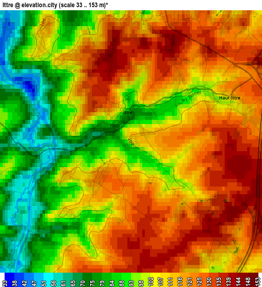
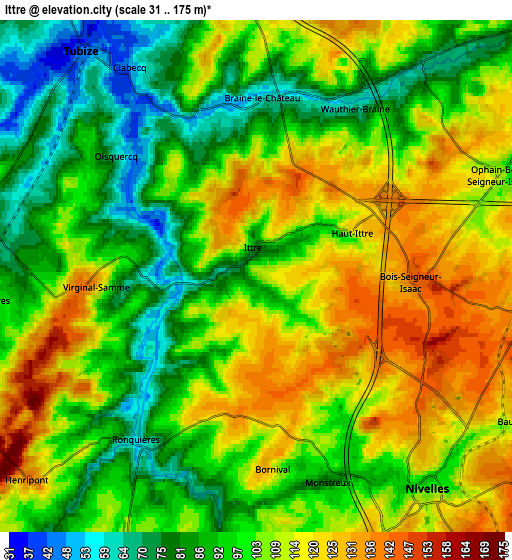
Below is the Elevation map of Ittre, which displays elevation range with different colors. Scale of the first map is from 33 to 153 m (108 to 502 ft) with average elevation of 107.5 meters (=353 ft) [note 1]
These maps also provides idea of topography and contour of this city, they are displayed at different zoom levels. More info about maps, scale and edge coordinates you can find below images.
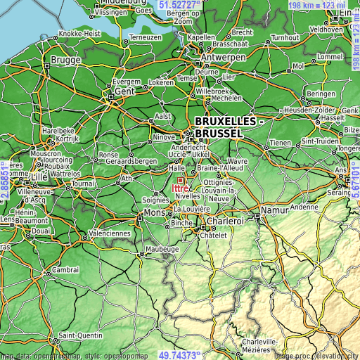
| \ | Map #1 | Map #2 | Topo.Map |
| Scale [m] | 33..153 m | 31..175 m | × |
| Scale [ft] | 108..502 ft | 102..574 ft | × |
| Average | 107.5 m = 353 ft | 102.6 m = 337 ft | × |
| Width | 6.2 km = 3.9 mi | 12.39 km = 7.7 mi | 198.3 km = 123.2 mi |
| Height | 6.2 km = 3.9 mi | 12.39 km = 7.7 mi | 198.3 km = 123.2 mi |
| ↑Max Latitude | 50.671819° | 50.699662° | 51.52727° |
| Latitude at center | 50.64396° | 50.64396° | 50.64396° |
| ↓Min Latitude | 50.616084° | 50.588192° | 49.74373° |
| ← Min Longitude | 4.220815° | 4.176869° | 2.85851° |
| Longitude center | 4.26476° | 4.26476° | 4.26476° |
| →Max Longitude | 4.308705° | 4.352651° | 5.67101° |
Nearby cities:
Cities around Ittre sort by population:
• Braine-l'Alleud elevation 93 m
8.5 km,  58°
58°
• Halle 34 m
10.2 km,  347°
347°
• Waterloo 119 m
12.3 km,  50°
50°
• Nivelles 101 m
6.8 km,  138°
138°
• Tubize 39 m
6.9 km,  319°
319°
• Braine-le-Comte 96 m
9.2 km,  245°
245°
• Sint-Genesius-Rode 83 m
13.1 km,  29°
29°
• Genappe 112 m
13.7 km,  105°
105°
• Seneffe 112 m
12.5 km,  180°
180°
• Rebecq-Rognon 65 m
11.2 km,  274°
274°
• Écaussinnes-d’Enghien 104 m
10.9 km,  219°
219°
• Braine-le-Château 78 m
4 km,  9°
9°
Multilingual:
 En español:
Ittre elevación 111 m.
 En France:
Ittre élévation 111 m.


Sources and notes:
- [note 1] Map square and city borders are not equal. Map elevation data is calculated only from area inside that square.
- [src 1] Elevation data from geonames database provided with same terms of usage.
- [src 2] The elevation map of Ittre is generated using elevation data from NASA's 3 arcsec (90m) resolution SRTM data.
- [src 3] Base (background) map © OpenStreetMap contributors tiles are generated by Geofabrik and OpenTopoMap.
Copyright & License:
This Ittre Elevation Map is licensed under CC BY-SA. You may reuse any part from this page, if you give a proper credit by linking to this URL:
 More info on terms of use page.