La Hulpe elevation
La Hulpe (Wallonia, Province du Brabant Wallon), Belgium elevation is 86 meters and La Hulpe elevation in feet is 282 ft above sea level [src 1]. La Hulpe is a populated place (feature code) with elevation that is 13 meters (43 ft) smaller than average city elevation in Belgium.
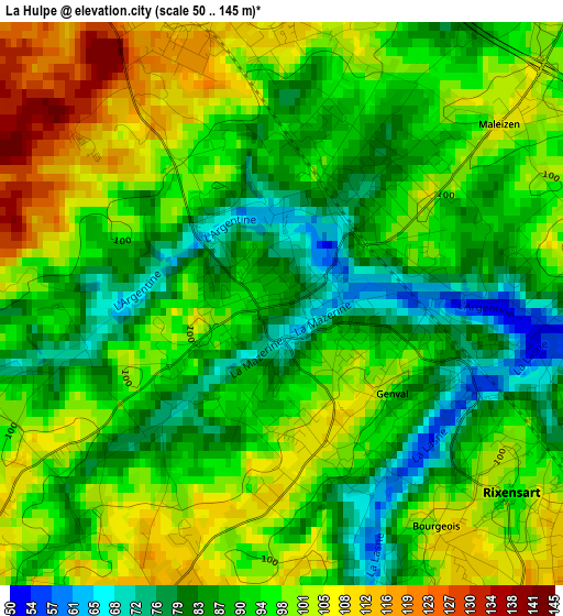
Below is the Elevation map of La Hulpe, which displays elevation range with different colors. Scale of the first map is from 50 to 145 m (164 to 476 ft) with average elevation of 93.8 meters (=308 ft) [note 1]
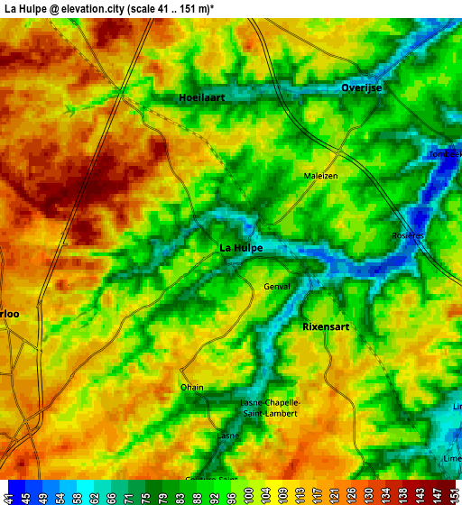
These maps also provides idea of topography and contour of this city, they are displayed at different zoom levels. More info about maps, scale and edge coordinates you can find below images.
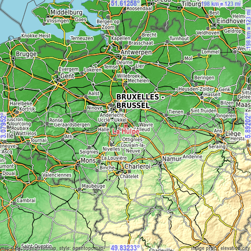
| \ | Map #1 | Map #2 | Topo.Map |
| Scale [m] | 50..145 m | 41..151 m | × |
| Scale [ft] | 164..476 ft | 135..495 ft | × |
| Average | 93.8 m = 308 ft | 100.4 m = 329 ft | × |
| Width | 6.19 km = 3.8 mi | 12.37 km = 7.7 mi | 197.9 km = 123 mi |
| Height | 6.19 km = 3.8 mi | 12.37 km = 7.7 mi | 197.9 km = 123 mi |
| ↑Max Latitude | 50.758718° | 50.786509° | 51.61258° |
| Latitude at center | 50.73091° | 50.73091° | 50.73091° |
| ↓Min Latitude | 50.703086° | 50.675245° | 49.83233° |
| ← Min Longitude | 4.441825° | 4.397879° | 3.07952° |
| Longitude center | 4.48577° | 4.48577° | 4.48577° |
| →Max Longitude | 4.529715° | 4.573661° | 5.89202° |
Nearby cities:
Cities around La Hulpe sort by population:
• Braine-l'Alleud elevation 93 m
9.8 km,  237°
237°
• Wavre 72 m
8.3 km,  100°
100°
• Waterloo 119 m
6.4 km,  253°
253°
• Overijse 88 m
5.9 km,  35°
35°
• Rixensart 101 m
3.5 km,  126°
126°
• Tervuren 79 m
10.5 km,  10°
10°
• Sint-Genesius-Rode 83 m
9.2 km,  280°
280°
• Basse Lasne 65 m
4 km,  173°
173°
• Hoeilaart 84 m
4.2 km,  343°
343°
• Ottignies 65 m
9.3 km,  141°
141°
• Huldenberg 48 m
9.4 km,  46°
46°
• Linkebeek 85 m
11.2 km,  291°
291°
Multilingual:
 En español:
La Hulpe elevación 86 m.
 En France:
La Hulpe élévation 86 m.


Sources and notes:
- [note 1] Map square and city borders are not equal. Map elevation data is calculated only from area inside that square.
- [src 1] Elevation data from geonames database provided with same terms of usage.
- [src 2] The elevation map of La Hulpe is generated using elevation data from NASA's 3 arcsec (90m) resolution SRTM data.
- [src 3] Base (background) map © OpenStreetMap contributors tiles are generated by Geofabrik and OpenTopoMap.
Copyright & License:
This La Hulpe Elevation Map is licensed under CC BY-SA. You may reuse any part from this page, if you give a proper credit by linking to this URL:
 More info on terms of use page.