Perwez elevation
Perwez (Wallonia, Province du Brabant Wallon), Belgium elevation is 147 meters and Perwez elevation in feet is 482 ft above sea level [src 1]. Perwez is a populated place (feature code) with elevation that is 48 meters (157 ft) bigger than average city elevation in Belgium.
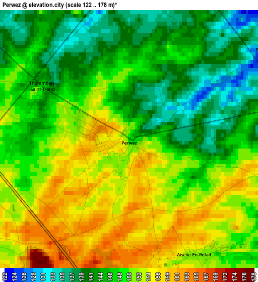
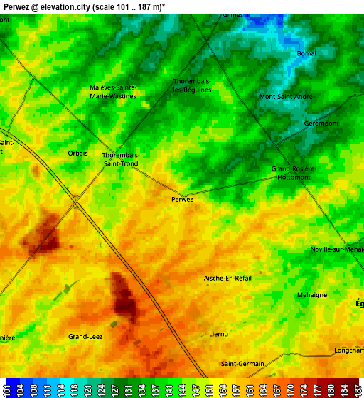
Below is the Elevation map of Perwez, which displays elevation range with different colors. Scale of the first map is from 122 to 178 m (400 to 584 ft) with average elevation of 148.3 meters (=487 ft) [note 1]
These maps also provides idea of topography and contour of this city, they are displayed at different zoom levels. More info about maps, scale and edge coordinates you can find below images.
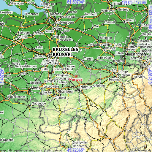
| \ | Map #1 | Map #2 | Topo.Map |
| Scale [m] | 122..178 m | 101..187 m | × |
| Scale [ft] | 400..584 ft | 331..614 ft | × |
| Average | 148.3 m = 487 ft | 146.7 m = 481 ft | × |
| Width | 6.2 km = 3.9 mi | 12.4 km = 7.7 mi | 198.4 km = 123.3 mi |
| Height | 6.2 km = 3.9 mi | 12.4 km = 7.7 mi | 198.4 km = 123.3 mi |
| ↑Max Latitude | 50.652131° | 50.679985° | 51.50794° |
| Latitude at center | 50.62426° | 50.62426° | 50.62426° |
| ↓Min Latitude | 50.596373° | 50.568469° | 49.72365° |
| ← Min Longitude | 4.769595° | 4.725649° | 3.40729° |
| Longitude center | 4.81354° | 4.81354° | 4.81354° |
| →Max Longitude | 4.857485° | 4.901431° | 6.21979° |
Nearby cities:
Cities around Perwez sort by population:
• Gembloux elevation 158 m
10.7 km,  229°
229°
• Éghezée 147 m
7.9 km,  118°
118°
• Jodoigne 74 m
11.7 km,  19°
19°
• Chaumont-Gistoux 121 m
8.8 km,  312°
312°
• Mont-Saint-Guibert 85 m
14.4 km,  274°
274°
• Chastre-Villeroux-Blanmont 133 m
12.2 km,  261°
261°
• Walhain-Saint-Paul 147 m
8.1 km, 271°
• Ramillies 150 m
6.3 km,  80°
80°
• Incourt 125 m
7.6 km,  351°
351°
• Wasseiges 133 m
13.5 km,  91°
91°
• Noville-les-Bois 174 m
14.2 km, 121°
• Forville 171 m
14.2 km,  113°
113°
Multilingual:
 En español:
Perwez elevación 147 m.
 En France:
Perwez élévation 147 m.


Sources and notes:
- [note 1] Map square and city borders are not equal. Map elevation data is calculated only from area inside that square.
- [src 1] Elevation data from geonames database provided with same terms of usage.
- [src 2] The elevation map of Perwez is generated using elevation data from NASA's 3 arcsec (90m) resolution SRTM data.
- [src 3] Base (background) map © OpenStreetMap contributors tiles are generated by Geofabrik and OpenTopoMap.
Copyright & License:
This Perwez Elevation Map is licensed under CC BY-SA. You may reuse any part from this page, if you give a proper credit by linking to this URL:
 More info on terms of use page.