Rijkevorsel elevation
Rijkevorsel (Flanders, Provincie Antwerpen), Belgium elevation is 24 meters and Rijkevorsel elevation in feet is 79 ft above sea level [src 1]. Rijkevorsel is a populated place (feature code) with elevation that is 75 meters (246 ft) smaller than average city elevation in Belgium.
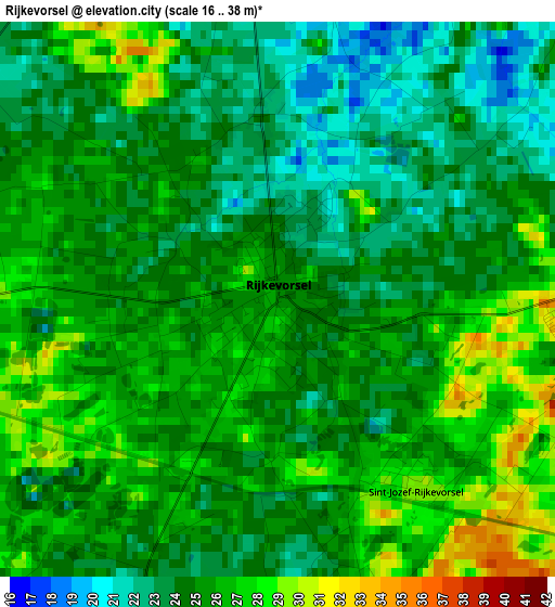
Below is the Elevation map of Rijkevorsel, which displays elevation range with different colors. Scale of the first map is from 16 to 38 m (52 to 125 ft) with average elevation of 24.8 meters (=81 ft) [note 1]
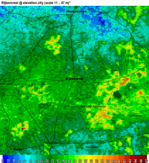
These maps also provides idea of topography and contour of this city, they are displayed at different zoom levels. More info about maps, scale and edge coordinates you can find below images.
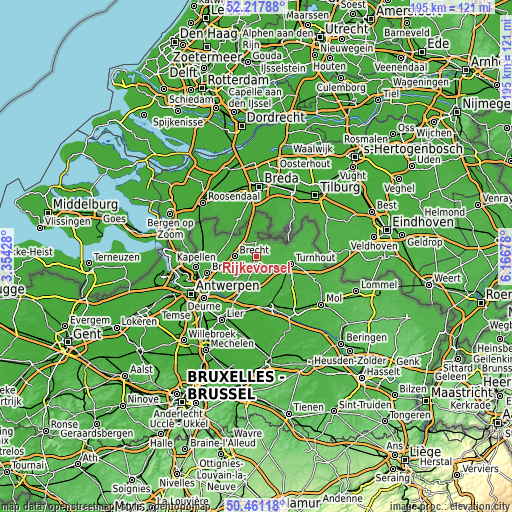
| \ | Map #1 | Map #2 | Topo.Map |
| Scale [m] | 16..38 m | 11..47 m | × |
| Scale [ft] | 52..125 ft | 36..154 ft | × |
| Average | 24.8 m = 81 ft | 23.3 m = 76 ft | × |
| Width | 6.1 km = 3.8 mi | 12.21 km = 7.6 mi | 195.3 km = 121.4 mi |
| Height | 6.1 km = 3.8 mi | 12.21 km = 7.6 mi | 195.3 km = 121.4 mi |
| ↑Max Latitude | 51.37539° | 51.402813° | 52.21788° |
| Latitude at center | 51.34795° | 51.34795° | 51.34795° |
| ↓Min Latitude | 51.320494° | 51.293022° | 50.46118° |
| ← Min Longitude | 4.716585° | 4.672639° | 3.35428° |
| Longitude center | 4.76053° | 4.76053° | 4.76053° |
| →Max Longitude | 4.804475° | 4.848421° | 6.16678° |
Nearby cities:
Cities around Rijkevorsel sort by population:
• Turnhout elevation 29 m
13.1 km,  102°
102°
• Brecht 23 m
8.5 km,  271°
271°
• Zoersel 17 m
9.5 km,  200°
200°
• Hoogstraten 21 m
5.8 km,  359°
359°
• Wuustwezel 18 m
12.5 km,  293°
293°
• Beerse 27 m
7.2 km,  116°
116°
• Lille 17 m
12.6 km,  159°
159°
• Oud-Turnhout 25 m
15.8 km, 101°
• Vosselaar 22 m
10 km, 116°
• Merksplas 26 m
7.4 km,  80°
80°
• Oostmalle 23 m
5.7 km, 199°
• Baarle-Hertog 24 m
11.1 km,  55°
55°
Multilingual:
 En español:
Rijkevorsel elevación 24 m.
 En France:
Rijkevorsel élévation 24 m.
 Auf Deutsch:
Rijkevorsel höhe über dem Meeresspiegel ist 24 m.

Sources and notes:
- [note 1] Map square and city borders are not equal. Map elevation data is calculated only from area inside that square.
- [src 1] Elevation data from geonames database provided with same terms of usage.
- [src 2] The elevation map of Rijkevorsel is generated using elevation data from NASA's 3 arcsec (90m) resolution SRTM data.
- [src 3] Base (background) map © OpenStreetMap contributors tiles are generated by Geofabrik and OpenTopoMap.
Copyright & License:
This Rijkevorsel Elevation Map is licensed under CC BY-SA. You may reuse any part from this page, if you give a proper credit by linking to this URL:
 More info on terms of use page.