Tielt elevation
Tielt (Flanders, Provincie West-Vlaanderen), Belgium elevation is 46 meters and Tielt elevation in feet is 151 ft above sea level [src 1]. Tielt is a seat of a third-order administrative division (feature code) with elevation that is 53 meters (174 ft) smaller than average city elevation in Belgium.
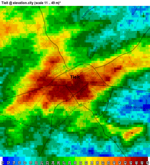
Below is the Elevation map of Tielt, which displays elevation range with different colors. Scale of the first map is from 11 to 49 m (36 to 161 ft) with average elevation of 27.5 meters (=90 ft) [note 1]
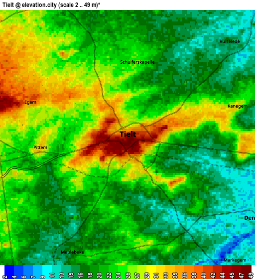
These maps also provides idea of topography and contour of this city, they are displayed at different zoom levels. More info about maps, scale and edge coordinates you can find below images.
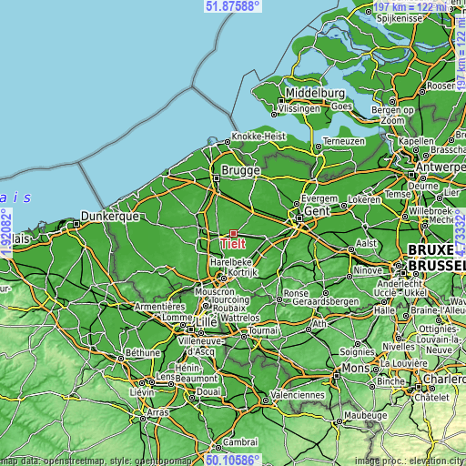
| \ | Map #1 | Map #2 | Topo.Map |
| Scale [m] | 11..49 m | 2..49 m | × |
| Scale [ft] | 36..161 ft | 7..161 ft | × |
| Average | 27.5 m = 90 ft | 22.3 m = 73 ft | × |
| Width | 6.15 km = 3.8 mi | 12.3 km = 7.6 mi | 196.8 km = 122.3 mi |
| Height | 6.15 km = 3.8 mi | 12.3 km = 7.6 mi | 196.8 km = 122.3 mi |
| ↑Max Latitude | 51.026958° | 51.054589° | 51.87588° |
| Latitude at center | 50.99931° | 50.99931° | 50.99931° |
| ↓Min Latitude | 50.971646° | 50.943965° | 50.10586° |
| ← Min Longitude | 3.283125° | 3.239179° | 1.92082° |
| Longitude center | 3.32707° | 3.32707° | 3.32707° |
| →Max Longitude | 3.371015° | 3.414961° | 4.73332° |
Nearby cities:
Cities around Tielt sort by population:
• Izegem elevation 18 m
12.4 km,  219°
219°
• Zulte 11 m
12.3 km,  136°
136°
• Wingene 26 m
7.5 km,  330°
330°
• Meulebeke 19 m
6 km,  207°
207°
• Ingelmunster 15 m
10.1 km, 209°
• Ardooie 21 m
9.5 km,  253°
253°
• Wielsbeke 9 m
11.4 km,  165°
165°
• Lichtervelde 24 m
13 km,  286°
286°
• Dentergem 11 m
7.4 km,  121°
121°
• Oostrozebeke 14 m
8.7 km, 174°
• Pittem 32 m
4.5 km,  260°
260°
• Ruiselede 15 m
6.5 km,  45°
45°
Multilingual:
 En español:
Tielt elevación 46 m.
 En France:
Tielt élévation 46 m.


Sources and notes:
- [note 1] Map square and city borders are not equal. Map elevation data is calculated only from area inside that square.
- [src 1] Elevation data from geonames database provided with same terms of usage.
- [src 2] The elevation map of Tielt is generated using elevation data from NASA's 3 arcsec (90m) resolution SRTM data.
- [src 3] Base (background) map © OpenStreetMap contributors tiles are generated by Geofabrik and OpenTopoMap.
Copyright & License:
This Tielt Elevation Map is licensed under CC BY-SA. You may reuse any part from this page, if you give a proper credit by linking to this URL:
 More info on terms of use page.