Vilvoorde elevation
Vilvoorde (Flanders, Provincie Vlaams-Brabant), Belgium elevation is 19 meters and Vilvoorde elevation in feet is 62 ft above sea level [src 1]. Vilvoorde is a populated place (feature code) with elevation that is 80 meters (262 ft) smaller than average city elevation in Belgium.
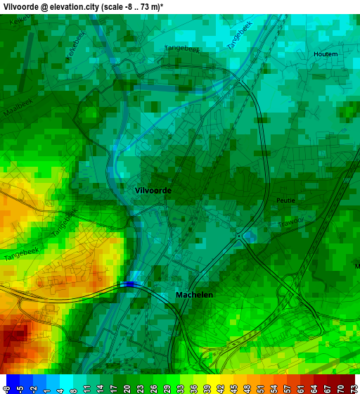
Below is the Elevation map of Vilvoorde, which displays elevation range with different colors. Scale of the first map is from -8 to 73 m (-26 to 240 ft) with average elevation of 20.4 meters (=67 ft) [note 1]
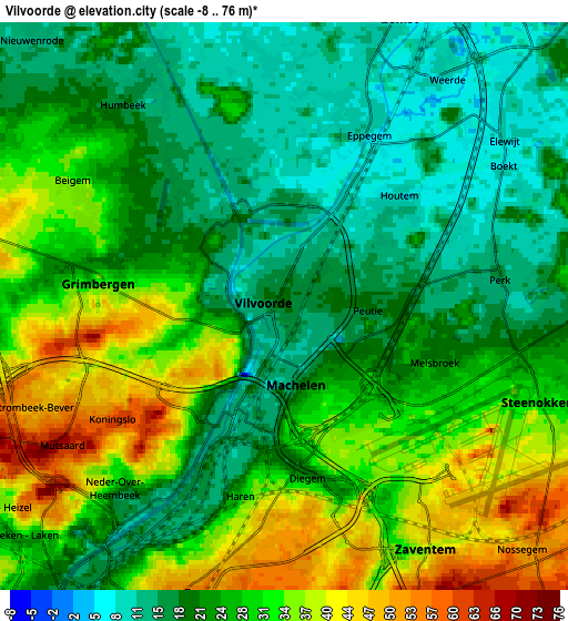
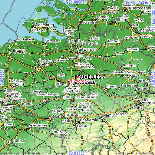
These maps also provides idea of topography and contour of this city, they are displayed at different zoom levels. More info about maps, scale and edge coordinates you can find below images.
| \ | Map #1 | Map #2 | Topo.Map |
| Scale [m] | -8..73 m | -8..76 m | × |
| Scale [ft] | -26..240 ft | -26..249 ft | × |
| Average | 20.4 m = 67 ft | 25.7 m = 84 ft | × |
| Width | 6.16 km = 3.8 mi | 12.32 km = 7.7 mi | 197.1 km = 122.5 mi |
| Height | 6.16 km = 3.8 mi | 12.32 km = 7.7 mi | 197.1 km = 122.5 mi |
| ↑Max Latitude | 50.95583° | 50.983504° | 51.80607° |
| Latitude at center | 50.92814° | 50.92814° | 50.92814° |
| ↓Min Latitude | 50.900433° | 50.87271° | 50.03333° |
| ← Min Longitude | 4.385435° | 4.341489° | 3.02313° |
| Longitude center | 4.42938° | 4.42938° | 4.42938° |
| →Max Longitude | 4.473325° | 4.517271° | 5.83563° |
Nearby cities:
Cities around Vilvoorde sort by population:
• Grimbergen elevation 29 m
4.1 km,  279°
279°
• Zaventem 46 m
5.8 km,  148°
148°
• Zemst 11 m
6.5 km,  19°
19°
• Meise 58 m
7.3 km, 279°
• Kortenberg 47 m
9.1 km,  118°
118°
• Wemmel 39 m
8.9 km,  255°
255°
• Kraainem 51 m
7.9 km,  159°
159°
• Machelen 30 m
2.1 km, 156°
• Kampenhout 14 m
8.7 km,  79°
79°
• Steenokkerzeel 23 m
5.7 km,  100°
100°
• Diegem 19 m
3.4 km,  175°
175°
• Bever 49 m
8 km, 260°
Multilingual:
 En español:
Vilvoorde elevación 19 m.
 En France:
Vilvoorde élévation 19 m.
 Auf Deutsch:
Vilvoorde höhe über dem Meeresspiegel ist 19 m.

Sources and notes:
- [note 1] Map square and city borders are not equal. Map elevation data is calculated only from area inside that square.
- [src 1] Elevation data from geonames database provided with same terms of usage.
- [src 2] The elevation map of Vilvoorde is generated using elevation data from NASA's 3 arcsec (90m) resolution SRTM data.
- [src 3] Base (background) map © OpenStreetMap contributors tiles are generated by Geofabrik and OpenTopoMap.
Copyright & License:
This Vilvoorde Elevation Map is licensed under CC BY-SA. You may reuse any part from this page, if you give a proper credit by linking to this URL:
 More info on terms of use page.